TopoQuest Logo
Do you find TopoQuest useful?
Help keep TopoQuest running and adding new maps/features by donating!
Bitcoin:  19c7KJd3qBynnjoSw5npx9KScwjBe4ifkT
Litecoin:  LXs6TkuXGGXo1vDsWCkWVdjQX94eUKd6ui
Home View Maps Find Maps Find Places Resources & Links


Graylock Butte, Oregon Topographic Map

USGS Map Title: Graylock Butte, OR
USGS Map MRC: 44119B4
DRG (GeoTIFF) Download: o44119b4.tif


Neighboring USGS Topographic Map Quads:


  Aldrich Gulch, OR  
44119C5
 

  Aldrich Mountain South, OR  
44119C4
 

  Big Weasel Springs, OR  
44119C3
 

  Suplee Butte, OR  
44119B5
 

  Graylock Butte, OR  
44119B4
 

  Flagtail Mountain, OR  
44119B3
 

  Funny Butte, OR  
44119A5
 

  Izee, OR  
44119A4
 

  Lewis Creek, OR  
44119A3


Map MRC Location:

N45°
W120°
N45°
W119°
H8 H7 H6 H5 H4 H3 H2 H1
G8 G7 G6 G5 G4 G3 G2 G1
F8 F7 F6 F5 F4 F3 F2 F1
E8 E7 E6 E5 E4 E3 E2 E1
D8 D7 D6 D5 D4 D3 D2 D1
C8 C7 C6 C5 C4 C3 C2 C1
B8 B7 B6 B5 B4 B3 B2 B1
A8 A7 A6 A5 A4 A3 A2 A1
N44°
W120°
N44°
W119°

Graylock Butte, OR USGS 1:24K Topographic Map Preview:
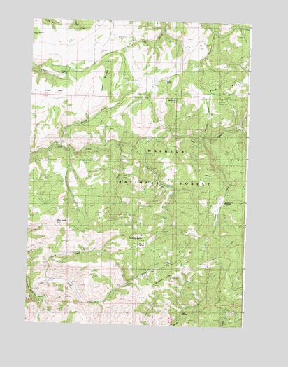
Graylock Butte, OR USGS Topographic Map
Click on map above to begin viewing in our Map Viewer.

This topographic map contains these locations and features:
Feature Name Type Latitude Longitude GNIS ID View Map
Antelope CreekStreamN44.2021°W119.4019°1137235View Map
Big BaldySummitN44.1663°W119.4811°1137967View Map
Blue CreekStreamN44.2065°W119.3830°1138297View Map
Buck CreekStreamN44.2004°W119.4383°1138760View Map
Camp FarawayLocaleN44.1296°W119.4119°1139242View Map
Cougar MountainSummitN44.2254°W119.4591°1140236View Map
Deer Creek FlatsFlatN44.2193°W119.4330°1116693View Map
Dewey CreekStreamN44.1985°W119.4500°1140987View Map
Dry Pine CreekStreamN44.1251°W119.4927°1145225View Map
Dugout CreekStreamN44.1960°W119.4789°1141385View Map
Frenchy ButteSummitN44.1593°W119.4369°1142476View Map
Frenchy SpringSpringN44.1582°W119.4362°1142477View Map
Graylock ButteSummitN44.1446°W119.4189°1143014View Map
Indian CreekStreamN44.1385°W119.4958°1144024View Map
Maggot SpringSpringN44.2248°W119.4234°1145731View Map
McMullen SpringSpringN44.2172°W119.4177°1146025View Map
Pewee CreekStreamN44.1415°W119.4889°1147624View Map
Pewee Creek ReservoirReservoirN44.1546°W119.4719°1154197View Map
Round CreekStreamN44.1976°W119.4833°1148763View Map
Vester CreekStreamN44.2015°W119.4033°1151756View Map
Vester Creek MeadowsFlatN44.1751°W119.3910°1151757View Map

Note: Coordinates in the location and feature list above are referenced to NAD83 datum.


Copyright (C) 2008-2025 Ryan Niemi / Sunset Dynamics ... All Rights Reserved