TopoQuest Logo
Do you find TopoQuest useful?
Help keep TopoQuest running and adding new maps/features by donating!
Bitcoin:  19c7KJd3qBynnjoSw5npx9KScwjBe4ifkT
Litecoin:  LXs6TkuXGGXo1vDsWCkWVdjQX94eUKd6ui
Home View Maps Find Maps Find Places Resources & Links


Florida, Missouri Topographic Map

USGS Map Title: Florida, MO
USGS Map MRC: 39091D7
DRG (GeoTIFF) Download: o39091d7.tif


Neighboring USGS Topographic Map Quads:


  Goss, MO  
39091E8
 

  Stoutsville, MO  
39091E7
 

  Clarence Cannon Dam, MO  
39091E6
 

  Paris East, MO  
39091D8
 

  Florida, MO  
39091D7
 

  Perry, MO  
39091D6
 

  Molino, MO  
39091C8
 

  Santa Fe, MO  
39091C7
 

  Hutchison, MO  
39091C6


Map MRC Location:

N40°
W92°
N40°
W91°
H8 H7 H6 H5 H4 H3 H2 H1
G8 G7 G6 G5 G4 G3 G2 G1
F8 F7 F6 F5 F4 F3 F2 F1
E8 E7 E6 E5 E4 E3 E2 E1
D8 D7 D6 D5 D4 D3 D2 D1
C8 C7 C6 C5 C4 C3 C2 C1
B8 B7 B6 B5 B4 B3 B2 B1
A8 A7 A6 A5 A4 A3 A2 A1
N39°
W92°
N39°
W91°

Florida, MO USGS 1:24K Topographic Map Preview:
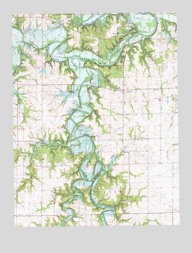
Florida, MO USGS Topographic Map
Click on map above to begin viewing in our Map Viewer.

This topographic map contains these locations and features:
Feature Name Type Latitude Longitude GNIS ID View Map
Bear BranchStreamN39.3859°W91.8004°713773View Map
Bergthold DamDamN39.3917°W91.7735°765076View Map
Bonsall School (historical)SchoolN39.4547°W91.8486°744007View Map
Brush CreekStreamN39.4250°W91.8309°714852View Map
Buzzards RoostPopulated PlaceN39.4712°W91.7943°740718View Map
Carr BranchStreamN39.4881°W91.7796°715420View Map
Casey College School (historical)SchoolN39.4931°W91.8380°743991View Map
Dashner School (historical)SchoolN39.4145°W91.8352°743993View Map
FloridaPopulated PlaceN39.4931°W91.7871°718036View Map
Hawkins CemeteryCemeteryN39.4942°W91.8454°719238View Map
Ivy BranchStreamN39.4645°W91.8154°720190View Map
Jack Simpson DamDamN39.4500°W91.8468°760310View Map
Jack Simpson LakeReservoirN39.4664°W91.8518°760266View Map
Jordan BranchStreamN39.4687°W91.8741°720432View Map
Lake Tom SawyerReservoirN39.4880°W91.7932°758354View Map
Lake Tom Sawyer DamDamN39.4884°W91.7918°760284View Map
Long BranchStreamN39.4027°W91.8215°721512View Map
Mark Twain Birthplace State Historic SiteParkN39.4887°W91.7818°736219View Map
Mark Twain State ParkParkN39.4764°W91.8002°721880View Map
Peak School (historical)SchoolN39.3806°W91.8640°744043View Map
Poage School (historical)SchoolN39.4467°W91.7913°743994View Map
Simpson Farms Lake DamDamN39.4684°W91.8518°760265View Map
Smiley BranchStreamN39.3837°W91.8002°726571View Map
South Brush CreekStreamN39.4162°W91.8616°726705View Map
South Fork ChurchChurchN39.3895°W91.7904°729396View Map
South Fork Recreation AreaParkN39.4500°W91.8124°736218View Map
South Fork Salt RiverStreamN39.4745°W91.8299°726753View Map
South Fork School (historical)SchoolN39.3892°W91.7892°744466View Map
Township of JeffersonCivilN39.4912°W91.8174°767040View Map
Township of South ForkCivilN39.3803°W91.8376°767043View Map
Vaughn HollowValleyN39.4070°W91.8046°728155View Map
VictorPopulated PlaceN39.4542°W91.8293°741339View Map
Victor ChurchChurchN39.4581°W91.8527°728183View Map
Victor School (historical)SchoolN39.4581°W91.8471°743992View Map
Village of FloridaCivilN39.4930°W91.7906°2398888View Map

Note: Coordinates in the location and feature list above are referenced to NAD83 datum.


Copyright (C) 2008-2025 Ryan Niemi / Sunset Dynamics ... All Rights Reserved