TopoQuest Logo
Do you find TopoQuest useful?
Help keep TopoQuest running and adding new maps/features by donating!
Bitcoin:  19c7KJd3qBynnjoSw5npx9KScwjBe4ifkT
Litecoin:  LXs6TkuXGGXo1vDsWCkWVdjQX94eUKd6ui
Home View Maps Find Maps Find Places Resources & Links


Santa Fe, Missouri Topographic Map

USGS Map Title: Santa Fe, MO
USGS Map MRC: 39091C7
DRG (GeoTIFF) Download: o39091c7.tif


Neighboring USGS Topographic Map Quads:


  Paris East, MO  
39091D8
 

  Florida, MO  
39091D7
 

  Perry, MO  
39091D6
 

  Molino, MO  
39091C8
 

  Santa Fe, MO  
39091C7
 

  Hutchison, MO  
39091C6
 

  Mexico West, MO  
39091B8
 

  Mexico East, MO  
39091B7
 

  Laddonia, MO  
39091B6


Map MRC Location:

N40°
W92°
N40°
W91°
H8 H7 H6 H5 H4 H3 H2 H1
G8 G7 G6 G5 G4 G3 G2 G1
F8 F7 F6 F5 F4 F3 F2 F1
E8 E7 E6 E5 E4 E3 E2 E1
D8 D7 D6 D5 D4 D3 D2 D1
C8 C7 C6 C5 C4 C3 C2 C1
B8 B7 B6 B5 B4 B3 B2 B1
A8 A7 A6 A5 A4 A3 A2 A1
N39°
W92°
N39°
W91°

Santa Fe, MO USGS 1:24K Topographic Map Preview:
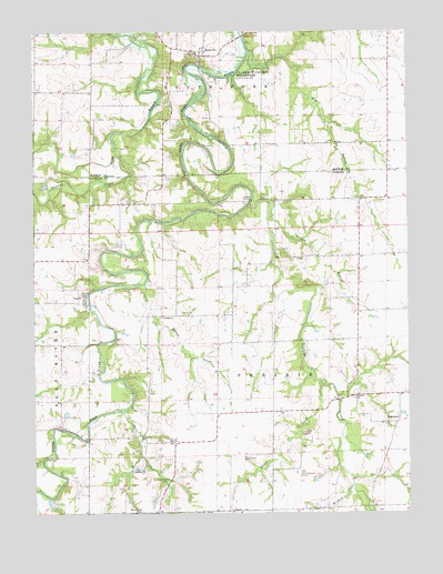
Santa Fe, MO USGS Topographic Map
Click on map above to begin viewing in our Map Viewer.

This topographic map contains these locations and features:
Feature Name Type Latitude Longitude GNIS ID View Map
Azdell Lake DamDamN39.2717°W91.7552°762732View Map
Beagles School (historical)SchoolN39.3028°W91.7666°744318View Map
Bean CreekStreamN39.2762°W91.8457°713768View Map
Bean Creek CemeteryCemeteryN39.2506°W91.8393°713769View Map
Bean Creek School (historical)SchoolN39.2501°W91.8341°744320View Map
Bethel ChurchChurchN39.3009°W91.8324°729436View Map
Botts School (historical)SchoolN39.3009°W91.8143°744316View Map
Dye School (historical)SchoolN39.2575°W91.7627°744321View Map
Elm BranchStreamN39.3692°W91.8029°717498View Map
Eubank CemeteryCemeteryN39.2589°W91.8335°717640View Map
Fisher School (historical)SchoolN39.3300°W91.8382°744315View Map
Hazel CreekStreamN39.2842°W91.7802°719274View Map
Hazel School (historical)SchoolN39.2767°W91.7963°744319View Map
Littleby ChurchChurchN39.2800°W91.7679°729540View Map
Littleby CreekStreamN39.3309°W91.8029°721362View Map
Long Branch (historical)LocaleN39.3456°W91.8741°744003View Map
May Lake DamDamN39.2584°W91.8602°762184View Map
Millard Lake DamDamN39.3548°W91.7726°762185View Map
Ringo School (historical)SchoolN39.3309°W91.7713°744317View Map
Rock Hill CemeteryCemeteryN39.2531°W91.7599°744159View Map
Santa FePopulated PlaceN39.3689°W91.8191°726050View Map
Santa Fe Post OfficePost OfficeN39.3686°W91.8193°2782945View Map
Talleys BranchStreamN39.3295°W91.7954°727443View Map
Tattys CreekStreamN39.3098°W91.8379°727478View Map
Wafer Ash School (historical)SchoolN39.3526°W91.7982°744004View Map
Wildcat CreekStreamN39.2573°W91.7685°728835View Map
WorcesterPopulated PlaceN39.2737°W91.7541°741373View Map
Youngs CreekStreamN39.3428°W91.8477°753013View Map

Note: Coordinates in the location and feature list above are referenced to NAD83 datum.


Copyright (C) 2008-2025 Ryan Niemi / Sunset Dynamics ... All Rights Reserved