TopoQuest Logo
Do you find TopoQuest useful?
Help keep TopoQuest running and adding new maps/features by donating!
Bitcoin:  19c7KJd3qBynnjoSw5npx9KScwjBe4ifkT
Litecoin:  LXs6TkuXGGXo1vDsWCkWVdjQX94eUKd6ui
Home View Maps Find Maps Find Places Resources & Links


Forest Home, Alabama Topographic Map

USGS Map Title: Forest Home, AL
USGS Map MRC: 31086G7
DRG (GeoTIFF) Download: o31086g7.tif


Neighboring USGS Topographic Map Quads:


  Pine Apple North, AL  
31086H8
 

  Ridgeville, AL  
31086H7
 

  Fort Dale, AL  
31086H6
 

  Pine Apple South, AL  
31086G8
 

  Forest Home, AL  
31086G7
 

  Greenville West, AL  
31086G6
 

  Bethel, AL  
31086F8
 

  Georgiana West, AL  
31086F7
 

  Georgiana East, AL  
31086F6


Map MRC Location:

N32°
W87°
N32°
W86°
H8 H7 H6 H5 H4 H3 H2 H1
G8 G7 G6 G5 G4 G3 G2 G1
F8 F7 F6 F5 F4 F3 F2 F1
E8 E7 E6 E5 E4 E3 E2 E1
D8 D7 D6 D5 D4 D3 D2 D1
C8 C7 C6 C5 C4 C3 C2 C1
B8 B7 B6 B5 B4 B3 B2 B1
A8 A7 A6 A5 A4 A3 A2 A1
N31°
W87°
N31°
W86°

Forest Home, AL USGS 1:24K Topographic Map Preview:
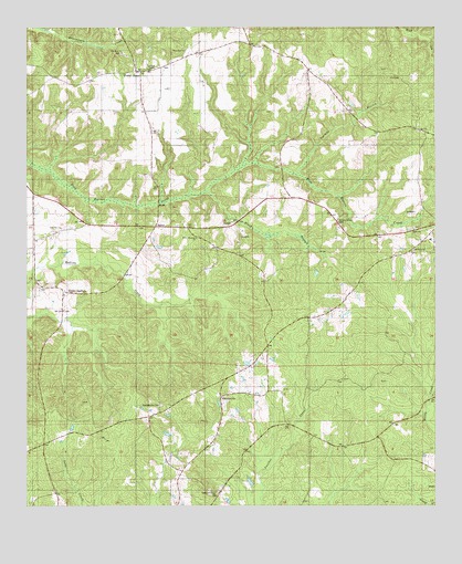
Forest Home, AL USGS Topographic Map
Click on map above to begin viewing in our Map Viewer.

This topographic map contains these locations and features:
Feature Name Type Latitude Longitude GNIS ID View Map
Black BranchStreamN31.8313°W86.8219°134989View Map
Buckaloo ChurchChurchN31.8168°W86.7566°134994View Map
Butler County State Wildlife Management AreaParkN31.7599°W86.8022°144701View Map
Butler SpringsPopulated PlaceN31.8021°W86.8661°155001View Map
Butler Springs Baptist ChurchChurchN31.8013°W86.8636°154085View Map
Butler Springs CemeteryCemeteryN31.8010°W86.8633°135756View Map
English PondReservoirN31.7706°W86.8611°135003View Map
Forest HomePopulated PlaceN31.8624°W86.8428°118495View Map
Forest Home CemeteryCemeteryN31.8646°W86.8333°135762View Map
Forest Home ChurchChurchN31.8646°W86.8361°135007View Map
Forest Home ChurchChurchN31.8540°W86.8397°135008View Map
Forest Home Post OfficePost OfficeN31.8638°W86.8402°167484View Map
Forest Home School (historical)SchoolN31.8627°W86.8472°135009View Map
Forest Home Volunteer Fire DepartmentBuildingN31.8637°W86.8407°2691533View Map
HerbertPopulated PlaceN31.8360°W86.8053°156468View Map
Hickory Grove CemeteryCemeteryN31.8249°W86.7797°135019View Map
Pine Flat ChurchChurchN31.8227°W86.8644°135041View Map
Pine Flat SchoolSchoolN31.8218°W86.8661°135042View Map
Providence - Mount Pisgah Volunteer Fire DepartmentBuildingN31.7610°W86.8261°2691506View Map
Rock Rest ChurchChurchN31.8693°W86.8264°164170View Map
Rocky Mountain ChurchChurchN31.8199°W86.8230°164171View Map
Salem ChurchChurchN31.8224°W86.7564°135054View Map
SaucerPopulated PlaceN31.8229°W86.8355°135056View Map
ShacklesvillePopulated PlaceN31.7788°W86.8155°155365View Map
Shacklesville CemeteryCemeteryN31.7763°W86.8339°135057View Map
Shacklesville ChurchChurchN31.7785°W86.8153°135058View Map
Shackleville Volunteer Fire DepartmentBuildingN31.8061°W86.7760°2691531View Map
Tenmile BranchStreamN31.8365°W86.7925°135062View Map
The Independent Holiness ChurchChurchN31.8204°W86.7716°163370View Map
Watts CemeteryCemeteryN31.8304°W86.8661°141943View Map
Zion ChurchChurchN31.8479°W86.7544°164172View Map
Zion Rest ChurchChurchN31.8685°W86.8458°135067View Map

Note: Coordinates in the location and feature list above are referenced to NAD83 datum.


Copyright (C) 2008-2025 Ryan Niemi / Sunset Dynamics ... All Rights Reserved