TopoQuest Logo
Do you find TopoQuest useful?
Help keep TopoQuest running and adding new maps/features by donating!
Bitcoin:  19c7KJd3qBynnjoSw5npx9KScwjBe4ifkT
Litecoin:  LXs6TkuXGGXo1vDsWCkWVdjQX94eUKd6ui
Home View Maps Find Maps Find Places Resources & Links


Bethel, Alabama Topographic Map

USGS Map Title: Bethel, AL
USGS Map MRC: 31086F8
DRG (GeoTIFF) Download: o31086f8.tif


Neighboring USGS Topographic Map Quads:


  McWilliams, AL  
31087G1
 

  Pine Apple South, AL  
31086G8
 

  Forest Home, AL  
31086G7
 

  Skinnerton, AL  
31087F1
 

  Bethel, AL  
31086F8
 

  Georgiana West, AL  
31086F7
 

  China, AL  
31087E1
 

  Lyeffion, AL  
31086E8
 

  Garland, AL  
31086E7


Map MRC Location:

N32°
W87°
N32°
W86°
H8 H7 H6 H5 H4 H3 H2 H1
G8 G7 G6 G5 G4 G3 G2 G1
F8 F7 F6 F5 F4 F3 F2 F1
E8 E7 E6 E5 E4 E3 E2 E1
D8 D7 D6 D5 D4 D3 D2 D1
C8 C7 C6 C5 C4 C3 C2 C1
B8 B7 B6 B5 B4 B3 B2 B1
A8 A7 A6 A5 A4 A3 A2 A1
N31°
W87°
N31°
W86°

Bethel, AL USGS 1:24K Topographic Map Preview:
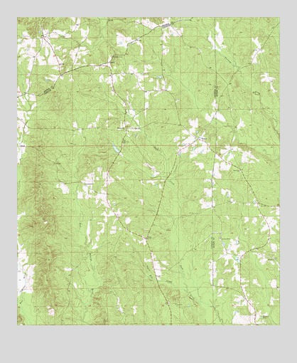
Bethel, AL USGS Topographic Map
Click on map above to begin viewing in our Map Viewer.

This topographic map contains these locations and features:
Feature Name Type Latitude Longitude GNIS ID View Map
Alvin Mixon DamDamN31.6952°W86.9500°129929View Map
Alvin Mixon LakeReservoirN31.6968°W86.9530°129928View Map
Bennett PondLakeN31.6285°W86.8836°113927View Map
BethelPopulated PlaceN31.7007°W86.9141°114005View Map
Bethel West CemeteryCemeteryN31.7018°W86.9153°149624View Map
Bethel West ChurchChurchN31.7013°W86.9150°133093View Map
CommercePopulated PlaceN31.6818°W86.9672°156205View Map
Concord CemeteryCemeteryN31.6343°W86.9278°133105View Map
Concord Methodist ChurchChurchN31.6338°W86.9247°116486View Map
DeansPopulated PlaceN31.6602°W86.9389°156257View Map
Horse BranchStreamN31.6557°W86.9247°133126View Map
Little Duck CreekStreamN31.6654°W86.9239°133136View Map
McCreary School (historical)SchoolN31.6835°W86.9733°133143View Map
Middleton CemeteryCemeteryN31.7343°W86.9553°152312View Map
MixonvillePopulated PlaceN31.7049°W86.9486°156722View Map
Mount Ross ChurchChurchN31.6518°W86.8772°152505View Map
Mount Zion CemeteryCemeteryN31.6599°W86.9514°149649View Map
Mount Zion ChurchChurchN31.6646°W86.9475°149650View Map
Mount Zion Church (historical)ChurchN31.6552°W86.9541°133150View Map
Mount Zion Junior High SchoolSchoolN31.6690°W86.9516°133151View Map
New Hope ChurchChurchN31.6993°W86.9500°123808View Map
New Hope Church (historical)ChurchN31.6582°W86.9539°133156View Map
Old Bethel CemeteryCemeteryN31.6952°W86.9050°135785View Map
Pilgrim Rest ChurchChurchN31.7207°W86.9353°149656View Map
Pine Level ChurchChurchN31.6879°W86.8939°164102View Map
Pine Level SchoolSchoolN31.6882°W86.8944°135043View Map
Pleasant Hill ChurchChurchN31.6604°W86.9033°124984View Map
Salter School (historical)SchoolN31.7196°W86.9375°133182View Map
Sepulga Post Office (historical)Post OfficeN31.6310°W86.9519°166031View Map
Tigett Mill CreekStreamN31.6390°W86.9194°127977View Map
Tisdale School (historical)SchoolN31.6690°W86.9333°133192View Map

Note: Coordinates in the location and feature list above are referenced to NAD83 datum.


Copyright (C) 2008-2025 Ryan Niemi / Sunset Dynamics ... All Rights Reserved