TopoQuest Logo
Do you find TopoQuest useful?
Help keep TopoQuest running and adding new maps/features by donating!
Bitcoin:  19c7KJd3qBynnjoSw5npx9KScwjBe4ifkT
Litecoin:  LXs6TkuXGGXo1vDsWCkWVdjQX94eUKd6ui
Home View Maps Find Maps Find Places Resources & Links


Ridgeville, Alabama Topographic Map

USGS Map Title: Ridgeville, AL
USGS Map MRC: 31086H7
DRG (GeoTIFF) Download: o31086h7.tif


Neighboring USGS Topographic Map Quads:


  Minter, AL  
32086A8
 

  Braggs, AL  
32086A7
 

  Mount Willing, AL  
32086A6
 

  Pine Apple North, AL  
31086H8
 

  Ridgeville, AL  
31086H7
 

  Fort Dale, AL  
31086H6
 

  Pine Apple South, AL  
31086G8
 

  Forest Home, AL  
31086G7
 

  Greenville West, AL  
31086G6


Map MRC Location:

N32°
W87°
N32°
W86°
H8 H7 H6 H5 H4 H3 H2 H1
G8 G7 G6 G5 G4 G3 G2 G1
F8 F7 F6 F5 F4 F3 F2 F1
E8 E7 E6 E5 E4 E3 E2 E1
D8 D7 D6 D5 D4 D3 D2 D1
C8 C7 C6 C5 C4 C3 C2 C1
B8 B7 B6 B5 B4 B3 B2 B1
A8 A7 A6 A5 A4 A3 A2 A1
N31°
W87°
N31°
W86°

Ridgeville, AL USGS 1:24K Topographic Map Preview:
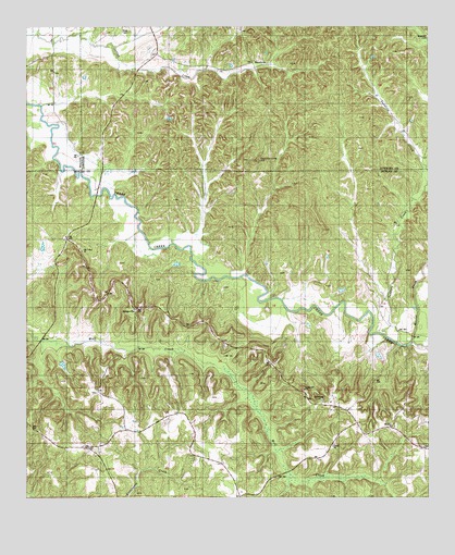
Ridgeville, AL USGS Topographic Map
Click on map above to begin viewing in our Map Viewer.

This topographic map contains these locations and features:
Feature Name Type Latitude Longitude GNIS ID View Map
Bragg CemeteryCemeteryN31.8993°W86.7841°135753View Map
Bragg Hill ChurchChurchN31.9038°W86.7886°134991View Map
Bragg Hill SchoolSchoolN31.9029°W86.7878°134992View Map
County Line HillSummitN31.9646°W86.8036°136339View Map
Crenshaws CemeteryCemeteryN31.9007°W86.7839°154087View Map
Forest Home DivisionCivilN31.8762°W86.7944°165672View Map
Herbert Temple ChurchChurchN31.8960°W86.8244°135018View Map
Hopewell BranchStreamN31.9235°W86.7694°120357View Map
Hopewell CemeteryCemeteryN31.9976°W86.7503°136374View Map
Ishams CreekStreamN31.9338°W86.8119°135020View Map
Jerusalem ChurchChurchN31.8904°W86.8225°135021View Map
MacedoniaPopulated PlaceN31.9926°W86.8039°156645View Map
Manningham CemeteryCemeteryN31.8882°W86.7511°135771View Map
Mount Olive ChurchChurchN31.8938°W86.7614°135031View Map
Mussel CreekStreamN31.9168°W86.7564°152577View Map
Oak Valley ChurchChurchN31.9404°W86.8575°135037View Map
Oklahoma School (historical)SchoolN31.8924°W86.8403°135038View Map
PalmyraPopulated PlaceN31.9976°W86.7525°156852View Map
Perkins Chapel ChurchChurchN31.8865°W86.8541°135040View Map
RidgevillePopulated PlaceN31.9251°W86.8403°154090View Map
Ridgeville ChurchChurchN31.9251°W86.8403°135051View Map
Snow CemeteryCemeteryN31.9985°W86.8433°136458View Map
Thompson CemeteryCemeteryN31.9029°W86.8530°135064View Map

Note: Coordinates in the location and feature list above are referenced to NAD83 datum.


Copyright (C) 2008-2024 Ryan Niemi / Sunset Dynamics ... All Rights Reserved