TopoQuest Logo
Do you find TopoQuest useful?
Help keep TopoQuest running and adding new maps/features by donating!
Bitcoin:  19c7KJd3qBynnjoSw5npx9KScwjBe4ifkT
Litecoin:  LXs6TkuXGGXo1vDsWCkWVdjQX94eUKd6ui
Home View Maps Find Maps Find Places Resources & Links


Pine Apple North, Alabama Topographic Map

USGS Map Title: Pine Apple North, AL
USGS Map MRC: 31086H8
DRG (GeoTIFF) Download: o31086h8.tif


Neighboring USGS Topographic Map Quads:


  Carlowville, AL  
32087A1
 

  Minter, AL  
32086A8
 

  Braggs, AL  
32086A7
 

  Oak Hill, AL  
31087H1
 

  Pine Apple North, AL  
31086H8
 

  Ridgeville, AL  
31086H7
 

  McWilliams, AL  
31087G1
 

  Pine Apple South, AL  
31086G8
 

  Forest Home, AL  
31086G7


Map MRC Location:

N32°
W87°
N32°
W86°
H8 H7 H6 H5 H4 H3 H2 H1
G8 G7 G6 G5 G4 G3 G2 G1
F8 F7 F6 F5 F4 F3 F2 F1
E8 E7 E6 E5 E4 E3 E2 E1
D8 D7 D6 D5 D4 D3 D2 D1
C8 C7 C6 C5 C4 C3 C2 C1
B8 B7 B6 B5 B4 B3 B2 B1
A8 A7 A6 A5 A4 A3 A2 A1
N31°
W87°
N31°
W86°

Pine Apple North, AL USGS 1:24K Topographic Map Preview:
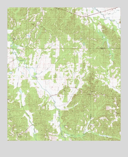
Pine Apple North, AL USGS Topographic Map
Click on map above to begin viewing in our Map Viewer.

This topographic map contains these locations and features:
Feature Name Type Latitude Longitude GNIS ID View Map
Arkadelphia ChurchChurchN31.8965°W86.9980°138417View Map
Beaver CreekStreamN31.8815°W86.9153°138425View Map
Beech Grove School (historical)SchoolN31.9079°W86.9714°138426View Map
Brestwork CreekStreamN31.8843°W86.9230°159006View Map
Cedar Grove church (historical)ChurchN31.9707°W86.8786°138448View Map
Copeland DamDamN31.9551°W86.9366°130031View Map
Copelands PondReservoirN31.9551°W86.9366°130032View Map
Donald LakeReservoirN31.9390°W86.9962°130029View Map
E G Donald Lake DamDamN31.9385°W86.9950°130030View Map
Faith TempleChurchN31.9040°W86.9992°138468View Map
Friendship ChurchChurchN31.8818°W86.9900°138471View Map
Gaines ChapelChurchN31.9988°W86.9425°138472View Map
Hills CreekStreamN31.9376°W86.9672°138484View Map
Hopewell ChurchChurchN31.9949°W86.9255°138491View Map
Indian CreekStreamN31.9935°W86.8939°138495View Map
MontereyPopulated PlaceN31.9035°W86.8819°152363View Map
Monterey CemeteryCemeteryN31.9010°W86.8828°135772View Map
Monterey ChurchChurchN31.9015°W86.8803°135030View Map
Mount MoriahPopulated PlaceN31.9176°W86.9000°135775View Map
Mount Moriah Baptist ChurchChurchN31.9188°W86.9083°154088View Map
Mount Moriah CemeteryCemeteryN31.9193°W86.9080°135776View Map
Mount Moriah Post Office (historical)Post OfficeN31.9188°W86.9080°166046View Map
Palmer CemeteryCemeteryN31.9849°W86.9697°138545View Map
Peters ChurchChurchN31.9738°W86.9786°138550View Map
Pleasant Hill ChurchChurchN31.9215°W86.9078°135044View Map
Rock SpringsPopulated PlaceN31.9715°W86.9908°138564View Map
Saint Peters Church (historical)ChurchN31.9660°W86.9675°138579View Map
Starling Church (historical)ChurchN31.9682°W86.9428°138595View Map
Thurston Adams DamDamN31.9251°W86.9900°130021View Map
Thurston Adams PondReservoirN31.9251°W86.9900°130020View Map
Turkey CreekStreamN31.9504°W86.9872°128154View Map
Wardlaw CreekStreamN31.9424°W86.9703°138607View Map
Wildcat CreekStreamN31.9663°W86.9936°138614View Map
Windhams Store (historical)LocaleN31.9285°W86.8908°135066View Map
Wolf CreekStreamN31.9954°W86.8980°155309View Map
Womacks Post Office (historical)Post OfficeN31.9863°W86.9130°138616View Map

Note: Coordinates in the location and feature list above are referenced to NAD83 datum.


Copyright (C) 2008-2025 Ryan Niemi / Sunset Dynamics ... All Rights Reserved