TopoQuest Logo
Do you find TopoQuest useful?
Help keep TopoQuest running and adding new maps/features by donating!
Bitcoin:  19c7KJd3qBynnjoSw5npx9KScwjBe4ifkT
Litecoin:  LXs6TkuXGGXo1vDsWCkWVdjQX94eUKd6ui
Home View Maps Find Maps Find Places Resources & Links


Georgiana West, Alabama Topographic Map

USGS Map Title: Georgiana West, AL
USGS Map MRC: 31086F7
DRG (GeoTIFF) Download: o31086f7.tif


Neighboring USGS Topographic Map Quads:


  Pine Apple South, AL  
31086G8
 

  Forest Home, AL  
31086G7
 

  Greenville West, AL  
31086G6
 

  Bethel, AL  
31086F8
 

  Georgiana West, AL  
31086F7
 

  Georgiana East, AL  
31086F6
 

  Lyeffion, AL  
31086E8
 

  Garland, AL  
31086E7
 

  McKenzie, AL  
31086E6


Map MRC Location:

N32°
W87°
N32°
W86°
H8 H7 H6 H5 H4 H3 H2 H1
G8 G7 G6 G5 G4 G3 G2 G1
F8 F7 F6 F5 F4 F3 F2 F1
E8 E7 E6 E5 E4 E3 E2 E1
D8 D7 D6 D5 D4 D3 D2 D1
C8 C7 C6 C5 C4 C3 C2 C1
B8 B7 B6 B5 B4 B3 B2 B1
A8 A7 A6 A5 A4 A3 A2 A1
N31°
W87°
N31°
W86°

Georgiana West, AL USGS 1:24K Topographic Map Preview:
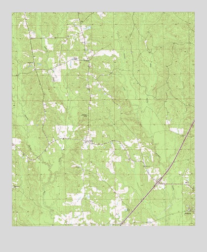
Georgiana West, AL USGS Topographic Map
Click on map above to begin viewing in our Map Viewer.

This topographic map contains these locations and features:
Feature Name Type Latitude Longitude GNIS ID View Map
BeaconPopulated PlaceN31.7146°W86.8230°134987View Map
Calvary ChurchChurchN31.6504°W86.7564°115408View Map
Casey PondReservoirN31.7229°W86.8333°115684View Map
Ebenezer CemeteryCemeteryN31.6777°W86.7583°135002View Map
Ebenezer Missionary Baptist ChurchChurchN31.6774°W86.7566°135760View Map
Exit 114CrossingN31.6507°W86.7753°155651View Map
Furlong CreekStreamN31.6502°W86.8500°118768View Map
Morrow ChurchChurchN31.6602°W86.7841°123094View Map
Mount Pisgah CemeteryCemeteryN31.7202°W86.8600°135780View Map
Mount Pisgah ChurchChurchN31.7204°W86.8605°123340View Map
Mount Pisgah School (historical)SchoolN31.7199°W86.8608°164468View Map
Oaklog CreekStreamN31.6785°W86.7803°124157View Map
ProvidencePopulated PlaceN31.7221°W86.8228°156939View Map
Providence ChurchChurchN31.7229°W86.8233°135048View Map
Spring Hill ChurchChurchN31.6477°W86.8733°127249View Map
Stamps CemeteryCemeteryN31.6593°W86.8286°127297View Map
StarlingtonPopulated PlaceN31.6749°W86.8253°127322View Map
Starlington ChurchChurchN31.6735°W86.8222°135061View Map
Starlington Lookout TowerTowerN31.6896°W86.8236°164424View Map
Starlington Volunteer Fire DepartmentBuildingN31.6743°W86.8088°2691538View Map
W O Blackmon DamDamN31.7402°W86.8216°129944View Map
Wise PondReservoirN31.6345°W86.7972°129136View Map

Note: Coordinates in the location and feature list above are referenced to NAD83 datum.


Copyright (C) 2008-2025 Ryan Niemi / Sunset Dynamics ... All Rights Reserved