TopoQuest Logo
Do you find TopoQuest useful?
Help keep TopoQuest running and adding new maps/features by donating!
Bitcoin:  19c7KJd3qBynnjoSw5npx9KScwjBe4ifkT
Litecoin:  LXs6TkuXGGXo1vDsWCkWVdjQX94eUKd6ui
Home View Maps Find Maps Find Places Resources & Links


Algoma, Wisconsin Topographic Map

USGS Map Title: Algoma, WI
USGS Map MRC: 44087E4
DRG (GeoTIFF) Download: o44087e4.tif


Neighboring USGS Topographic Map Quads:


  Brussels, WI  
44087F5
 

  Forestville, WI  
44087F4
 

  Algoma NE, WI  
44087F3
 

  Casco, WI  
44087E5
 

  Algoma, WI  
44087E4


  Kewaunee, WI  
44087D5


Map MRC Location:

N45°
W88°
N45°
W87°
H8 H7 H6 H5 H4 H3 H2 H1
G8 G7 G6 G5 G4 G3 G2 G1
F8 F7 F6 F5 F4 F3 F2 F1
E8 E7 E6 E5 E4 E3 E2 E1
D8 D7 D6 D5 D4 D3 D2 D1
C8 C7 C6 C5 C4 C3 C2 C1
B8 B7 B6 B5 B4 B3 B2 B1
A8 A7 A6 A5 A4 A3 A2 A1
N44°
W88°
N44°
W87°

Algoma, WI USGS 1:24K Topographic Map Preview:
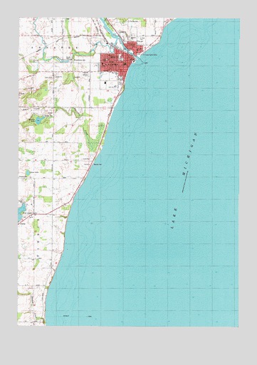
Algoma, WI USGS Topographic Map
Click on map above to begin viewing in our Map Viewer.

This topographic map contains these locations and features:
Feature Name Type Latitude Longitude GNIS ID View Map
61 ReservoirReservoirN44.6117°W87.4468°1793532View Map
Ahnapee RiverStreamN44.6083°W87.4331°1560713View Map
Alapma Boat ClubLocaleN44.6117°W87.4401°1578167View Map
Alaska LakeLakeN44.5472°W87.4981°1577475View Map
AlgomaPopulated PlaceN44.6089°W87.4326°1560759View Map
Algoma Elementary SchoolSchoolN44.6063°W87.4404°1840621View Map
Algoma Fire Department - Algoma Rescue SquadBuildingN44.6094°W87.4372°2698015View Map
Algoma High SchoolSchoolN44.5971°W87.4456°1840622View Map
Algoma Marina IncorporatedHarborN44.6094°W87.4487°1578564View Map
Algoma Police DepartmentBuildingN44.6064°W87.4394°2759394View Map
Algoma United Methodist ChurchChurchN44.6061°W87.4509°1840623View Map
Algoma Utilities CommissionLocaleN44.6078°W87.4343°1578077View Map
Algoma Wastewater Treatment PlantLocaleN44.6125°W87.4417°2710343View Map
BruemmervillePopulated PlaceN44.6067°W87.4701°1562289View Map
Calvary Assembly of God ChurchChurchN44.6078°W87.4373°1840626View Map
City of AlgomaCivilN44.6058°W87.4465°1582672View Map
East Alaska LakeLakeN44.5457°W87.4991°1564268View Map
Episcopal Church of Saint Agnes by the LakeChurchN44.6058°W87.4379°1840633View Map
Evergreen CemeteryCemeteryN44.6022°W87.4616°1564752View Map
Henry Iwen DamDamN44.6117°W87.4468°1793531View Map
K and D GreenhouseBuildingN44.6081°W87.4481°2710473View Map
Kewaunee County ParkParkN44.5847°W87.4848°1578075View Map
Kewaunee County ParkParkN44.5492°W87.4976°1578079View Map
Krohns LakeLakeN44.5833°W87.4885°1567650View Map
Mashek CreekStreamN44.5014°W87.4834°1569110View Map
Newman ParkParkN44.6094°W87.4437°1578076View Map
Perry ParkParkN44.6083°W87.4437°1578134View Map
Peterson ParkParkN44.6167°W87.4379°1840665View Map
Saint Mary SchoolSchoolN44.6122°W87.4329°1578168View Map
Saint Mary's Catholic CemeteryCemeteryN44.6169°W87.4323°1573265View Map
Saint Marys Catholic ChurchChurchN44.6117°W87.4331°1840692View Map
Saint Paul CemeteryCemeteryN44.6237°W87.4381°1573434View Map
Saint Paul's Evangelical Lutheran SchoolSchoolN44.6023°W87.4444°1578132View Map
Saint Pauls Evangelical Lutheran ChurchChurchN44.6094°W87.4384°1840697View Map
Silver CreekStreamN44.6172°W87.4451°1574120View Map
Silver Creek School (historical)SchoolN44.6175°W87.4912°1574126View Map
Silver LakeLakeN44.5620°W87.4946°1574139View Map
Threemile CreekStreamN44.5667°W87.4573°1575419View Map
Town of PierceCivilN44.5392°W87.4917°1583920View Map
Wiesner CemeteryCemeteryN44.5600°W87.4998°1578078View Map
Wings of Eagles Christian AcademySchoolN44.5954°W87.4464°2716876View Map

Note: Coordinates in the location and feature list above are referenced to NAD83 datum.


Copyright (C) 2008-2025 Ryan Niemi / Sunset Dynamics ... All Rights Reserved