TopoQuest Logo
Do you find TopoQuest useful?
Help keep TopoQuest running and adding new maps/features by donating!
Bitcoin:  19c7KJd3qBynnjoSw5npx9KScwjBe4ifkT
Litecoin:  LXs6TkuXGGXo1vDsWCkWVdjQX94eUKd6ui
Home View Maps Find Maps Find Places Resources & Links


Forreston North, Illinois Topographic Map

USGS Map Title: Forreston North, IL
USGS Map MRC: 42089B5
DRG (GeoTIFF) Download: o42089b5.tif


Neighboring USGS Topographic Map Quads:


  Freeport West, IL  
42089C6
 

  Freeport East, IL  
42089C5
 

  Ridott, IL  
42089C4
 

  Shannon, IL  
42089B6
 

  Forreston North, IL  
42089B5
 

  German Valley, IL  
42089B4
 

  Brookville, IL  
42089A6
 

  Forreston South, IL  
42089A5
 

  Mount Morris, IL  
42089A4


Map MRC Location:

N43°
W90°
N43°
W89°
H8 H7 H6 H5 H4 H3 H2 H1
G8 G7 G6 G5 G4 G3 G2 G1
F8 F7 F6 F5 F4 F3 F2 F1
E8 E7 E6 E5 E4 E3 E2 E1
D8 D7 D6 D5 D4 D3 D2 D1
C8 C7 C6 C5 C4 C3 C2 C1
B8 B7 B6 B5 B4 B3 B2 B1
A8 A7 A6 A5 A4 A3 A2 A1
N42°
W90°
N42°
W89°

Forreston North, IL USGS 1:24K Topographic Map Preview:
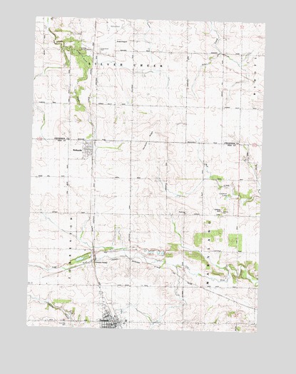
Forreston North, IL USGS Topographic Map
Click on map above to begin viewing in our Map Viewer.

This topographic map contains these locations and features:
Feature Name Type Latitude Longitude GNIS ID View Map
Albertus AirportAirportN42.2469°W89.5844°427298View Map
BaileyvillePopulated PlaceN42.1972°W89.5934°403811View Map
Baileyville Baptist ChurchChurchN42.1992°W89.5959°1967955View Map
Baileyville Post OfficePost OfficeN42.1968°W89.5931°1808184View Map
Baileyville Reformed ChurchChurchN42.1972°W89.5965°1967956View Map
Coffman BluffSummitN42.1736°W89.5204°406331View Map
Coffman CemeteryCemeteryN42.1731°W89.5207°1705916View Map
Coffman LakeLakeN42.1794°W89.5185°406332View Map
Collman School (historical)SchoolN42.2147°W89.5318°406389View Map
Crane School (historical)SchoolN42.2150°W89.6057°406745View Map
Cranes Grove CemeteryCemeteryN42.2372°W89.5898°406741View Map
Cyclone Heights School (historical)SchoolN42.1420°W89.5412°406915View Map
ForrestonPopulated PlaceN42.1261°W89.5793°408540View Map
Forreston City HallBuildingN42.1267°W89.5790°1967957View Map
Forreston Fire Protection DistrictBuildingN42.1265°W89.5772°2640366View Map
Forreston High SchoolSchoolN42.1272°W89.5723°1808228View Map
Forreston Post OfficePost OfficeN42.1267°W89.5780°1808229View Map
Forreston StationLocaleN42.1514°W89.5890°1705918View Map
Gravel Pit School (historical)SchoolN42.1567°W89.6004°409343View Map
Green Prairie School (historical)SchoolN42.1714°W89.5371°409394View Map
Hardpan RidgeRidgeN42.1997°W89.5623°409776View Map
Kutz QuarryMineN42.1309°W89.6015°1983740View Map
Maple Hill School (historical)SchoolN42.1703°W89.5715°412958View Map
Myers QuarryMineN42.1945°W89.5093°1983741View Map
North Grove ChurchChurchN42.1720°W89.5412°1705917View Map
North Grove Zion Reformed CemeteryCemeteryN42.1722°W89.5398°1808283View Map
Oakdale Nature PreserveParkN42.2386°W89.6018°1705920View Map
Pleasant Hill School (historical)SchoolN42.1275°W89.5404°415868View Map
Prairie Hill School (historical)SchoolN42.2364°W89.5323°416145View Map
Rummel RLA Airport (historical)AirportN42.1667°W89.5001°427314View Map
Silver Creek Center School (historical)SchoolN42.2367°W89.5721°418506View Map
South FreeportPopulated PlaceN42.2409°W89.5726°423192View Map
Sunnyside School (historical)SchoolN42.2156°W89.5709°419402View Map
Timber Ridge Mobile Home ParkPopulated PlaceN42.2436°W89.6025°2630249View Map
Township of MarylandCivilN42.1573°W89.5118°429335View Map
Township of Silver CreekCivilN42.2440°W89.5684°429753View Map
Village of ForrestonCivilN42.1265°W89.5782°2398900View Map
White Oak CemeteryCemeteryN42.1270°W89.6026°1705919View Map
White Oak School (historical)SchoolN42.1272°W89.6082°421061View Map

Note: Coordinates in the location and feature list above are referenced to NAD83 datum.


Copyright (C) 2008-2025 Ryan Niemi / Sunset Dynamics ... All Rights Reserved