TopoQuest Logo
Do you find TopoQuest useful?
Help keep TopoQuest running and adding new maps/features by donating!
Bitcoin:  19c7KJd3qBynnjoSw5npx9KScwjBe4ifkT
Litecoin:  LXs6TkuXGGXo1vDsWCkWVdjQX94eUKd6ui
Home View Maps Find Maps Find Places Resources & Links


Fort White, Florida Topographic Map

USGS Map Title: Fort White, FL
USGS Map MRC: 29082H6
DRG (GeoTIFF) Download: o29082h6.tif


Neighboring USGS Topographic Map Quads:


  O'Brien SE, FL  
30082A7
 

  Columbia, FL  
30082A6
 

  Ellisville, FL  
30082A5
 

  Hildreth, FL  
29082H7
 

  Fort White, FL  
29082H6
 

  Mikesville, FL  
29082H5
 

  Bell, FL  
29082G7
 

  High Springs SW, FL  
29082G6
 

  High Springs, FL  
29082G5


Map MRC Location:

N30°
W83°
N30°
W82°
H8 H7 H6 H5 H4 H3 H2 H1
G8 G7 G6 G5 G4 G3 G2 G1
F8 F7 F6 F5 F4 F3 F2 F1
E8 E7 E6 E5 E4 E3 E2 E1
D8 D7 D6 D5 D4 D3 D2 D1
C8 C7 C6 C5 C4 C3 C2 C1
B8 B7 B6 B5 B4 B3 B2 B1
A8 A7 A6 A5 A4 A3 A2 A1
N29°
W83°
N29°
W82°

Fort White, FL USGS 1:24K Topographic Map Preview:
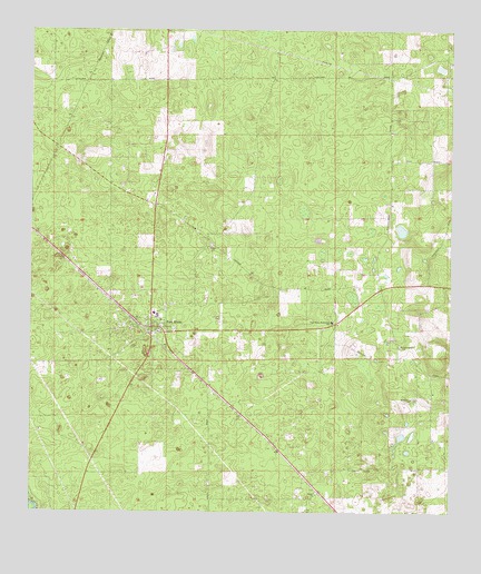
Fort White, FL USGS Topographic Map
Click on map above to begin viewing in our Map Viewer.

This topographic map contains these locations and features:
Feature Name Type Latitude Longitude GNIS ID View Map
Almeidas Landing AirportAirportN29.9677°W82.7012°309442View Map
Antioch Missionary Baptist ChurchChurchN29.9225°W82.7200°2547097View Map
Bethlehem CemeteryCemeteryN29.9050°W82.6353°2547182View Map
Bethlehem Community ParkParkN29.9133°W82.6342°2547183View Map
Bethlehem United Methodist ChurchChurchN29.9047°W82.6362°278568View Map
Bradley AirportAirportN29.9245°W82.6936°309441View Map
Church of GodChurchN29.9217°W82.7119°2546978View Map
Clay Electric Cooperative Fort White SubstationBuildingN29.9228°W82.6644°2547180View Map
Columbia County Sheriff's Office District 2BuildingN29.9214°W82.7141°2333189View Map
Deese Memorial ParkParkN29.9242°W82.7142°2547078View Map
Elim Baptist ChurchChurchN29.9433°W82.6962°282154View Map
Elim CemeteryCemeteryN29.9436°W82.6969°2547179View Map
Fort WhitePopulated PlaceN29.9233°W82.7137°282713View Map
Fort White Baptist ChurchChurchN29.9236°W82.7139°2547077View Map
Fort White CemeteryCemeteryN29.9280°W82.7100°2546997View Map
Fort White Church of ChristChurchN29.9361°W82.7328°2547178View Map
Fort White DivisionCivilN29.9635°W82.6722°1935773View Map
Fort White Elementary SchoolSchoolN29.9267°W82.7132°2547037View Map
Fort White High SchoolSchoolN29.9310°W82.7115°2547057View Map
Fort White High School Football StadiumParkN29.9300°W82.7086°2546979View Map
Fort White Middle SchoolSchoolN29.9294°W82.7100°2546980View Map
Fort White Post OfficePost OfficeN29.9242°W82.7161°2547117View Map
Fort White Town HallBuildingN29.9200°W82.7142°2547118View Map
Fort White United Methodist ChurchChurchN29.9247°W82.7111°2547017View Map
Fort White-Bethlehem School (historical)SchoolN29.9244°W82.6596°282714View Map
Heavenly Rest Memorial ParkCemeteryN29.9178°W82.7194°2547119View Map
Ichetucknee / South Columbia Volunteer Fire Department Station 46BuildingN29.9256°W82.7160°2547177View Map
Lazy S Farm AirportAirportN29.8767°W82.6386°309492View Map
Shiloh Baptist ChurchChurchN29.8802°W82.6646°291035View Map
Shiloh CemeteryCemeteryN29.8805°W82.6650°2547184View Map
Town of Fort WhiteCivilN29.9224°W82.7136°2406511View Map
Tustenuggee CemeteryCemeteryN29.9186°W82.6397°2547181View Map
Tustenuggee United Methodist ChurchChurchN29.9186°W82.6393°292587View Map
Woftoka (historical)Populated PlaceN29.8836°W82.6998°294494View Map

Note: Coordinates in the location and feature list above are referenced to NAD83 datum.


Copyright (C) 2008-2024 Ryan Niemi / Sunset Dynamics ... All Rights Reserved