TopoQuest Logo
Do you find TopoQuest useful?
Help keep TopoQuest running and adding new maps/features by donating!
Bitcoin:  19c7KJd3qBynnjoSw5npx9KScwjBe4ifkT
Litecoin:  LXs6TkuXGGXo1vDsWCkWVdjQX94eUKd6ui
Home View Maps Find Maps Find Places Resources & Links


High Springs SW, Florida Topographic Map

USGS Map Title: High Springs SW, FL
USGS Map MRC: 29082G6
DRG (GeoTIFF) Download: o29082g6.tif


Neighboring USGS Topographic Map Quads:


  Hildreth, FL  
29082H7
 

  Fort White, FL  
29082H6
 

  Mikesville, FL  
29082H5
 

  Bell, FL  
29082G7
 

  High Springs SW, FL  
29082G6
 

  High Springs, FL  
29082G5
 

  Fourmile Lake, FL  
29082F7
 

  Waters Lake, FL  
29082F6
 

  Newberry, FL  
29082F5


Map MRC Location:

N30°
W83°
N30°
W82°
H8 H7 H6 H5 H4 H3 H2 H1
G8 G7 G6 G5 G4 G3 G2 G1
F8 F7 F6 F5 F4 F3 F2 F1
E8 E7 E6 E5 E4 E3 E2 E1
D8 D7 D6 D5 D4 D3 D2 D1
C8 C7 C6 C5 C4 C3 C2 C1
B8 B7 B6 B5 B4 B3 B2 B1
A8 A7 A6 A5 A4 A3 A2 A1
N29°
W83°
N29°
W82°

High Springs SW, FL USGS 1:24K Topographic Map Preview:
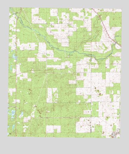
High Springs SW, FL USGS Topographic Map
Click on map above to begin viewing in our Map Viewer.

This topographic map contains these locations and features:
Feature Name Type Latitude Longitude GNIS ID View Map
Bagget LakeLakeN29.7733°W82.7437°278028View Map
Blue SpringsSpringN29.8300°W82.6826°279073View Map
BudaPopulated PlaceN29.7591°W82.6259°295161View Map
Central Florida Electric Cooperative Neals SubstationBuildingN29.7825°W82.7183°2546898View Map
ClarkPopulated PlaceN29.7733°W82.6259°280491View Map
Cornerstone Baptist ChurchChurchN29.8700°W82.7369°2546900View Map
Cow CreekStreamN29.8688°W82.7448°280925View Map
CraggsPopulated PlaceN29.7788°W82.7410°295223View Map
Fort White Branch LibraryBuildingN29.8700°W82.7372°2546977View Map
Gilchrist County Fire and Rescue Station 3BuildingN29.8152°W82.7144°2644042View Map
Ginnie SpringSpringN29.8361°W82.6998°283095View Map
Hollingsworth BluffPopulated PlaceN29.8691°W82.7429°284162View Map
July SpringSpringN29.8361°W82.6960°284968View Map
Lilly SpringSpringN29.8294°W82.6612°285517View Map
Mount Pleasant Baptist ChurchChurchN29.7841°W82.6571°287298View Map
Mount Pleasant CemeteryCemeteryN29.8006°W82.6569°2546897View Map
NealsPopulated PlaceN29.7688°W82.7126°295477View Map
Nobel Hill CemeteryCemeteryN29.7850°W82.6368°287749View Map
Poe SpringSpringN29.8258°W82.6487°289105View Map
Rum IslandIslandN29.8336°W82.6776°290050View Map
Spring Ridge Census Designated PlaceCensusN29.8218°W82.7245°2628533View Map

Note: Coordinates in the location and feature list above are referenced to NAD83 datum.


Copyright (C) 2008-2025 Ryan Niemi / Sunset Dynamics ... All Rights Reserved