TopoQuest Logo
Do you find TopoQuest useful?
Help keep TopoQuest running and adding new maps/features by donating!
Bitcoin:  19c7KJd3qBynnjoSw5npx9KScwjBe4ifkT
Litecoin:  LXs6TkuXGGXo1vDsWCkWVdjQX94eUKd6ui
Home View Maps Find Maps Find Places Resources & Links


Fortescue, New Jersey Topographic Map

USGS Map Title: Fortescue, NJ
USGS Map MRC: 39075B2
DRG (GeoTIFF) Download: o39075b2.tif


Neighboring USGS Topographic Map Quads:


  Ben Davis Point, NJ  
39075C3
 

  Cedarville, NJ  
39075C2
 

  Dividing Creek, NJ  
39075C1


  Fortescue, NJ  
39075B2
 

  Port Norris, NJ  
39075B1
 

  Bennetts Pier, DE  
39075A3


Map MRC Location:

N40°
W76°
N40°
W75°
H8 H7 H6 H5 H4 H3 H2 H1
G8 G7 G6 G5 G4 G3 G2 G1
F8 F7 F6 F5 F4 F3 F2 F1
E8 E7 E6 E5 E4 E3 E2 E1
D8 D7 D6 D5 D4 D3 D2 D1
C8 C7 C6 C5 C4 C3 C2 C1
B8 B7 B6 B5 B4 B3 B2 B1
A8 A7 A6 A5 A4 A3 A2 A1
N39°
W76°
N39°
W75°

Fortescue, NJ USGS 1:24K Topographic Map Preview:
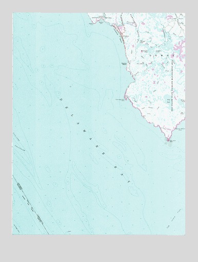
Fortescue, NJ USGS Topographic Map
Click on map above to begin viewing in our Map Viewer.

This topographic map contains these locations and features:
Feature Name Type Latitude Longitude GNIS ID View Map
Beadon CoveBayN39.2454°W75.1857°874579View Map
Beadon CreekStreamN39.2461°W75.1829°874580View Map
Beadon PointCapeN39.2443°W75.1910°874581View Map
Boiler CreekGutN39.2079°W75.1444°874843View Map
Brandywine RangeChannelN39.1668°W75.2496°884530View Map
Courtney PondsLakeN39.2275°W75.1459°875676View Map
Cross LedgeBarN39.1801°W75.2471°875745View Map
Downe Township Fire and Rescue Fortescue Company 1 - Station 39BuildingN39.2400°W75.1695°2401776View Map
Egg Island (historical)IslandN39.1793°W75.1371°873765View Map
Egg Island Fish and Wildlife Management AreaParkN39.2084°W75.1330°883044View Map
Egg Island FlatsFlatN39.1359°W75.1319°876123View Map
Egg Island PointCapeN39.1776°W75.1371°876124View Map
Elbow of Cross LedgeBarN39.1737°W75.2449°876133View Map
Elder GutGutN39.2243°W75.1494°876135View Map
False Egg Island PointCapeN39.2007°W75.1677°876293View Map
Fishing CreekStreamN39.2112°W75.1613°876354View Map
FortescuePopulated PlaceN39.2376°W75.1716°876423View Map
Fortescue BeachBeachN39.2368°W75.1732°876424View Map
Fortescue CreekGutN39.2307°W75.1607°876425View Map
Indian DitchCanalN39.2234°W75.1541°877325View Map
Joe Flogger ShoalBarN39.1501°W75.2496°217265View Map
Johnsons DitchCanalN39.2465°W75.1302°877479View Map
King PondLakeN39.2004°W75.1374°877570View Map
Lower Brothers Creek (historical)StreamN39.1848°W75.1424°877960View Map
Main Maull RangeChannelN39.1348°W75.2224°217878View Map
McCormick PondLakeN39.2287°W75.1505°878211View Map
Miah Maull RangeChannelN39.1390°W75.2385°884557View Map
Middle Brothers CreekStreamN39.1916°W75.1519°878294View Map
Oyster CreekStreamN39.2386°W75.1559°879070View Map
Piersons DitchStreamN39.2252°W75.1374°874123View Map
Raybins BeachLocaleN39.2221°W75.1657°879625View Map
Straight CreekStreamN39.2024°W75.1657°880964View Map
The Three MouthsLakeN39.2204°W75.1546°881152View Map
Upper Brothers CreekStreamN39.1957°W75.1552°881380View Map
Widgeon PondsLakeN39.1993°W75.1271°881822View Map
Wilmas PondLakeN39.2318°W75.1588°881865View Map

Note: Coordinates in the location and feature list above are referenced to NAD83 datum.


Copyright (C) 2008-2025 Ryan Niemi / Sunset Dynamics ... All Rights Reserved