TopoQuest Logo
Do you find TopoQuest useful?
Help keep TopoQuest running and adding new maps/features by donating!
Bitcoin:  19c7KJd3qBynnjoSw5npx9KScwjBe4ifkT
Litecoin:  LXs6TkuXGGXo1vDsWCkWVdjQX94eUKd6ui
Home View Maps Find Maps Find Places Resources & Links


Fountaintown, Indiana Topographic Map

USGS Map Title: Fountaintown, IN
USGS Map MRC: 39085F7
DRG (GeoTIFF) Download: o39085f7.tif


Neighboring USGS Topographic Map Quads:


  Cumberland, IN  
39085G8
 

  Greenfield, IN  
39085G7
 

  Cleveland, IN  
39085G6
 

  Acton, IN  
39085F8
 

  Fountaintown, IN  
39085F7
 

  Morristown, IN  
39085F6
 

  Boggstown, IN  
39085E8
 

  Shelbyville, IN  
39085E7
 

  Rays Crossing, IN  
39085E6


Map MRC Location:

N40°
W86°
N40°
W85°
H8 H7 H6 H5 H4 H3 H2 H1
G8 G7 G6 G5 G4 G3 G2 G1
F8 F7 F6 F5 F4 F3 F2 F1
E8 E7 E6 E5 E4 E3 E2 E1
D8 D7 D6 D5 D4 D3 D2 D1
C8 C7 C6 C5 C4 C3 C2 C1
B8 B7 B6 B5 B4 B3 B2 B1
A8 A7 A6 A5 A4 A3 A2 A1
N39°
W86°
N39°
W85°

Fountaintown, IN USGS 1:24K Topographic Map Preview:
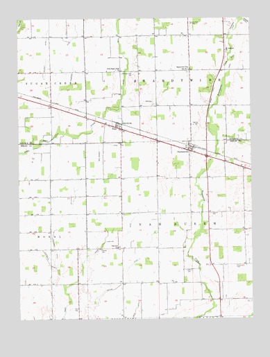
Fountaintown, IN USGS Topographic Map
Click on map above to begin viewing in our Map Viewer.

This topographic map contains these locations and features:
Feature Name Type Latitude Longitude GNIS ID View Map
Andis DitchCanalN39.7314°W85.7600°430168View Map
Ashcraft DitchCanalN39.7325°W85.8594°430306View Map
Brandywine Elementary SchoolSchoolN39.7284°W85.7828°431451View Map
Brown DitchCanalN39.7173°W85.7705°431613View Map
CarrolltonPopulated PlaceN39.7056°W85.8208°434493View Map
Concord CemeteryCemeteryN39.6690°W85.7717°432853View Map
Duckworth DitchCanalN39.6489°W85.8594°433751View Map
Fairview CemeteryCemeteryN39.6540°W85.8314°434319View Map
Fairview ChurchChurchN39.6550°W85.8225°434338View Map
Farm StripAirportN39.6887°W85.8421°2677112View Map
Fisher CemeteryCemeteryN39.6296°W85.8436°434107View Map
FountaintownPopulated PlaceN39.6948°W85.7830°434718View Map
Fountaintown Community Volunteer Fire DepartmentBuildingN39.6938°W85.7794°2626230View Map
Gorton Memorial ChurchChurchN39.6398°W85.7583°435224View Map
Hamilton DitchCanalN39.6609°W85.8166°435643View Map
Lisher CemeteryCemeteryN39.6453°W85.7824°437979View Map
Little Sugar Creek CemeteryCemeteryN39.7277°W85.8139°438155View Map
Little Sugar Creek ChurchChurchN39.7281°W85.8203°438156View Map
MacDougall DitchCanalN39.6978°W85.8283°438445View Map
Manlove ParkParkN39.7375°W85.7816°438521View Map
Maxwell DitchStreamN39.7170°W85.8189°438756View Map
Mc Neil Field Airport (historical)AirportN39.6650°W85.8180°2677050View Map
Moral Post Office (historical)Post OfficeN39.6764°W85.8630°453038View Map
Mount Lebanon ChurchChurchN39.7362°W85.7636°439595View Map
Osgood Field (historical)AirportN39.7478°W85.8072°449186View Map
Pelham CemeteryCemeteryN39.6470°W85.7584°440979View Map
Powers DitchCanalN39.7475°W85.7508°441526View Map
Reedville StationPopulated PlaceN39.7062°W85.8191°441861View Map
Sexton DitchCanalN39.6420°W85.8166°443230View Map
Snodgrass DitchCanalN39.6623°W85.8558°443732View Map
Stucker Fork Structure Number 15DamN39.6684°W85.8516°448904View Map
Thompson DitchCanalN39.7223°W85.8475°444714View Map
Township of BrandywineCivilN39.7281°W85.7823°453133View Map
Township of Van BurenCivilN39.6623°W85.7867°453952View Map
Wilson DitchStreamN39.7170°W85.8189°446142View Map

Note: Coordinates in the location and feature list above are referenced to NAD83 datum.


Copyright (C) 2008-2025 Ryan Niemi / Sunset Dynamics ... All Rights Reserved