TopoQuest Logo
Do you find TopoQuest useful?
Help keep TopoQuest running and adding new maps/features by donating!
Bitcoin:  19c7KJd3qBynnjoSw5npx9KScwjBe4ifkT
Litecoin:  LXs6TkuXGGXo1vDsWCkWVdjQX94eUKd6ui
Home View Maps Find Maps Find Places Resources & Links


Greenfield, Indiana Topographic Map

USGS Map Title: Greenfield, IN
USGS Map MRC: 39085G7
DRG (GeoTIFF) Download: o39085g7.tif


Neighboring USGS Topographic Map Quads:


  McCordsville, IN  
39085H8
 

  Ingalls, IN  
39085H7
 

  Pendleton, IN  
39085H6
 

  Cumberland, IN  
39085G8
 

  Greenfield, IN  
39085G7
 

  Cleveland, IN  
39085G6
 

  Acton, IN  
39085F8
 

  Fountaintown, IN  
39085F7
 

  Morristown, IN  
39085F6


Map MRC Location:

N40°
W86°
N40°
W85°
H8 H7 H6 H5 H4 H3 H2 H1
G8 G7 G6 G5 G4 G3 G2 G1
F8 F7 F6 F5 F4 F3 F2 F1
E8 E7 E6 E5 E4 E3 E2 E1
D8 D7 D6 D5 D4 D3 D2 D1
C8 C7 C6 C5 C4 C3 C2 C1
B8 B7 B6 B5 B4 B3 B2 B1
A8 A7 A6 A5 A4 A3 A2 A1
N39°
W86°
N39°
W85°

Greenfield, IN USGS 1:24K Topographic Map Preview:
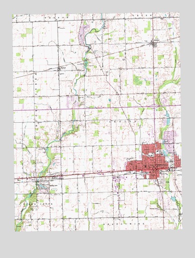
Greenfield, IN USGS Topographic Map
Click on map above to begin viewing in our Map Viewer.

This topographic map contains these locations and features:
Feature Name Type Latitude Longitude GNIS ID View Map
Alford CemeteryCemeteryN39.8481°W85.7910°430071View Map
Boots DitchCanalN39.7937°W85.7564°431351View Map
Bowman AcresPopulated PlaceN39.7620°W85.7675°431406View Map
Boyd DitchCanalN39.8267°W85.8141°431425View Map
Bradley United Methodist ChurchChurchN39.7853°W85.7717°2096121View Map
Brant DitchCanalN39.8534°W85.8094°431454View Map
Church of GodChurchN39.7864°W85.7789°2096119View Map
City of GreenfieldCivilN39.7936°W85.7737°2394986View Map
Cooper CemeteryCemeteryN39.8716°W85.7620°432945View Map
Cooper CornerPopulated PlaceN39.8717°W85.7700°432947View Map
Crestview Conservation ClubLocaleN39.7975°W85.8508°452300View Map
Dye CemeteryCemeteryN39.7771°W85.8597°433822View Map
Eastes DitchCanalN39.7806°W85.8628°433950View Map
Faith United Methodist ChurchChurchN39.7886°W85.7653°2096126View Map
First Baptist ChurchChurchN39.7808°W85.7786°2096123View Map
First Christian ChurchChurchN39.7858°W85.7681°2096124View Map
First Presbyterian ChurchChurchN39.7842°W85.7711°2096122View Map
Frost FieldAirportN39.7924°W85.7871°2676875View Map
Fuller DitchCanalN39.8209°W85.8169°434894View Map
Grace Baptist ChurchChurchN39.8458°W85.8403°2096128View Map
GreenfieldPopulated PlaceN39.7850°W85.7694°449837View Map
Greenfield Conservation ClubLocaleN39.8462°W85.8208°452330View Map
Greenfield Courthouse Square Historic DistrictParkN39.7847°W85.7689°2096133View Map
Greenfield Fire Department Station 21BuildingN39.7840°W85.7698°2625858View Map
Greenfield Fire Department Station 422BuildingN39.8145°W85.7740°2625544View Map
Greenfield Friends ChurchChurchN39.7917°W85.7756°2096118View Map
Greenfield High SchoolSchoolN39.7925°W85.7714°447051View Map
Greenfield Police DepartmentBuildingN39.7836°W85.7695°2758198View Map
Greenfield Post OfficePost OfficeN39.7872°W85.7692°2096132View Map
Greenfield-Central High SchoolSchoolN39.7862°W85.7769°447052View Map
Griffith CemeteryCemeteryN39.7953°W85.8508°435503View Map
Hall DitchCanalN39.7706°W85.8478°435615View Map
Hancock CountyCivilN39.8235°W85.7732°450357View Map
Hancock County Sheriff's OfficeBuildingN39.7848°W85.7673°2758067View Map
Hancock Memorial Hospital and Health ServicesHospitalN39.7952°W85.7682°2096116View Map
Harris Elementary SchoolSchoolN39.7928°W85.7714°435784View Map
Henry DitchCanalN39.8709°W85.8019°436032View Map
Immanuel Holiness ChurchChurchN39.7897°W85.7539°2096127View Map
Interchange 104CrossingN39.8211°W85.7700°2096134View Map
Jones DitchCanalN39.8739°W85.8719°437094View Map
Kirkhoff DitchCanalN39.7898°W85.8619°437355View Map
Leary DitchCanalN39.7692°W85.8061°437702View Map
Leary Weber DitchCanalN39.8470°W85.8339°437703View Map
Life AmbulanceBuildingN39.7829°W85.8055°2719396View Map
Lincoln Park Elementary SchoolSchoolN39.7809°W85.7716°437928View Map
Little Brandywine CreekStreamN39.7589°W85.7519°437999View Map
MaxwellPopulated PlaceN39.8575°W85.7700°438753View Map
Maxwell Middle SchoolSchoolN39.8587°W85.7711°447050View Map
Maxwell United Methodist ChurchChurchN39.8589°W85.7697°2096131View Map
McNamee CemeteryCemeteryN39.7530°W85.8741°438923View Map
Memorial HospitalHospitalN39.7950°W85.7683°438989View Map
MohawkPopulated PlaceN39.8437°W85.8408°439311View Map
Mohawk United Methodist ChurchChurchN39.8417°W85.8414°2096129View Map
Mount Carmel CemeteryCemeteryN39.8672°W85.8064°439540View Map
Nazarene ChurchChurchN39.8403°W85.8405°439954View Map
New DitchCanalN39.8648°W85.8222°440041View Map
Ogle DitchCanalN39.8081°W85.8669°440519View Map
Otterbein United Methodist ChurchChurchN39.8128°W85.8572°440757View Map
Owen CemeteryCemeteryN39.7626°W85.8627°440790View Map
Park CemeteryCemeteryN39.7772°W85.7651°440870View Map
Parker DitchCanalN39.8153°W85.8439°440884View Map
PhiladelphiaPopulated PlaceN39.7814°W85.8455°441077View Map
Philadelphia United Methodist ChurchChurchN39.7814°W85.8444°2096130View Map
Potts DitchCanalN39.8039°W85.7805°441509View Map
Protestant Church of GreenfieldChurchN39.7864°W85.7672°2096125View Map
Putter DitchCanalN39.7753°W85.7661°441674View Map
Reeves CemeteryCemeteryN39.8401°W85.8052°441873View Map
Richey DitchCanalN39.8539°W85.7536°441955View Map
Riley Memorial ParkParkN39.7878°W85.7566°442019View Map
Riley SchoolSchoolN39.7864°W85.7714°442030View Map
Roberts LakeLakeN39.7946°W85.7629°442160View Map
Saint Michael SchoolSchoolN39.7912°W85.7905°442741View Map
Saint Michaels ChurchChurchN39.7914°W85.7906°2096120View Map
Smith Johnson DitchCanalN39.7828°W85.8391°443697View Map
Spring LakeLakeN39.7761°W85.8547°443990View Map
Spring LakePopulated PlaceN39.7767°W85.8530°443991View Map
Sugar Creek CemeteryCemeteryN39.8257°W85.8258°444329View Map
Sugar Creek Township Fire DepartmentBuildingN39.7805°W85.8644°2625592View Map
Sugar HillsPopulated PlaceN39.8612°W85.8228°446672View Map
Sugar Hills Lake DamLakeN39.8641°W85.8223°448534View Map
Town of Spring LakeCivilN39.7767°W85.8536°2397675View Map
Township of CenterCivilN39.8161°W85.7763°453180View Map
Trinity Park United Methodist ChurchChurchN39.7917°W85.7731°2096117View Map
Weber DitchCanalN39.7581°W85.8033°445617View Map
Weston SchoolSchoolN39.7878°W85.7872°445852View Map
Wicker DitchCanalN39.8534°W85.8097°446002View Map
Willet CemeteryCemeteryN39.8098°W85.8291°446047View Map
Williamson DitchCanalN39.7592°W85.7603°446087View Map

Note: Coordinates in the location and feature list above are referenced to NAD83 datum.


Copyright (C) 2008-2024 Ryan Niemi / Sunset Dynamics ... All Rights Reserved