TopoQuest Logo
Do you find TopoQuest useful?
Help keep TopoQuest running and adding new maps/features by donating!
Bitcoin:  19c7KJd3qBynnjoSw5npx9KScwjBe4ifkT
Litecoin:  LXs6TkuXGGXo1vDsWCkWVdjQX94eUKd6ui
Home View Maps Find Maps Find Places Resources & Links


Fourth of July Creek, Oregon Topographic Map

USGS Map Title: Fourth of July Creek, OR
USGS Map MRC: 42124A1
DRG (GeoTIFF) Download: o42124a1.tif


Neighboring USGS Topographic Map Quads:


  Bosley Butte, OR  
42124B2
 

  Quail Prairie Mountain, OR  
42124B1
 

  Chetco Peak, OR  
42123B8
 

  Mount Emily, OR  
42124A2
 

  Fourth of July Creek, OR  
42124A1
 

  Biscuit Hill, OR  
42123A8
 

  Smith River, CA  
41124H2
 

  High Divide, CA  
41124H1
 

  High Plateau Mountain, CA  
41123H8


Map MRC Location:

N43°
W125°
N43°
W124°
H8 H7 H6 H5 H4 H3 H2 H1
G8 G7 G6 G5 G4 G3 G2 G1
F8 F7 F6 F5 F4 F3 F2 F1
E8 E7 E6 E5 E4 E3 E2 E1
D8 D7 D6 D5 D4 D3 D2 D1
C8 C7 C6 C5 C4 C3 C2 C1
B8 B7 B6 B5 B4 B3 B2 B1
A8 A7 A6 A5 A4 A3 A2 A1
N42°
W125°
N42°
W124°

Fourth of July Creek, OR USGS 1:24K Topographic Map Preview:
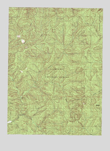
Fourth of July Creek, OR USGS Topographic Map
Click on map above to begin viewing in our Map Viewer.

This topographic map contains these locations and features:
Feature Name Type Latitude Longitude GNIS ID View Map
Bear CreekStreamN42.0193°W124.1056°1137674View Map
Bear RidgeRidgeN42.0079°W124.0992°1137739View Map
Bear Wallow Lookout (historical)LocaleN42.1012°W124.0184°1137771View Map
Bridge CreekStreamN42.0159°W124.0948°1138605View Map
Dry CreekStreamN42.0359°W124.1081°1154708View Map
East Fork Winchuck RiverStreamN42.0190°W124.1056°1141618View Map
Elk CreekStreamN42.0115°W124.1229°1141744View Map
Elk MountainSummitN42.0307°W124.1238°1141787View Map
Emily Creek WayTrailN42.1048°W124.1109°1141872View Map
First Camp Recreation SiteLocaleN42.0193°W124.1101°1926242View Map
Fourth of July CreekStreamN42.0468°W124.0898°1142375View Map
Harbor DivisionCivilN42.0804°W124.0342°1938023View Map
Kink CreekStreamN42.0859°W124.0498°1154711View Map
Louise CreekStreamN42.0290°W124.1109°1154709View Map
Ludlum House Recreation SiteLocaleN42.0357°W124.1093°1156467View Map
Ludlum PlaceLocaleN42.0365°W124.1079°1133775View Map
Packsaddle LookoutLocaleN42.0268°W124.0229°1156456View Map
Packsaddle MountainSummitN42.0307°W124.0079°1147340View Map
Packsaddle TrailTrailN42.0171°W124.0548°1147345View Map
Salmon CreekStreamN42.0129°W124.1193°1148967View Map
Sankey CreekStreamN42.0082°W124.0854°1149066View Map
Wheeler CreekStreamN42.0359°W124.1084°1152171View Map
Wheeler Creek Natural Research AreaParkN42.0832°W124.1054°1133776View Map
Wheeler RidgeRidgeN42.0887°W124.0929°1154712View Map
Winchuck Recreation SiteLocaleN42.0201°W124.1079°1152481View Map

Note: Coordinates in the location and feature list above are referenced to NAD83 datum.


Copyright (C) 2008-2025 Ryan Niemi / Sunset Dynamics ... All Rights Reserved