TopoQuest Logo
Do you find TopoQuest useful?
Help keep TopoQuest running and adding new maps/features by donating!
Bitcoin:  19c7KJd3qBynnjoSw5npx9KScwjBe4ifkT
Litecoin:  LXs6TkuXGGXo1vDsWCkWVdjQX94eUKd6ui
Home View Maps Find Maps Find Places Resources & Links


Quail Prairie Mountain, Oregon Topographic Map

USGS Map Title: Quail Prairie Mountain, OR
USGS Map MRC: 42124B1
DRG (GeoTIFF) Download: o42124b1.tif


Neighboring USGS Topographic Map Quads:


  Collier Butte, OR  
42124C2
 

  Big Craggies, OR  
42124C1
 

  Tincup Peak, OR  
42123C8
 

  Bosley Butte, OR  
42124B2
 

  Quail Prairie Mountain, OR  
42124B1
 

  Chetco Peak, OR  
42123B8
 

  Mount Emily, OR  
42124A2
 

  Fourth of July Creek, OR  
42124A1
 

  Biscuit Hill, OR  
42123A8


Map MRC Location:

N43°
W125°
N43°
W124°
H8 H7 H6 H5 H4 H3 H2 H1
G8 G7 G6 G5 G4 G3 G2 G1
F8 F7 F6 F5 F4 F3 F2 F1
E8 E7 E6 E5 E4 E3 E2 E1
D8 D7 D6 D5 D4 D3 D2 D1
C8 C7 C6 C5 C4 C3 C2 C1
B8 B7 B6 B5 B4 B3 B2 B1
A8 A7 A6 A5 A4 A3 A2 A1
N42°
W125°
N42°
W124°

Quail Prairie Mountain, OR USGS 1:24K Topographic Map Preview:
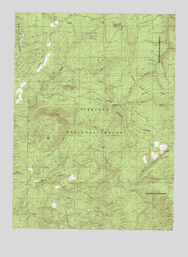
Quail Prairie Mountain, OR USGS Topographic Map
Click on map above to begin viewing in our Map Viewer.

This topographic map contains these locations and features:
Feature Name Type Latitude Longitude GNIS ID View Map
Basin ButteSummitN42.1787°W124.1006°1137552View Map
Basin CreekStreamN42.1834°W124.0845°1137555View Map
Boulder CreekStreamN42.2296°W124.0009°1138469View Map
Coon CreekStreamN42.1359°W124.0081°1140074View Map
Devils BackboneRidgeN42.2001°W124.0579°1140936View Map
Grass LakeLakeN42.1679°W124.0776°1154710View Map
Long RidgeRidgeN42.2254°W124.1026°2726374View Map
Long Ridge Campground (historical)ParkN42.2457°W124.0845°1154713View Map
Moores CreekStreamN42.1990°W124.0406°1155737View Map
Moores RidgeRidgeN42.2015°W124.0023°1159169View Map
Nook CreekStreamN42.2193°W124.0873°1154714View Map
Packers Cabin Group CampLocaleN42.2479°W124.0848°1926251View Map
Pollywog ButteSummitN42.1978°W124.0455°1147865View Map
Quail Prairie CreekStreamN42.1898°W124.1159°1148075View Map
Quail Prairie MountainSummitN42.2421°W124.0454°1148076View Map
Red Mountain CreekStreamN42.1479°W124.0367°1148322View Map
Red Mountain PrairieFlatN42.1822°W124.0184°1148324View Map
Snaketooth ButteSummitN42.1527°W124.1073°1149792View Map
Snaketooth WayTrailN42.1671°W124.1165°1149793View Map
Submarine HoleRapidsN42.2346°W124.0040°1154831View Map
Swede HeavenSummitN42.1696°W124.0554°1150776View Map
West Coon CreekStreamN42.1509°W124.0526°1152038View Map

Note: Coordinates in the location and feature list above are referenced to NAD83 datum.


Copyright (C) 2008-2025 Ryan Niemi / Sunset Dynamics ... All Rights Reserved