TopoQuest Logo
Do you find TopoQuest useful?
Help keep TopoQuest running and adding new maps/features by donating!
Bitcoin:  19c7KJd3qBynnjoSw5npx9KScwjBe4ifkT
Litecoin:  LXs6TkuXGGXo1vDsWCkWVdjQX94eUKd6ui
Home View Maps Find Maps Find Places Resources & Links


Bosley Butte, Oregon Topographic Map

USGS Map Title: Bosley Butte, OR
USGS Map MRC: 42124B2
DRG (GeoTIFF) Download: o42124b2.tif


Neighboring USGS Topographic Map Quads:


  Sundown Mountain, OR  
42124C3
 

  Collier Butte, OR  
42124C2
 

  Big Craggies, OR  
42124C1
 

  Carpenterville, OR  
42124B3
 

  Bosley Butte, OR  
42124B2
 

  Quail Prairie Mountain, OR  
42124B1
 

  Brookings, OR  
42124A3
 

  Mount Emily, OR  
42124A2
 

  Fourth of July Creek, OR  
42124A1


Map MRC Location:

N43°
W125°
N43°
W124°
H8 H7 H6 H5 H4 H3 H2 H1
G8 G7 G6 G5 G4 G3 G2 G1
F8 F7 F6 F5 F4 F3 F2 F1
E8 E7 E6 E5 E4 E3 E2 E1
D8 D7 D6 D5 D4 D3 D2 D1
C8 C7 C6 C5 C4 C3 C2 C1
B8 B7 B6 B5 B4 B3 B2 B1
A8 A7 A6 A5 A4 A3 A2 A1
N42°
W125°
N42°
W124°

Bosley Butte, OR USGS 1:24K Topographic Map Preview:
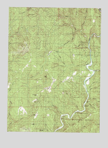
Bosley Butte, OR USGS Topographic Map
Click on map above to begin viewing in our Map Viewer.

This topographic map contains these locations and features:
Feature Name Type Latitude Longitude GNIS ID View Map
Big Redwood CreekStreamN42.1590°W124.1440°1138053View Map
Bosley ButteSummitN42.2092°W124.2253°1138448View Map
Bravo Ranch (historical)LocaleN42.1476°W124.2334°1138582View Map
Buzzard RoostSummitN42.2420°W124.2229°1139084View Map
Cashner ButteSummitN42.1812°W124.1977°1139431View Map
Eagle CreekStreamN42.2159°W124.1437°1141469View Map
First CreekStreamN42.1671°W124.1468°1142135View Map
Gardner BarBarN42.1776°W124.1429°1154697View Map
Horse PrairieFlatN42.1412°W124.2134°1143779View Map
Ice Box Hole Boat LaunchLocaleN42.1256°W124.1866°2668510View Map
Little Redwood CreekStreamN42.1546°W124.1459°1144924View Map
Little Redwood Recreation SiteLocaleN42.1540°W124.1456°1154696View Map
Looking-Glass PrairieFlatN42.1598°W124.2148°1145454View Map
Miller BarBarN42.1415°W124.1734°1154698View Map
Miller Bar Boat LaunchLocaleN42.1361°W124.1780°2668440View Map
Miller Bar Recreation SiteLocaleN42.1398°W124.1765°1926248View Map
Mineral Hill ForkStreamN42.2265°W124.1556°1146316View Map
Nook Bar Boat LaunchLocaleN42.1462°W124.1572°2668564View Map
Nook Bar Recreation SiteLocaleN42.1462°W124.1568°1926249View Map
Nook CreekStreamN42.1473°W124.1570°1146870View Map
Northern PrairieFlatN42.2049°W124.1950°1147079View Map
Palmer ButteSummitN42.1268°W124.2276°1147367View Map
Panda RidgeRidgeN42.1362°W124.1529°1729806View Map
Panther CreekStreamN42.1921°W124.1473°1147387View Map
Prairie CreekStreamN42.1918°W124.1740°1147976View Map
Rainbow CreekStreamN42.2098°W124.1445°1148166View Map
Ransom CreekStreamN42.1343°W124.2440°1148217View Map
Redwood Bar Boat LaunchLocaleN42.1531°W124.1478°2668565View Map
Redwood Bar Recreation SiteLocaleN42.1559°W124.1448°1926254View Map
Robinson SpringSpringN42.2060°W124.1831°1148556View Map
Robinson Spring CreekStreamN42.2268°W124.1615°1148558View Map
Second CreekStreamN42.1651°W124.1440°1149204View Map
South Fork Boat LaunchLocaleN42.1860°W124.1344°2668410View Map
South Fork Camp Recreation SiteLocaleN42.1871°W124.1340°1926258View Map
South Fork Chetco RiverStreamN42.1859°W124.1368°1149949View Map
Stump PrairieFlatN42.1312°W124.2176°1150508View Map
Wilson CreekStreamN42.1423°W124.1784°1152453View Map
Wilson PrairieFlatN42.1720°W124.1914°1152462View Map
Yank PrairieFlatN42.1618°W124.2114°1152694View Map

Note: Coordinates in the location and feature list above are referenced to NAD83 datum.


Copyright (C) 2008-2025 Ryan Niemi / Sunset Dynamics ... All Rights Reserved