TopoQuest Logo
Do you find TopoQuest useful?
Help keep TopoQuest running and adding new maps/features by donating!
Bitcoin:  19c7KJd3qBynnjoSw5npx9KScwjBe4ifkT
Litecoin:  LXs6TkuXGGXo1vDsWCkWVdjQX94eUKd6ui
Home View Maps Find Maps Find Places Resources & Links


Frenchville, Pennsylvania Topographic Map

USGS Map Title: Frenchville, PA
USGS Map MRC: 41078A2
DRG (GeoTIFF) Download: o41078a2.tif


Neighboring USGS Topographic Map Quads:


  The Knobs, PA  
41078B3
 

  Devils Elbow, PA  
41078B2
 

  Pottersdale, PA  
41078B1
 

  Lecontes Mills, PA  
41078A3
 

  Frenchville, PA  
41078A2
 

  Karthaus, PA  
41078A1
 

  Wallaceton, PA  
40078H3
 

  Philipsburg, PA  
40078H2
 

  Black Moshannon, PA  
40078H1


Map MRC Location:

N42°
W79°
N42°
W78°
H8 H7 H6 H5 H4 H3 H2 H1
G8 G7 G6 G5 G4 G3 G2 G1
F8 F7 F6 F5 F4 F3 F2 F1
E8 E7 E6 E5 E4 E3 E2 E1
D8 D7 D6 D5 D4 D3 D2 D1
C8 C7 C6 C5 C4 C3 C2 C1
B8 B7 B6 B5 B4 B3 B2 B1
A8 A7 A6 A5 A4 A3 A2 A1
N41°
W79°
N41°
W78°

Frenchville, PA USGS 1:24K Topographic Map Preview:
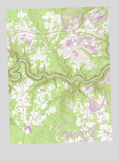
Frenchville, PA USGS Topographic Map
Click on map above to begin viewing in our Map Viewer.

This topographic map contains these locations and features:
Feature Name Type Latitude Longitude GNIS ID View Map
Alder RunStreamN41.0556°W78.1731°1168132View Map
Aurora Mine StationLocaleN41.0684°W78.2472°1213031View Map
Basin RunStreamN41.0581°W78.1456°1168796View Map
Big RunStreamN41.0612°W78.2000°1198037View Map
Browns RunStreamN41.0281°W78.1831°1192196View Map
Buck RunStreamN41.0873°W78.2447°1170552View Map
Buck Run School (historical)SchoolN41.1031°W78.2411°1205471View Map
Central PointLocaleN41.1084°W78.1447°1202118View Map
CoudleyPopulated PlaceN41.0720°W78.2389°1203350View Map
Deer CreekStreamN41.0787°W78.2350°1173081View Map
Deer TunnelTunnelN41.0637°W78.2472°1173104View Map
Fairmont School (historical)SchoolN41.0776°W78.1578°1205476View Map
FairviewPopulated PlaceN41.0345°W78.2320°1203550View Map
Fairview ChurchChurchN41.0348°W78.2325°1205481View Map
Fairview SchoolSchoolN41.0406°W78.2353°1205479View Map
Folmar AirportAirportN41.0003°W78.1255°2443650View Map
FrenchvillePopulated PlaceN41.1048°W78.2200°1175232View Map
Frenchville Post OfficePost OfficeN41.1038°W78.2270°2772708View Map
Frenchville StationLocaleN41.0709°W78.2389°1212783View Map
Frenchville Station (historical)LocaleN41.0778°W78.2289°1205472View Map
Guenot SettlementPopulated PlaceN41.0806°W78.1433°1203729View Map
Hubler RunStreamN41.0137°W78.2006°1177539View Map
KeewaydinPopulated PlaceN41.1045°W78.1553°1178297View Map
Kettle Spring RunStreamN41.0423°W78.1833°1178425View Map
Mignot SchoolSchoolN41.0812°W78.2025°1205473View Map
Mons RunStreamN41.0137°W78.2000°1181441View Map
Mount Pleasant School (historical)SchoolN41.0851°W78.1736°1205475View Map
MowryPopulated PlaceN41.0601°W78.1406°1204236View Map
Mowry RunStreamN41.0556°W78.1550°1181984View Map
Mulsonburg SchoolSchoolN41.1017°W78.1931°1205474View Map
PalestinePopulated PlaceN41.0231°W78.2214°1204351View Map
Palestine ChurchChurchN41.0234°W78.2211°1205482View Map
Palestine School (historical)SchoolN41.0370°W78.2039°1205480View Map
Pleasant HillPopulated PlaceN41.0073°W78.1303°1184025View Map
Pleasant Hill School (historical)SchoolN41.0023°W78.1317°1205478View Map
Potter RunStreamN41.0923°W78.1256°1184339View Map
River Hill Mine StationLocaleN41.0614°W78.1625°1212784View Map
Rolling StonePopulated PlaceN41.0559°W78.1536°1204538View Map
Rolling Stone RunStreamN41.0581°W78.1586°1185410View Map
Saint Johns ChurchChurchN41.1051°W78.1472°1186159View Map
Sandy CreekStreamN41.0584°W78.1758°1186944View Map
Shingle HollowValleyN41.1235°W78.1289°1187532View Map
Sylvan GrovePopulated PlaceN41.0295°W78.1545°1204789View Map
Sylvan Grove ChurchChurchN41.0203°W78.1622°1189214View Map
Sylvan Grove SchoolSchoolN41.0295°W78.1545°1205477View Map
Township of GrahamCivilN41.0161°W78.2235°1216235View Map
Willholm RunStreamN41.0612°W78.1967°1191449View Map

Note: Coordinates in the location and feature list above are referenced to NAD83 datum.


Copyright (C) 2008-2025 Ryan Niemi / Sunset Dynamics ... All Rights Reserved