TopoQuest Logo
Do you find TopoQuest useful?
Help keep TopoQuest running and adding new maps/features by donating!
Bitcoin:  19c7KJd3qBynnjoSw5npx9KScwjBe4ifkT
Litecoin:  LXs6TkuXGGXo1vDsWCkWVdjQX94eUKd6ui
Home View Maps Find Maps Find Places Resources & Links


Fulton East, Alabama Topographic Map

USGS Map Title: Fulton East, AL
USGS Map MRC: 31087G6
DRG (GeoTIFF) Download: o31087g6.tif


Neighboring USGS Topographic Map Quads:


  Bashi, AL  
31087H7
 

  Thomasville, AL  
31087H6
 

  Pine Hill, AL  
31087H5
 

  Fulton West, AL  
31087G7
 

  Fulton East, AL  
31087G6
 

  Lower Peach Tree, AL  
31087G5
 

  Grove Hill, AL  
31087F7
 

  Whatley, AL  
31087F6
 

  Chance, AL  
31087F5


Map MRC Location:

N32°
W88°
N32°
W87°
H8 H7 H6 H5 H4 H3 H2 H1
G8 G7 G6 G5 G4 G3 G2 G1
F8 F7 F6 F5 F4 F3 F2 F1
E8 E7 E6 E5 E4 E3 E2 E1
D8 D7 D6 D5 D4 D3 D2 D1
C8 C7 C6 C5 C4 C3 C2 C1
B8 B7 B6 B5 B4 B3 B2 B1
A8 A7 A6 A5 A4 A3 A2 A1
N31°
W88°
N31°
W87°

Fulton East, AL USGS 1:24K Topographic Map Preview:
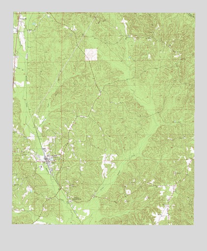
Fulton East, AL USGS Topographic Map
Click on map above to begin viewing in our Map Viewer.

This topographic map contains these locations and features:
Feature Name Type Latitude Longitude GNIS ID View Map
Allen BranchStreamN31.8474°W87.7417°112996View Map
Almeda (historical)LocaleN31.8279°W87.7403°133570View Map
Bassett CreekStreamN31.8663°W87.7497°133580View Map
Bassett Creek CemeteryCemeteryN31.7743°W87.7481°1730351View Map
Bassett Creek ChurchChurchN31.7735°W87.7489°154973View Map
Centerline Methodist ChurchChurchN31.7885°W87.6258°115875View Map
DickinsonPopulated PlaceN31.7635°W87.7106°117273View Map
Dickinson Baptist ChurchChurchN31.7652°W87.7103°133613View Map
First Baptist Church of FultonChurchN31.7932°W87.7402°2580369View Map
First Century ChurchChurchN31.7588°W87.7444°133622View Map
FultonPopulated PlaceN31.7885°W87.7272°118753View Map
Fulton DivisionCivilN31.7980°W87.6610°165700View Map
Fulton Elementary SchoolSchoolN31.7840°W87.7300°133628View Map
Fulton Post OfficePost OfficeN31.7893°W87.7276°169224View Map
Fulton Volunteer Fire Department Station 1BuildingN31.7877°W87.7271°2691075View Map
Fulton Volunteer Fire Department Station 2BuildingN31.7901°W87.7237°2691196View Map
Henley CemeteryCemeteryN31.7913°W87.7436°119964View Map
Liberty ChurchChurchN31.8132°W87.7006°121543View Map
Liley ChurchChurchN31.7896°W87.7172°163608View Map
McWerPopulated PlaceN31.8613°W87.6956°163122View Map
Midway CemeteryCemeteryN31.7729°W87.7086°1805478View Map
Midway ChurchChurchN31.7729°W87.7092°122711View Map
New Hope ChurchChurchN31.8635°W87.6531°152633View Map
North Clarke Industrial ParkLocaleN31.8706°W87.7452°2579584View Map
Okolona ChurchChurchN31.8046°W87.7489°124192View Map
Orphans CreekStreamN31.8004°W87.7322°124307View Map
Pleasant HillPopulated PlaceN31.8474°W87.6356°1730355View Map
Pleasant Hill CemeteryCemeteryN31.8482°W87.6353°1805659View Map
Pleasant Hill Methodist ChurchChurchN31.8477°W87.6347°124987View Map
Rock West African Methodist Episcopal ChurchChurchN31.8604°W87.6550°164114View Map
RuralPopulated PlaceN31.8643°W87.7386°157002View Map
Saint Paul Post Office (historical)Post OfficeN31.7543°W87.6483°133699View Map
Salem Baptist ChurchChurchN31.7618°W87.6439°153297View Map
Salem CemeteryCemeteryN31.7649°W87.6447°133702View Map
ScyrenePopulated PlaceN31.7557°W87.6478°157034View Map
Spencer Chapel ChurchChurchN31.7910°W87.7169°163622View Map
Tantroft BranchStreamN31.8413°W87.7414°127669View Map
Tate CemeteryCemeteryN31.8329°W87.6922°133716View Map
Tate CemeteryCemeteryN31.8635°W87.7075°163623View Map
Thomasville Sewage LagoonLocaleN31.8515°W87.7431°2579713View Map
Town of FultonCivilN31.7916°W87.7397°2406530View Map
Truevine ChurchChurchN31.7732°W87.6522°164135View Map

Note: Coordinates in the location and feature list above are referenced to NAD83 datum.


Copyright (C) 2008-2025 Ryan Niemi / Sunset Dynamics ... All Rights Reserved