TopoQuest Logo
Do you find TopoQuest useful?
Help keep TopoQuest running and adding new maps/features by donating!
Bitcoin:  19c7KJd3qBynnjoSw5npx9KScwjBe4ifkT
Litecoin:  LXs6TkuXGGXo1vDsWCkWVdjQX94eUKd6ui
Home View Maps Find Maps Find Places Resources & Links


Owendale, Michigan Topographic Map

USGS Map Title: Owendale, MI
USGS Map MRC: 43083F3
DRG (GeoTIFF) Download: o43083f3.tif


Neighboring USGS Topographic Map Quads:


  Bay Port West, MI  
43083G4
 

  Bay Port East, MI  
43083G3
 

  Elkton, MI  
43083G2
 

  Sebewaing, MI  
43083F4
 

  Owendale, MI  
43083F3
 

  Gagetown, MI  
43083F2
 

  Colling, MI  
43083E4
 

  Ellington, MI  
43083E3
 

  Cass City, MI  
43083E2


Map MRC Location:

N44°
W84°
N44°
W83°
H8 H7 H6 H5 H4 H3 H2 H1
G8 G7 G6 G5 G4 G3 G2 G1
F8 F7 F6 F5 F4 F3 F2 F1
E8 E7 E6 E5 E4 E3 E2 E1
D8 D7 D6 D5 D4 D3 D2 D1
C8 C7 C6 C5 C4 C3 C2 C1
B8 B7 B6 B5 B4 B3 B2 B1
A8 A7 A6 A5 A4 A3 A2 A1
N43°
W84°
N43°
W83°

Owendale, MI USGS 1:24K Topographic Map Preview:
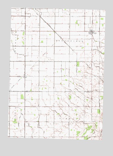
Owendale, MI USGS Topographic Map
Click on map above to begin viewing in our Map Viewer.

This topographic map contains these locations and features:
Feature Name Type Latitude Longitude GNIS ID View Map
BachPopulated PlaceN43.6831°W83.3558°620407View Map
Bach Post Office (historical)Post OfficeN43.6831°W83.3558°2548602View Map
Bach Station (historical)LocaleN43.6844°W83.3556°2548483View Map
Bearss DrainCanalN43.6684°W83.2869°620887View Map
Borodychuk DrainCanalN43.6420°W83.3602°621747View Map
Brookfield ExitCanalN43.6422°W83.2847°622032View Map
Carlton DrainCanalN43.6328°W83.3291°622734View Map
Columbia ExitCanalN43.6950°W83.2563°623637View Map
Crawford DrainCanalN43.6722°W83.2711°624034View Map
Ducolon DrainCanalN43.6489°W83.3086°624954View Map
Freeman DrainCanalN43.6684°W83.2763°626459View Map
OwendalePopulated PlaceN43.7292°W83.2680°634244View Map
Owendale Fire DepartmentBuildingN43.7287°W83.2695°2548415View Map
Owendale Historical MarkerParkN43.7286°W83.2675°2548583View Map
Owendale Post OfficePost OfficeN43.7292°W83.2683°2548412View Map
Owendale Station (historical)LocaleN43.7283°W83.2667°2548411View Map
Owendale-Gagetown High SchoolSchoolN43.7294°W83.2647°2548414View Map
Saint Peter Lutheran ChurchChurchN43.6836°W83.3592°2548357View Map
Saint Peters SchoolSchoolN43.6836°W83.3600°637022View Map
Township of BrookfieldCivilN43.7141°W83.2961°1625988View Map
Township of ElmwoodCivilN43.6274°W83.2933°1626236View Map
United Methodist ChurchChurchN43.7292°W83.2700°2548413View Map
Village of OwendaleCivilN43.7274°W83.2671°2399603View Map

Note: Coordinates in the location and feature list above are referenced to NAD83 datum.


Copyright (C) 2008-2025 Ryan Niemi / Sunset Dynamics ... All Rights Reserved