TopoQuest Logo
Do you find TopoQuest useful?
Help keep TopoQuest running and adding new maps/features by donating!
Bitcoin:  19c7KJd3qBynnjoSw5npx9KScwjBe4ifkT
Litecoin:  LXs6TkuXGGXo1vDsWCkWVdjQX94eUKd6ui
Home View Maps Find Maps Find Places Resources & Links


Galena, Maryland Topographic Map

USGS Map Title: Galena, MD
USGS Map MRC: 39075C8
DRG (GeoTIFF) Download: o39075c8.tif


Neighboring USGS Topographic Map Quads:


  Spesutie, MD  
39076D1
 

  Earleville, MD  
39075D8
 

  Cecilton, MD  
39075D7
 

  Betterton, MD  
39076C1
 

  Galena, MD  
39075C8
 

  Millington, MD  
39075C7
 

  Chestertown, MD  
39076B1
 

  Church Hill, MD  
39075B8
 

  Sudlersville, MD  
39075B7


Map MRC Location:

N40°
W76°
N40°
W75°
H8 H7 H6 H5 H4 H3 H2 H1
G8 G7 G6 G5 G4 G3 G2 G1
F8 F7 F6 F5 F4 F3 F2 F1
E8 E7 E6 E5 E4 E3 E2 E1
D8 D7 D6 D5 D4 D3 D2 D1
C8 C7 C6 C5 C4 C3 C2 C1
B8 B7 B6 B5 B4 B3 B2 B1
A8 A7 A6 A5 A4 A3 A2 A1
N39°
W76°
N39°
W75°

Galena, MD USGS 1:24K Topographic Map Preview:
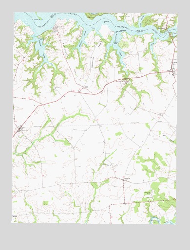
Galena, MD USGS Topographic Map
Click on map above to begin viewing in our Map Viewer.

This topographic map contains these locations and features:
Feature Name Type Latitude Longitude GNIS ID View Map
Asbury Methodist CemeteryCemeteryN39.2640°W75.8928°591806View Map
Asbury United Methodist ChurchChurchN39.2659°W75.8933°582933View Map
Big Marsh PointCapeN39.3693°W75.9316°583223View Map
BlackLocaleN39.3084°W75.9344°583260View Map
Brookewood CovePopulated PlaceN39.3590°W75.9608°591822View Map
ChestervillePopulated PlaceN39.2759°W75.9152°583736View Map
Chesterville ForestPopulated PlaceN39.2684°W75.8933°589955View Map
Chesterville Post Office (historical)Post OfficeN39.2762°W75.9158°595421View Map
Cleavers CornerPopulated PlaceN39.2712°W75.9769°595122View Map
Clevers CornerLocaleN39.2712°W75.9766°591840View Map
Cow CreekStreamN39.2884°W75.9291°595208View Map
Daffodil IslandIslandN39.3582°W75.9233°584006View Map
Daves HillSummitN39.3334°W75.9155°590069View Map
District 2, KennedyvilleCivilN39.3057°W75.9848°1929534View Map
Dogwood VillagePopulated PlaceN39.3476°W75.8819°591850View Map
Dyer CreekStreamN39.3623°W75.8908°584206View Map
Emmanuel Church (historical)ChurchN39.2759°W75.9147°591857View Map
FredericktownPopulated PlaceN39.3662°W75.8838°590250View Map
Freeman CreekStreamN39.3665°W75.9444°595205View Map
GalenaPopulated PlaceN39.3407°W75.8788°590270View Map
Galena Middle SchoolSchoolN39.3388°W75.8783°591870View Map
Galena Post OfficePost OfficeN39.3410°W75.8828°595425View Map
Galena Town HallBuildingN39.3404°W75.8783°591871View Map
Galena Wastewater Treatment PlantLocaleN39.3386°W75.8867°2503302View Map
GeorgetownPopulated PlaceN39.3618°W75.8802°590291View Map
Glasgow FarmLocaleN39.2714°W75.8856°2663547View Map
GlencoePopulated PlaceN39.3643°W75.9488°590325View Map
Goldsborough (historical)Populated PlaceN39.3657°W75.9988°591873View Map
Gooding Mill (historical)BuildingN39.3354°W75.9119°591874View Map
Hall CreekStreamN39.3662°W75.9027°584832View Map
Harmony CornerPopulated PlaceN39.3201°W75.9769°591881View Map
Harmony Post Office (historical)Post OfficeN39.3204°W75.9763°595429View Map
Hexton FarmsLocaleN39.3742°W75.9061°2704521View Map
Irelands CornerPopulated PlaceN39.3276°W75.8766°591891View Map
Island CreekStreamN39.3582°W75.9255°585156View Map
Joshua Chapel United Methodist ChurchChurchN39.2537°W75.9999°591900View Map
KennedyvillePopulated PlaceN39.3054°W75.9949°590588View Map
Kennedyville Census Designated PlaceCensusN39.3059°W75.9947°2583645View Map
Kennedyville Post OfficePost OfficeN39.3051°W75.9952°595431View Map
Kennedyville United Methodist ChurchChurchN39.3043°W75.9958°591901View Map
Kennedyville Volunteer Fire Company Station 4BuildingN39.3062°W75.9954°2131756View Map
Kent MuseumBuildingN39.3521°W75.9858°595125View Map
Kentmore ParkPopulated PlaceN39.3665°W75.9674°590594View Map
Knocks FollyPopulated PlaceN39.3540°W75.9844°591912View Map
Krastel Farms AirportAirportN39.3110°W75.9892°595306View Map
LambsonPopulated PlaceN39.3109°W75.8897°590628View Map
Little Marsh PointCapeN39.3634°W75.9227°585483View Map
Locust GrovePopulated PlaceN39.3304°W75.9461°590688View Map
Mill CreekStreamN39.3646°W75.8783°585866View Map
Money CreekStreamN39.3726°W75.9766°585918View Map
Old Field PointCapeN39.3640°W75.9141°586303View Map
Old Saint Dennis CemeteryCemeteryN39.3145°W75.8869°586997View Map
Olivet CemeteryCemeteryN39.3386°W75.8770°591934View Map
Olivet ChurchChurchN39.3384°W75.8772°586336View Map
Ordinary PointCapeN39.3715°W75.9797°586346View Map
Penningtons PointCapeN39.3632°W75.8866°596122View Map
Pig PointCapeN39.3668°W75.8758°589445View Map
Ponds BarCapeN39.3709°W75.9908°588535View Map
Raisins Wharf (historical)LocaleN39.3640°W75.9144°591942View Map
Rattlesnake PointCapeN39.3701°W75.9205°596125View Map
Saint Dennis Catholic CemeteryCemeteryN39.3454°W75.8797°591961View Map
Saint Dennis ChurchChurchN39.3459°W75.8791°586998View Map
Saint Dennis SchoolSchoolN39.3465°W75.8786°591962View Map
Saint Dennis SchoolSchoolN39.3462°W75.8780°595126View Map
School Number 5 (historical)SchoolN39.2776°W75.9211°591977View Map
School Number 6 (historical)SchoolN39.3307°W75.9469°591981View Map
School Number 8 (historical)SchoolN39.3140°W75.8866°591986View Map
Shellcross NeckCapeN39.3512°W75.9372°587321View Map
Shellcross WharfLocaleN39.3648°W75.9402°587322View Map
Shrewsbury ChurchChurchN39.3290°W75.9672°587358View Map
Shrewsbury NeckCapeN39.3459°W75.9572°587359View Map
Shrewsbury Parish CemeteryCemeteryN39.3294°W75.9677°591992View Map
Town of GalenaCivilN39.3426°W75.8787°2390197View Map
Turner CreekStreamN39.3640°W75.9822°587917View Map
Turner Creek Landing ParkParkN39.3487°W75.9852°592000View Map
Turner Creek ParkParkN39.3562°W75.9852°595128View Map
Turner Creek WharfLocaleN39.3579°W75.9827°587918View Map
Wesley Church (historical)ChurchN39.3348°W75.9136°595099View Map
Westminster CemeteryCemeteryN39.3583°W75.8789°588161View Map
Westminster ChurchChurchN39.3584°W75.8788°592007View Map
Woodland CreekStreamN39.3659°W75.9216°588327View Map

Note: Coordinates in the location and feature list above are referenced to NAD83 datum.


Copyright (C) 2008-2024 Ryan Niemi / Sunset Dynamics ... All Rights Reserved