TopoQuest Logo
Do you find TopoQuest useful?
Help keep TopoQuest running and adding new maps/features by donating!
Bitcoin:  19c7KJd3qBynnjoSw5npx9KScwjBe4ifkT
Litecoin:  LXs6TkuXGGXo1vDsWCkWVdjQX94eUKd6ui
Home View Maps Find Maps Find Places Resources & Links


Sudlersville, Maryland Topographic Map

USGS Map Title: Sudlersville, MD
USGS Map MRC: 39075B7
DRG (GeoTIFF) Download: o39075b7.tif


Neighboring USGS Topographic Map Quads:


  Galena, MD  
39075C8
 

  Millington, MD  
39075C7
 

  Clayton, DE  
39075C6
 

  Church Hill, MD  
39075B8
 

  Sudlersville, MD  
39075B7
 

  Kenton, DE  
39075B6
 

  Price, MD  
39075A8
 

  Goldsboro, MD  
39075A7
 

  Marydel, MD  
39075A6


Map MRC Location:

N40°
W76°
N40°
W75°
H8 H7 H6 H5 H4 H3 H2 H1
G8 G7 G6 G5 G4 G3 G2 G1
F8 F7 F6 F5 F4 F3 F2 F1
E8 E7 E6 E5 E4 E3 E2 E1
D8 D7 D6 D5 D4 D3 D2 D1
C8 C7 C6 C5 C4 C3 C2 C1
B8 B7 B6 B5 B4 B3 B2 B1
A8 A7 A6 A5 A4 A3 A2 A1
N39°
W76°
N39°
W75°

Sudlersville, MD USGS 1:24K Topographic Map Preview:
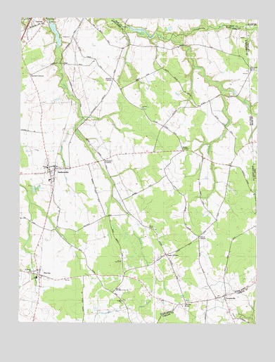
Sudlersville, MD USGS Topographic Map
Click on map above to begin viewing in our Map Viewer.

This topographic map contains these locations and features:
Feature Name Type Latitude Longitude GNIS ID View Map
BarclayPopulated PlaceN39.1443°W75.8641°597048View Map
Barclay Post OfficePost OfficeN39.1443°W75.8638°596113View Map
Barclay Town HallBuildingN39.1443°W75.8641°596040View Map
Blanco DitchStreamN39.2462°W75.7502°213684View Map
BoltonPopulated PlaceN39.2143°W75.7805°596137View Map
BusicPopulated PlaceN39.1390°W75.8241°596142View Map
Busic CemeteryCemeteryN39.1343°W75.8202°596143View Map
Busicks ChurchChurchN39.1337°W75.8202°597156View Map
Calvary ChurchChurchN39.1437°W75.8610°596044View Map
Carson CornersLocaleN39.1532°W75.7972°597193View Map
Chapel Branch DitchCanalN39.1879°W75.8505°597215View Map
Cleaves ForkPopulated PlaceN39.1329°W75.7872°588635View Map
Community Baptist ChurchChurchN39.1440°W75.8688°2503217View Map
District 1, DixonCivilN39.1677°W75.8322°1929416View Map
Duhamel CornersPopulated PlaceN39.1918°W75.8299°597354View Map
Epworth ChurchChurchN39.1621°W75.7783°597381View Map
Felton School (historical)SchoolN39.2168°W75.7749°596173View Map
Full Gospel ChurchChurchN39.1387°W75.8241°597439View Map
Goldsboro CemeteryCemeteryN39.1526°W75.8669°596066View Map
Gravelly RunStreamN39.2209°W75.7685°217904View Map
Hackett CornersLocaleN39.2265°W75.8697°597511View Map
Holdens Chapel CemeteryCemeteryN39.2130°W75.8101°596182View Map
Holdens ChurchChurchN39.2132°W75.8094°597565View Map
Jones Lake DamDamN39.2468°W75.8180°594514View Map
Marvin Memorial United Methodist ChurchChurchN39.1440°W75.8624°596076View Map
Moores Chapel (historical)ChurchN39.1909°W75.7635°596203View Map
Pearson GrovePopulated PlaceN39.2290°W75.7533°216175View Map
Peters CornersPopulated PlaceN39.1962°W75.7888°597890View Map
Prices ChapelChurchN39.1640°W75.8038°597919View Map
Saint Andrews Episcopal ChurchChurchN39.1848°W75.8580°596099View Map
Saint Daniels United Methodist ChurchChurchN39.1454°W75.8680°596100View Map
Schenk CornersLocaleN39.1607°W75.7799°598061View Map
Sewell BranchStreamN39.2418°W75.7952°217906View Map
Slabby ParkParkN39.1501°W75.8088°596237View Map
Stevens CornersLocaleN39.2248°W75.8255°598121View Map
SudlersvillePopulated PlaceN39.1871°W75.8588°598128View Map
Sudlersville CemeteryCemeteryN39.1890°W75.8494°596103View Map
Sudlersville Elementary SchoolSchoolN39.1835°W75.8593°596242View Map
Sudlersville Memorial LibraryBuildingN39.1868°W75.8591°596243View Map
Sudlersville Middle SchoolSchoolN39.1825°W75.8524°596244View Map
Sudlersville Post OfficePost OfficeN39.1853°W75.8583°596104View Map
Sudlersville Town HallBuildingN39.1873°W75.8580°596245View Map
Sudlersville United Methodist ChurchChurchN39.1875°W75.8596°596145View Map
Sudlersville Volunteer Fire Company Station 6BuildingN39.1893°W75.8601°2085717View Map
Taylor FieldAirportN39.1870°W75.7938°595351View Map
TemplevillePopulated PlaceN39.1362°W75.7660°591398View Map
Templeville CemeteryCemeteryN39.1343°W75.7749°595906View Map
Templeville Community ChurchChurchN39.1357°W75.7702°596247View Map
Templeville Community ParkParkN39.1357°W75.7663°595907View Map
Templeville Post OfficePost OfficeN39.1393°W75.7669°596248View Map
Templeville School (historical)SchoolN39.1346°W75.7755°596249View Map
Tilmon's Island WineryBuildingN39.1992°W75.8633°2704693View Map
Town of BarclayCivilN39.1436°W75.8639°2390712View Map
Town of SudlersvilleCivilN39.1832°W75.8535°2391432View Map
Town of TemplevilleCivilN39.1363°W75.7671°2391441View Map
Turners Mill (historical)LocaleN39.2471°W75.8191°592001View Map
UnicornPopulated PlaceN39.2482°W75.8630°598193View Map
Unicorn Fishing Lake ParkParkN39.2487°W75.8583°596252View Map
Unicorn ManorPopulated PlaceN39.2454°W75.8683°596253View Map
Unicorn Medical CenterHospitalN39.2398°W75.8733°596254View Map
Unicorn Mill PondReservoirN39.2434°W75.8564°598195View Map
Whalen FieldAirportN39.1663°W75.8387°2443771View Map
William T Roe Memorial BridgeBridgeN39.2093°W75.8388°596112View Map

Note: Coordinates in the location and feature list above are referenced to NAD83 datum.


Copyright (C) 2008-2025 Ryan Niemi / Sunset Dynamics ... All Rights Reserved