TopoQuest Logo
Do you find TopoQuest useful?
Help keep TopoQuest running and adding new maps/features by donating!
Bitcoin:  19c7KJd3qBynnjoSw5npx9KScwjBe4ifkT
Litecoin:  LXs6TkuXGGXo1vDsWCkWVdjQX94eUKd6ui
Home View Maps Find Maps Find Places Resources & Links


Gallion, Alabama Topographic Map

USGS Map Title: Gallion, AL
USGS Map MRC: 32087D6
DRG (GeoTIFF) Download: o32087d6.tif


Neighboring USGS Topographic Map Quads:


  Demopolis, AL  
32087E7
 

  Casemore, AL  
32087E6
 

  Newbern, AL  
32087E5
 

  Old Spring Hill, AL  
32087D7
 

  Gallion, AL  
32087D6
 

  Uniontown West, AL  
32087D5
 

  Linden, AL  
32087C7
 

  Thomaston West, AL  
32087C6
 

  Thomaston East, AL  
32087C5


Map MRC Location:

N33°
W88°
N33°
W87°
H8 H7 H6 H5 H4 H3 H2 H1
G8 G7 G6 G5 G4 G3 G2 G1
F8 F7 F6 F5 F4 F3 F2 F1
E8 E7 E6 E5 E4 E3 E2 E1
D8 D7 D6 D5 D4 D3 D2 D1
C8 C7 C6 C5 C4 C3 C2 C1
B8 B7 B6 B5 B4 B3 B2 B1
A8 A7 A6 A5 A4 A3 A2 A1
N32°
W88°
N32°
W87°

Gallion, AL USGS 1:24K Topographic Map Preview:
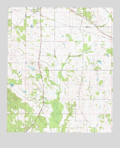
Gallion, AL USGS Topographic Map
Click on map above to begin viewing in our Map Viewer.

This topographic map contains these locations and features:
Feature Name Type Latitude Longitude GNIS ID View Map
AllenvillePopulated PlaceN32.4910°W87.6608°113019View Map
Allenville CemeteryCemeteryN32.4985°W87.6603°113020View Map
Bethea DamDamN32.4468°W87.6400°130588View Map
Bethlehem ChurchChurchN32.4935°W87.6675°114128View Map
Cedarcrest FarmsLocaleN32.4264°W87.6594°2611190View Map
Cuba PlantationLocaleN32.4411°W87.6519°2564083View Map
Fields LakeReservoirN32.4043°W87.7485°130534View Map
GallionPopulated PlaceN32.4968°W87.7161°155075View Map
John the Baptist CemeteryCemeteryN32.4951°W87.7464°1730315View Map
John the Baptist ChurchChurchN32.4954°W87.7461°137615View Map
Lake HenryReservoirN32.4222°W87.7446°119976View Map
Moss LakeReservoirN32.4455°W87.6406°123118View Map
Mount Horeb ChurchChurchN32.4374°W87.6431°152431View Map
N B Fields Lake DamDamN32.4035°W87.7483°130533View Map
Nazarea Galilee ChurchChurchN32.4368°W87.7014°123653View Map
Powell Creek Lake Number EightReservoirN32.4151°W87.7250°130544View Map
Powell Creek Number 7 DamDamN32.4218°W87.7417°130554View Map
Powell Creek Number 8 DamDamN32.4151°W87.7250°130543View Map
Saint James ChurchChurchN32.4107°W87.6653°126104View Map
Saint Pauls ChurchChurchN32.4049°W87.7072°155233View Map
Spencer Dam Number TwoDamN32.4368°W87.7183°130579View Map
Spencer Lake TwoReservoirN32.4391°W87.7207°130578View Map
Tombigbee (historical)Populated PlaceN32.4082°W87.6667°1730266View Map

Note: Coordinates in the location and feature list above are referenced to NAD83 datum.


Copyright (C) 2008-2024 Ryan Niemi / Sunset Dynamics ... All Rights Reserved