TopoQuest Logo
Do you find TopoQuest useful?
Help keep TopoQuest running and adding new maps/features by donating!
Bitcoin:  19c7KJd3qBynnjoSw5npx9KScwjBe4ifkT
Litecoin:  LXs6TkuXGGXo1vDsWCkWVdjQX94eUKd6ui
Home View Maps Find Maps Find Places Resources & Links


Uniontown West, Alabama Topographic Map

USGS Map Title: Uniontown West, AL
USGS Map MRC: 32087D5
DRG (GeoTIFF) Download: o32087d5.tif


Neighboring USGS Topographic Map Quads:


  Casemore, AL  
32087E6
 

  Newbern, AL  
32087E5
 

  Scott Station, AL  
32087E4
 

  Gallion, AL  
32087D6
 

  Uniontown West, AL  
32087D5
 

  Uniontown East, AL  
32087D4
 

  Thomaston West, AL  
32087C6
 

  Thomaston East, AL  
32087C5
 

  Central Mills, AL  
32087C4


Map MRC Location:

N33°
W88°
N33°
W87°
H8 H7 H6 H5 H4 H3 H2 H1
G8 G7 G6 G5 G4 G3 G2 G1
F8 F7 F6 F5 F4 F3 F2 F1
E8 E7 E6 E5 E4 E3 E2 E1
D8 D7 D6 D5 D4 D3 D2 D1
C8 C7 C6 C5 C4 C3 C2 C1
B8 B7 B6 B5 B4 B3 B2 B1
A8 A7 A6 A5 A4 A3 A2 A1
N32°
W88°
N32°
W87°

Uniontown West, AL USGS 1:24K Topographic Map Preview:
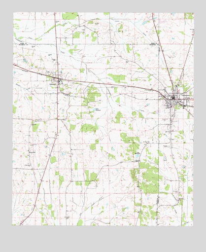
Uniontown West, AL USGS Topographic Map
Click on map above to begin viewing in our Map Viewer.

This topographic map contains these locations and features:
Feature Name Type Latitude Longitude GNIS ID View Map
Bethel CemeteryCemeteryN32.3799°W87.5872°1805469View Map
Bethel ChurchChurchN32.3799°W87.5875°114050View Map
Blanks CemeteryCemeteryN32.4712°W87.5472°114485View Map
Canebrake Agricultural Experimental Station (historical)LocaleN32.4643°W87.5042°149813View Map
Cedar Grove CemeteryCemeteryN32.4221°W87.6125°115778View Map
Cedar Grove ChurchChurchN32.4101°W87.6125°115784View Map
Cedar Grove PlantationLocaleN32.4478°W87.5758°2564082View Map
Cedar Lawn Plantation (historical)LocaleN32.4587°W87.5086°149815View Map
Coffee Springs Cumberland Presbyterian Church (historical)ChurchN32.4340°W87.5153°149820View Map
Cottrell LakeReservoirN32.4996°W87.5143°130631View Map
Devere DamDamN32.4168°W87.5350°130545View Map
FaunsdalePopulated PlaceN32.4599°W87.5939°118220View Map
Faunsdale DivisionCivilN32.4092°W87.6153°165874View Map
Faunsdale Junior High SchoolSchoolN32.4524°W87.5897°118221View Map
Faunsdale PlantationLocaleN32.4353°W87.6025°2564084View Map
Faunsdale Post OfficePost OfficeN32.4597°W87.5935°2789088View Map
Faunsdale Volunteer Fire DepartmentBuildingN32.4582°W87.5935°2691191View Map
First Baptist ChurchChurchN32.4482°W87.5114°146272View Map
First Presbyterian ChurchChurchN32.4518°W87.5142°146273View Map
First United Methodist Church of UniontownChurchN32.4529°W87.5147°149810View Map
Foot Washing Baptist Church (historical)ChurchN32.4468°W87.5169°146275View Map
FreetownPopulated PlaceN32.3882°W87.5111°149822View Map
Freetown School (historical)SchoolN32.3910°W87.5097°149884View Map
Goldman CemeteryCemeteryN32.4479°W87.5042°149817View Map
Greenlawn GardensCemeteryN32.4215°W87.5172°119367View Map
Greer CemeteryCemeteryN32.4937°W87.5681°119391View Map
Greer CreekStreamN32.4843°W87.6217°119394View Map
Greers ChurchChurchN32.4885°W87.5758°149466View Map
Hatch High SchoolSchoolN32.4454°W87.5156°119837View Map
Holy Cross CemeteryCemeteryN32.4515°W87.5169°149801View Map
Holy Cross Episcopal ChurchChurchN32.4515°W87.5167°149802View Map
Hopewell Presbyterian Church (historical)ChurchN32.4487°W87.5122°149803View Map
Jones CemeteryCemeteryN32.4890°W87.5508°120988View Map
Lake MeadwoodReservoirN32.4158°W87.5392°122623View Map
Lake RoselandReservoirN32.4433°W87.5685°125945View Map
Lewis School (historical)SchoolN32.4529°W87.5147°149809View Map
May Lee Church (historical)ChurchN32.4896°W87.5756°139016View Map
Mount Calvary CemeteryCemeteryN32.3954°W87.5106°123151View Map
Mount Calvary ChurchChurchN32.3904°W87.5094°123154View Map
Mount Olive CemeteryCemeteryN32.4232°W87.5328°1867917View Map
Mount Olive ChurchChurchN32.4235°W87.5322°123302View Map
Oak Grove Primitive Baptist ChurchChurchN32.4893°W87.5000°124088View Map
Oak Lawn Plantation (historical)LocaleN32.4201°W87.5147°149821View Map
Oscar Cobb DamDamN32.4885°W87.5200°130608View Map
Oscar Cobb LakeReservoirN32.4885°W87.5200°130609View Map
Perry County Training School (historical)SchoolN32.4449°W87.5164°149805View Map
Pitts FollyBuildingN32.4451°W87.5083°149818View Map
Quinn African Methodist Episcopal ChapelChurchN32.4493°W87.5172°150950View Map
RabbityardPopulated PlaceN32.4543°W87.5208°149800View Map
Rock ChapelChurchN32.4129°W87.5381°155217View Map
Rosemount CemeteryCemeteryN32.4557°W87.5153°149808View Map
Saint Michaels CemeteryCemeteryN32.4365°W87.6086°153278View Map
Sanctified ChurchChurchN32.4551°W87.5208°149799View Map
SiddonsvillePopulated PlaceN32.4182°W87.6133°126832View Map
Temple School (historical)SchoolN32.4512°W87.5128°149816View Map
The Cedars (historical)LocaleN32.4396°W87.5133°149819View Map
Town of FaunsdaleCivilN32.4576°W87.5938°2406495View Map
UniontownPopulated PlaceN32.4496°W87.5142°153806View Map
Uniontown Baptist ChurchChurchN32.4490°W87.5133°149807View Map
Uniontown District Academy (historical)SchoolN32.4465°W87.5164°149804View Map
Uniontown Elementary SchoolSchoolN32.4451°W87.5158°146296View Map
Uniontown Female Academy (historical)SchoolN32.4482°W87.5131°149806View Map
Uniontown Male Academy (historical)SchoolN32.4521°W87.5142°149814View Map
Uniontown Middle SchoolSchoolN32.4568°W87.5119°146297View Map
Uniontown Police DepartmentBuildingN32.4507°W87.5153°2751981View Map
Uniontown Post OfficePost OfficeN32.4520°W87.5147°2789082View Map
Uniontown Volunteer Fire DepartmentBuildingN32.4507°W87.5153°2691168View Map
Weaver Plantation (historical)LocaleN32.4626°W87.5153°149811View Map
Westwood Plantation (historical)LocaleN32.4599°W87.5144°149812View Map
Winfield CemeteryCemeteryN32.4379°W87.5186°129114View Map
Zion Hill ChurchChurchN32.4340°W87.6114°129352View Map

Note: Coordinates in the location and feature list above are referenced to NAD83 datum.


Copyright (C) 2008-2024 Ryan Niemi / Sunset Dynamics ... All Rights Reserved