TopoQuest Logo
Do you find TopoQuest useful?
Help keep TopoQuest running and adding new maps/features by donating!
Bitcoin:  19c7KJd3qBynnjoSw5npx9KScwjBe4ifkT
Litecoin:  LXs6TkuXGGXo1vDsWCkWVdjQX94eUKd6ui
Home View Maps Find Maps Find Places Resources & Links


Old Spring Hill, Alabama Topographic Map

USGS Map Title: Old Spring Hill, AL
USGS Map MRC: 32087D7
DRG (GeoTIFF) Download: o32087d7.tif


Neighboring USGS Topographic Map Quads:


  McDowell, AL  
32087E8
 

  Demopolis, AL  
32087E7
 

  Casemore, AL  
32087E6
 

  Jefferson, AL  
32087D8
 

  Old Spring Hill, AL  
32087D7
 

  Gallion, AL  
32087D6
 

  Myrtlewood North, AL  
32087C8
 

  Linden, AL  
32087C7
 

  Thomaston West, AL  
32087C6


Map MRC Location:

N33°
W88°
N33°
W87°
H8 H7 H6 H5 H4 H3 H2 H1
G8 G7 G6 G5 G4 G3 G2 G1
F8 F7 F6 F5 F4 F3 F2 F1
E8 E7 E6 E5 E4 E3 E2 E1
D8 D7 D6 D5 D4 D3 D2 D1
C8 C7 C6 C5 C4 C3 C2 C1
B8 B7 B6 B5 B4 B3 B2 B1
A8 A7 A6 A5 A4 A3 A2 A1
N32°
W88°
N32°
W87°

Old Spring Hill, AL USGS 1:24K Topographic Map Preview:
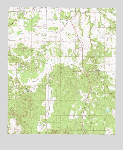
Old Spring Hill, AL USGS Topographic Map
Click on map above to begin viewing in our Map Viewer.

This topographic map contains these locations and features:
Feature Name Type Latitude Longitude GNIS ID View Map
City of DemopolisCivilN32.4980°W87.8298°2404214View Map
Demopolis Memorial Gardens CemeteryCemeteryN32.4875°W87.8056°122642View Map
Fairhaven Baptist ChurchChurchN32.4979°W87.8453°151766View Map
Gilfield Baptist ChurchChurchN32.4426°W87.7742°157966View Map
Gilfield CemeteryCemeteryN32.4426°W87.7751°1730248View Map
Hopewell CemeteryCemeteryN32.4265°W87.8283°1867925View Map
Hopewell ChurchChurchN32.4262°W87.8286°120372View Map
Lake MiriamReservoirN32.4172°W87.8535°122883View Map
Lake Miriam DamDamN32.4185°W87.8550°130552View Map
Mount Zion CemeteryCemeteryN32.4524°W87.8383°1867920View Map
Mount Zion ChurchChurchN32.4524°W87.8392°123463View Map
Nazareth of Galilee Baptist ChurchChurchN32.4960°W87.8739°123655View Map
Old Mount Canaan ChurchChurchN32.3929°W87.7842°124229View Map
Old Spring HillPopulated PlaceN32.4376°W87.7736°152796View Map
Old Spring Hill Memorial ChurchChurchN32.4371°W87.7753°137650View Map
Old Spring Hill Methodist CemeteryCemeteryN32.4368°W87.7750°1867958View Map
Old Springhill Volunteer Fire DepartmentBuildingN32.4300°W87.7746°2691581View Map
Pine Grove CemeteryCemeteryN32.3899°W87.8314°1867902View Map
Pine Grove ChurchChurchN32.3899°W87.8317°124788View Map
Powell Creek Lake Number NineReservoirN32.3987°W87.7587°130529View Map
Powell Creek Number 9 DamDamN32.3968°W87.7583°130528View Map
Saint Luke Baptist ChurchChurchN32.4096°W87.7506°126147View Map
Saint Luke CemeteryCemeteryN32.4101°W87.7508°1805543View Map
Saint Paul Baptist ChurchChurchN32.4962°W87.8025°153283View Map
Simmons Landing (historical)LocaleN32.4299°W87.8297°147646View Map
Whitfield Canal ExtensionCanalN32.4904°W87.8175°128922View Map

Note: Coordinates in the location and feature list above are referenced to NAD83 datum.


Copyright (C) 2008-2024 Ryan Niemi / Sunset Dynamics ... All Rights Reserved