TopoQuest Logo
Do you find TopoQuest useful?
Help keep TopoQuest running and adding new maps/features by donating!
Bitcoin:  19c7KJd3qBynnjoSw5npx9KScwjBe4ifkT
Litecoin:  LXs6TkuXGGXo1vDsWCkWVdjQX94eUKd6ui
Home View Maps Find Maps Find Places Resources & Links


Gardner, Arkansas Topographic Map

USGS Map Title: Gardner, AR
USGS Map MRC: 33092A4
DRG (GeoTIFF) Download: o33092a4.tif


Neighboring USGS Topographic Map Quads:


  El Dorado East, AR  
33092B5
 

  Urbana, AR  
33092B4
 

  New London, AR  
33092B3
 

  Lockhart, LA  
33092A5
 

  Gardner, AR  
33092A4
 

  Strong, AR  
33092A3
 

  Spearsville, LA  
32092H5
 

  Truxno, LA  
32092H4
 

  Marion West, LA  
32092H3


Map MRC Location:

N34°
W93°
N34°
W92°
H8 H7 H6 H5 H4 H3 H2 H1
G8 G7 G6 G5 G4 G3 G2 G1
F8 F7 F6 F5 F4 F3 F2 F1
E8 E7 E6 E5 E4 E3 E2 E1
D8 D7 D6 D5 D4 D3 D2 D1
C8 C7 C6 C5 C4 C3 C2 C1
B8 B7 B6 B5 B4 B3 B2 B1
A8 A7 A6 A5 A4 A3 A2 A1
N33°
W93°
N33°
W92°

Gardner, AR USGS 1:24K Topographic Map Preview:
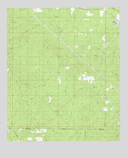
Gardner, AR USGS Topographic Map
Click on map above to begin viewing in our Map Viewer.

This topographic map contains these locations and features:
Feature Name Type Latitude Longitude GNIS ID View Map
Arthur BranchStreamN33.1051°W92.4449°59585View Map
AurellePopulated PlaceN33.0482°W92.4057°57293View Map
Aurelle Oil and Gas FieldOilfieldN33.0437°W92.3929°59586View Map
Aurelle Post Office (historical)Post OfficeN33.0504°W92.4068°84791View Map
Cane Creek CemeteryCemeteryN33.0785°W92.4426°59614View Map
Cane Creek ChurchChurchN33.0793°W92.4432°59615View Map
Forest Hill CemeteryCemeteryN33.0621°W92.3774°59679View Map
Forest Hill Methodist Church (historical)ChurchN33.0626°W92.3771°59680View Map
Free Hope CemeteryCemeteryN33.0390°W92.3907°59682View Map
Freehope ChurchChurchN33.0396°W92.3910°59684View Map
GardnerPopulated PlaceN33.1062°W92.3810°57793View Map
Mark Beach BayouStreamN33.0001°W92.3943°51670View Map
Pine Grove CemeteryCemeteryN33.0801°W92.4035°59802View Map
Pine Grove ChurchChurchN33.0829°W92.3929°59803View Map
Pleasant Grove CemeteryCemeteryN33.1160°W92.4465°59806View Map
Pleasant Grove Methodist ChurchChurchN33.1168°W92.4465°59807View Map
Pleasant Hill CemeteryCemeteryN33.0387°W92.4740°59808View Map
Pleasant Hill ChurchChurchN33.0276°W92.4440°59810View Map
Township of JohnsonCivilN33.1029°W92.4895°69751View Map

Note: Coordinates in the location and feature list above are referenced to NAD83 datum.


Copyright (C) 2008-2025 Ryan Niemi / Sunset Dynamics ... All Rights Reserved