TopoQuest Logo
Do you find TopoQuest useful?
Help keep TopoQuest running and adding new maps/features by donating!
Bitcoin:  19c7KJd3qBynnjoSw5npx9KScwjBe4ifkT
Litecoin:  LXs6TkuXGGXo1vDsWCkWVdjQX94eUKd6ui
Home View Maps Find Maps Find Places Resources & Links


Spearsville, Louisiana Topographic Map

USGS Map Title: Spearsville, LA
USGS Map MRC: 32092H5
DRG (GeoTIFF) Download: o32092h5.tif


Neighboring USGS Topographic Map Quads:


  Junction City, AR  
33092A6
 

  Lockhart, LA  
33092A5
 

  Gardner, AR  
33092A4
 

  Lillie, LA  
32092H6
 

  Spearsville, LA  
32092H5
 

  Truxno, LA  
32092H4
 

  Bernice, LA  
32092G6
 

  Shiloh, LA  
32092G5
 

  Farmerville, LA  
32092G4


Map MRC Location:

N33°
W93°
N33°
W92°
H8 H7 H6 H5 H4 H3 H2 H1
G8 G7 G6 G5 G4 G3 G2 G1
F8 F7 F6 F5 F4 F3 F2 F1
E8 E7 E6 E5 E4 E3 E2 E1
D8 D7 D6 D5 D4 D3 D2 D1
C8 C7 C6 C5 C4 C3 C2 C1
B8 B7 B6 B5 B4 B3 B2 B1
A8 A7 A6 A5 A4 A3 A2 A1
N32°
W93°
N32°
W92°

Spearsville, LA USGS 1:24K Topographic Map Preview:
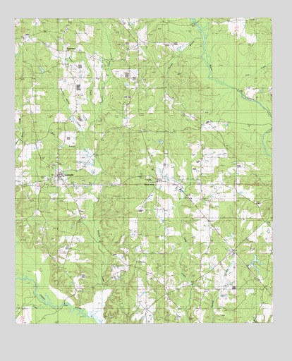
Spearsville, LA USGS Topographic Map
Click on map above to begin viewing in our Map Viewer.

This topographic map contains these locations and features:
Feature Name Type Latitude Longitude GNIS ID View Map
Antioch CemeteryCemeteryN32.9687°W92.5935°544042View Map
Antioch Church of ChristChurchN32.9668°W92.5957°553312View Map
Beech Grove ChurchChurchN32.8965°W92.6007°532884View Map
Beulah CemeteryCemeteryN32.9042°W92.5006°532998View Map
Camp Creek CemeteryCemeteryN32.8794°W92.5581°544050View Map
Camp Creek ChurchChurchN32.8793°W92.5585°533656View Map
Canaan CemeteryCemeteryN32.9945°W92.5657°533675View Map
Canaan ChurchChurchN32.9862°W92.5621°533676View Map
Carroll (historical)Populated PlaceN32.8876°W92.5051°548699View Map
Douglas SchoolSchoolN32.9293°W92.6229°534575View Map
Dry CreekStreamN32.8843°W92.6102°547319View Map
Fellowship CemeteryCemeteryN32.9323°W92.5356°544058View Map
Fellowship ChurchChurchN32.9326°W92.5371°534926View Map
Liberty CemeteryCemeteryN32.9310°W92.5289°544060View Map
Liberty ChurchChurchN32.9315°W92.5290°536424View Map
Lion CreekStreamN32.9715°W92.5182°536466View Map
Little Hope ChurchChurchN32.9949°W92.6024°536559View Map
Mile BranchStreamN32.9474°W92.5910°537081View Map
Morgan BranchStreamN32.9924°W92.5343°537201View Map
Mount Pisgah ChurchChurchN32.9318°W92.6115°537385View Map
Mount UnionPopulated PlaceN32.9335°W92.5551°540903View Map
Mount Union ChurchChurchN32.9329°W92.5565°537413View Map
Parish Governing Authority District 3CivilN32.9217°W92.5247°1929981View Map
Peter CreekStreamN32.9615°W92.5854°538083View Map
Peter Creek Ranch (historical)AirportN32.9790°W92.5932°1632953View Map
Resinger Hollis CreekStreamN32.9529°W92.5927°538568View Map
SpearsvillePopulated PlaceN32.9360°W92.6052°543689View Map
Spearsville High SchoolSchoolN32.9361°W92.6026°548729View Map
Spearsville Lookout TowerTowerN32.9004°W92.5665°548730View Map
Spearsville Volunteer Fire DepartmentBuildingN32.9389°W92.6045°2672894View Map
Sweet Union ChurchChurchN32.9546°W92.5482°539766View Map
TaylortownPopulated PlaceN32.9865°W92.6007°543716View Map
Tenmile CreekStreamN32.8785°W92.5879°539816View Map
Terral DamDamN32.8985°W92.5118°556844View Map
Terral LakeReservoirN32.8987°W92.5102°556845View Map
Village of SpearsvilleCivilN32.9339°W92.6022°2407552View Map
Ward ThreeCivilN32.9382°W92.5846°545231View Map

Note: Coordinates in the location and feature list above are referenced to NAD83 datum.


Copyright (C) 2008-2025 Ryan Niemi / Sunset Dynamics ... All Rights Reserved