TopoQuest Logo
Do you find TopoQuest useful?
Help keep TopoQuest running and adding new maps/features by donating!
Bitcoin:  19c7KJd3qBynnjoSw5npx9KScwjBe4ifkT
Litecoin:  LXs6TkuXGGXo1vDsWCkWVdjQX94eUKd6ui
Home View Maps Find Maps Find Places Resources & Links


Truxno, Louisiana Topographic Map

USGS Map Title: Truxno, LA
USGS Map MRC: 32092H4
DRG (GeoTIFF) Download: o32092h4.tif


Neighboring USGS Topographic Map Quads:


  Lockhart, LA  
33092A5
 

  Gardner, AR  
33092A4
 

  Strong, AR  
33092A3
 

  Spearsville, LA  
32092H5
 

  Truxno, LA  
32092H4
 

  Marion West, LA  
32092H3
 

  Shiloh, LA  
32092G5
 

  Farmerville, LA  
32092G4
 

  De Loutre, LA  
32092G3


Map MRC Location:

N33°
W93°
N33°
W92°
H8 H7 H6 H5 H4 H3 H2 H1
G8 G7 G6 G5 G4 G3 G2 G1
F8 F7 F6 F5 F4 F3 F2 F1
E8 E7 E6 E5 E4 E3 E2 E1
D8 D7 D6 D5 D4 D3 D2 D1
C8 C7 C6 C5 C4 C3 C2 C1
B8 B7 B6 B5 B4 B3 B2 B1
A8 A7 A6 A5 A4 A3 A2 A1
N32°
W93°
N32°
W92°

Truxno, LA USGS 1:24K Topographic Map Preview:
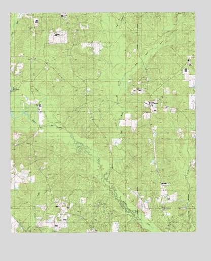
Truxno, LA USGS Topographic Map
Click on map above to begin viewing in our Map Viewer.

This topographic map contains these locations and features:
Feature Name Type Latitude Longitude GNIS ID View Map
Bethel ChurchChurchN32.9454°W92.4068°532982View Map
Bird ChapelChurchN32.9515°W92.3985°533130View Map
Birds Chapel CemeteryCemeteryN32.9515°W92.3976°544048View Map
Cherry Ridge (historical)Populated PlaceN32.9187°W92.4760°548700View Map
ConwayPopulated PlaceN32.8885°W92.3971°543102View Map
Conway CemeteryCemeteryN32.8887°W92.3960°544051View Map
Cook CemeteryCemeteryN32.9490°W92.3771°534094View Map
Judy CreekStreamN32.9899°W92.4315°536130View Map
LaranPopulated PlaceN32.9737°W92.4854°541123View Map
Laran CemeteryCemeteryN32.9974°W92.4854°536339View Map
Lick CreekStreamN32.9424°W92.4888°536443View Map
Little Bayou de LoutreStreamN32.9018°W92.4360°536482View Map
Mark Beach BayouStreamN32.9607°W92.4271°536901View Map
Mount Olive SchoolSchoolN32.9712°W92.4765°537371View Map
Mount Sharon ChurchChurchN32.9576°W92.4499°537402View Map
TruxnoPopulated PlaceN32.9476°W92.4060°543738View Map
Truxno Oil FieldOilfieldN32.9649°W92.4043°540012View Map
TugwellPopulated PlaceN32.8887°W92.3818°1630798View Map

Note: Coordinates in the location and feature list above are referenced to NAD83 datum.


Copyright (C) 2008-2025 Ryan Niemi / Sunset Dynamics ... All Rights Reserved