TopoQuest Logo
Do you find TopoQuest useful?
Help keep TopoQuest running and adding new maps/features by donating!
Bitcoin:  19c7KJd3qBynnjoSw5npx9KScwjBe4ifkT
Litecoin:  LXs6TkuXGGXo1vDsWCkWVdjQX94eUKd6ui
Home View Maps Find Maps Find Places Resources & Links


Strong, Arkansas Topographic Map

USGS Map Title: Strong, AR
USGS Map MRC: 33092A3
DRG (GeoTIFF) Download: o33092a3.tif


Neighboring USGS Topographic Map Quads:


  Urbana, AR  
33092B4
 

  New London, AR  
33092B3
 

  New Union, AR  
33092B2
 

  Gardner, AR  
33092A4
 

  Strong, AR  
33092A3
 

  Huttig, AR  
33092A2
 

  Truxno, LA  
32092H4
 

  Marion West, LA  
32092H3
 

  Marion East, LA  
32092H2


Map MRC Location:

N34°
W93°
N34°
W92°
H8 H7 H6 H5 H4 H3 H2 H1
G8 G7 G6 G5 G4 G3 G2 G1
F8 F7 F6 F5 F4 F3 F2 F1
E8 E7 E6 E5 E4 E3 E2 E1
D8 D7 D6 D5 D4 D3 D2 D1
C8 C7 C6 C5 C4 C3 C2 C1
B8 B7 B6 B5 B4 B3 B2 B1
A8 A7 A6 A5 A4 A3 A2 A1
N33°
W93°
N33°
W92°

Strong, AR USGS 1:24K Topographic Map Preview:
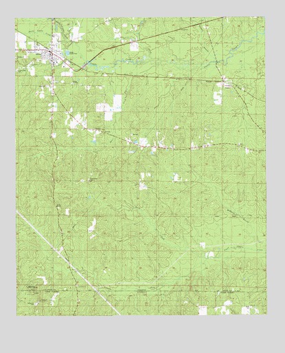
Strong, AR USGS Topographic Map
Click on map above to begin viewing in our Map Viewer.

This topographic map contains these locations and features:
Feature Name Type Latitude Longitude GNIS ID View Map
Batts CemeteryCemeteryN33.0723°W92.2635°59589View Map
Batts ChapelChurchN33.0715°W92.2637°59590View Map
Cannon CreekStreamN33.1048°W92.3043°47449View Map
City of StrongCivilN33.1079°W92.3599°2405534View Map
Donaghey State ParkParkN33.0099°W92.3690°534559View Map
Donaghey State ParkParkN33.0110°W92.3674°59632View Map
First Baptist ChurchChurchN33.1074°W92.3571°59667View Map
Gardner - Strong Elementary SchoolSchoolN33.1064°W92.3558°2039376View Map
Good Hope CemeteryCemeteryN33.0129°W92.3449°59714View Map
Good Hope Primitive Baptist ChurchChurchN33.0124°W92.3446°59688View Map
Gorman BranchStreamN33.1065°W92.2757°85269View Map
Hughes CemeteryCemeteryN33.0776°W92.3721°60937View Map
LapilePopulated PlaceN33.0935°W92.2688°77448View Map
Lapile Methodist ChurchChurchN33.0957°W92.2665°59723View Map
New Spring Hill ChurchChurchN33.0062°W92.3640°556122View Map
Norris BranchStreamN33.1162°W92.3482°52797View Map
North Fork Frank Lapere CreekStreamN33.0243°W92.2796°59774View Map
Pilgrims Rest CemeteryCemeteryN33.1029°W92.3740°59801View Map
South Fork Frank Lapere CreekStreamN33.0243°W92.2793°59849View Map
Spring Hill CemeteryCemeteryN33.0051°W92.3654°540773View Map
StrongPopulated PlaceN33.1076°W92.3349°78476View Map
Strong CemeteryCemeteryN33.0965°W92.3590°59857View Map
Strong Elementary SchoolSchoolN33.1054°W92.3560°59858View Map
Strong High SchoolSchoolN33.1057°W92.3556°59859View Map
Strong Oil FieldOilfieldN33.0985°W92.3460°59860View Map
Strong ParkParkN33.1204°W92.2921°59861View Map
Strong Post OfficePost OfficeN33.1114°W92.3623°84837View Map
Strong Volunteer Fire DepartmentBuildingN33.1106°W92.3583°2117178View Map
Sweet Home CemeteryCemeteryN33.0571°W92.3387°59863View Map
Teel CemeteryCemeteryN33.0760°W92.3174°59866View Map
Township of LapileCivilN33.0625°W92.2558°69752View Map
UnionPopulated PlaceN33.0760°W92.3349°58785View Map
Union CemeteryCemeteryN33.0035°W92.2585°540084View Map
VictoriaPopulated PlaceN33.0749°W92.3310°58802View Map

Note: Coordinates in the location and feature list above are referenced to NAD83 datum.


Copyright (C) 2008-2024 Ryan Niemi / Sunset Dynamics ... All Rights Reserved