TopoQuest Logo
Do you find TopoQuest useful?
Help keep TopoQuest running and adding new maps/features by donating!
Bitcoin:  19c7KJd3qBynnjoSw5npx9KScwjBe4ifkT
Litecoin:  LXs6TkuXGGXo1vDsWCkWVdjQX94eUKd6ui
Home View Maps Find Maps Find Places Resources & Links


Marion West, Louisiana Topographic Map

USGS Map Title: Marion West, LA
USGS Map MRC: 32092H3
DRG (GeoTIFF) Download: o32092h3.tif


Neighboring USGS Topographic Map Quads:


  Gardner, AR  
33092A4
 

  Strong, AR  
33092A3
 

  Huttig, AR  
33092A2
 

  Truxno, LA  
32092H4
 

  Marion West, LA  
32092H3
 

  Marion East, LA  
32092H2
 

  Farmerville, LA  
32092G4
 

  De Loutre, LA  
32092G3
 

  Haile, LA  
32092G2


Map MRC Location:

N33°
W93°
N33°
W92°
H8 H7 H6 H5 H4 H3 H2 H1
G8 G7 G6 G5 G4 G3 G2 G1
F8 F7 F6 F5 F4 F3 F2 F1
E8 E7 E6 E5 E4 E3 E2 E1
D8 D7 D6 D5 D4 D3 D2 D1
C8 C7 C6 C5 C4 C3 C2 C1
B8 B7 B6 B5 B4 B3 B2 B1
A8 A7 A6 A5 A4 A3 A2 A1
N32°
W93°
N32°
W92°

Marion West, LA USGS 1:24K Topographic Map Preview:
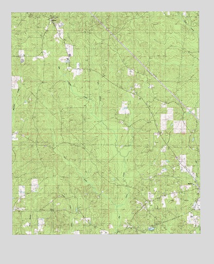
Marion West, LA USGS Topographic Map
Click on map above to begin viewing in our Map Viewer.

This topographic map contains these locations and features:
Feature Name Type Latitude Longitude GNIS ID View Map
Antioch CemeteryCemeteryN32.9249°W92.3535°532179View Map
Antioch ChurchChurchN32.9326°W92.3740°532191View Map
Center Branch ChurchChurchN32.8890°W92.3671°533846View Map
Concord ChurchChurchN32.8935°W92.2857°534075View Map
Dry BranchStreamN32.9376°W92.3132°534598View Map
Fairview CemeteryCemeteryN32.8782°W92.2929°544057View Map
Fairview ChurchChurchN32.8782°W92.2926°534886View Map
Good Hope ChurchChurchN32.9543°W92.3593°535273View Map
Meridian ChurchChurchN32.8968°W92.3438°537036View Map
Mount Horeb ChurchChurchN32.9549°W92.2926°537329View Map
Mount Union ChurchChurchN32.9324°W92.2779°537412View Map
OaklandPopulated PlaceN32.9957°W92.3507°555531View Map
Oakland Lookout TowerTowerN32.9965°W92.3496°548724View Map
Old Tennessee CemeteryCemeteryN32.9249°W92.3501°537864View Map
Parish Governing Authority District 6CivilN32.9234°W92.3411°1930161View Map
Pine Vale ChurchChurchN32.8779°W92.2857°538196View Map
Roark Allen CemeteryCemeteryN32.8831°W92.2535°538631View Map
Tick CreekStreamN32.8907°W92.3040°539917View Map
Union State Wildlife Management AreaParkN32.9332°W92.3313°540110View Map
Union Wildlife Management AreaParkN32.9318°W92.3379°548733View Map
Ward SixCivilN32.9279°W92.3532°545234View Map

Note: Coordinates in the location and feature list above are referenced to NAD83 datum.


Copyright (C) 2008-2024 Ryan Niemi / Sunset Dynamics ... All Rights Reserved