TopoQuest Logo
Do you find TopoQuest useful?
Help keep TopoQuest running and adding new maps/features by donating!
Bitcoin:  19c7KJd3qBynnjoSw5npx9KScwjBe4ifkT
Litecoin:  LXs6TkuXGGXo1vDsWCkWVdjQX94eUKd6ui
Home View Maps Find Maps Find Places Resources & Links


Lockwood, West Virginia Topographic Map

USGS Map Title: Lockwood, WV
USGS Map MRC: 38081C1
DRG (GeoTIFF) Download: o38081c1.tif


Neighboring USGS Topographic Map Quads:


  Elkhurst, WV  
38081D2
 

  Clay, WV  
38081D1
 

  Swandale, WV  
38080D8
 

  Bentree, WV  
38081C2
 

  Lockwood, WV  
38081C1
 

  Gilboa, WV  
38080C8
 

  Gauley Bridge, WV  
38081B2
 

  Ansted, WV  
38081B1
 

  Summersville Dam, WV  
38080B8


Map MRC Location:

N39°
W82°
N39°
W81°
H8 H7 H6 H5 H4 H3 H2 H1
G8 G7 G6 G5 G4 G3 G2 G1
F8 F7 F6 F5 F4 F3 F2 F1
E8 E7 E6 E5 E4 E3 E2 E1
D8 D7 D6 D5 D4 D3 D2 D1
C8 C7 C6 C5 C4 C3 C2 C1
B8 B7 B6 B5 B4 B3 B2 B1
A8 A7 A6 A5 A4 A3 A2 A1
N38°
W82°
N38°
W81°

Lockwood, WV USGS 1:24K Topographic Map Preview:
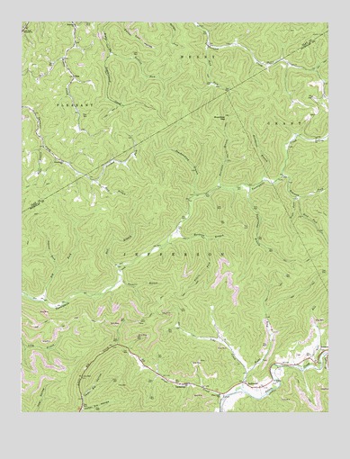
Lockwood, WV USGS Topographic Map
Click on map above to begin viewing in our Map Viewer.

This topographic map contains these locations and features:
Feature Name Type Latitude Longitude GNIS ID View Map
Ash ForkStreamN38.2859°W81.1154°1535049View Map
Bickmore ChurchChurchN38.3743°W81.1032°1535765View Map
Boardtree BranchStreamN38.3220°W81.0434°1536171View Map
Boardtree GapGapN38.3445°W81.0415°1536172View Map
Centennial Fairview Baptist ChurchChurchN38.2582°W81.0279°1741064View Map
Community ChurchChurchN38.3301°W81.1082°1537555View Map
Crooked ForkStreamN38.3243°W81.0951°1537835View Map
FolaPopulated PlaceN38.3576°W81.1037°1539110View Map
Fola Missionary Baptist ChurchChurchN38.3557°W81.1051°1741402View Map
Fola Post OfficePost OfficeN38.3579°W81.1037°1741403View Map
Hardway BranchStreamN38.3082°W81.0618°1539949View Map
Jefferson DistrictCivilN38.2684°W81.0833°1928294View Map
Laurel CreekStreamN38.2687°W81.0023°1541422View Map
Laurel ForkStreamN38.2954°W81.1104°1541436View Map
Lick Fork Freewill ChurchChurchN38.3723°W81.1246°1541899View Map
Line CreekStreamN38.2576°W81.0357°1541998View Map
LockwoodPopulated PlaceN38.2596°W81.0348°1542290View Map
Lower Elk HollowValleyN38.2509°W81.0998°1542539View Map
LyonsvillePopulated PlaceN38.2593°W81.0576°1542660View Map
Neil BranchStreamN38.2968°W81.0851°1544086View Map
Neil CemeteryCemeteryN38.2593°W81.0230°2586391View Map
Otter CreekStreamN38.2551°W81.0420°1544460View Map
Otter Creek School (historical)SchoolN38.2559°W81.0440°1544463View Map
Payne BranchStreamN38.3351°W81.1159°1544652View Map
Peachorchard BranchStreamN38.3190°W81.0534°1544673View Map
Peters ForkStreamN38.3057°W81.0498°1544750View Map
Right Fork Line CreekStreamN38.2623°W81.0329°1545663View Map
Right Fork Robinson ForkStreamN38.3193°W81.0132°1545689View Map
Road ForkStreamN38.3676°W81.0484°1545808View Map
Road ForkStreamN38.3190°W81.0126°1545818View Map
Robinson ForkStreamN38.3254°W81.0187°1545866View Map
Rock BranchStreamN38.3243°W81.0951°1545890View Map
Rocklick ForkStreamN38.3654°W81.0887°1545992View Map
Rosetta School (historical)SchoolN38.3557°W81.1051°1741421View Map
Stillhouse BranchStreamN38.3240°W81.0268°1547418View Map
Sugarcamp BranchStreamN38.3218°W81.0315°1547670View Map
Tate RunStreamN38.2634°W81.0107°1547915View Map
Twenty-Mile School (historical)SchoolN38.3376°W81.0048°1741124View Map
Twentymile ChurchChurchN38.3376°W81.0051°1548394View Map
Twomile BranchStreamN38.2921°W81.0845°1548426View Map
Upper Elk HollowValleyN38.2554°W81.0998°1548516View Map

Note: Coordinates in the location and feature list above are referenced to NAD83 datum.


Copyright (C) 2008-2025 Ryan Niemi / Sunset Dynamics ... All Rights Reserved