TopoQuest Logo
Do you find TopoQuest useful?
Help keep TopoQuest running and adding new maps/features by donating!
Bitcoin:  19c7KJd3qBynnjoSw5npx9KScwjBe4ifkT
Litecoin:  LXs6TkuXGGXo1vDsWCkWVdjQX94eUKd6ui
Home View Maps Find Maps Find Places Resources & Links


Fayetteville, West Virginia Topographic Map

USGS Map Title: Fayetteville, WV
USGS Map MRC: 38081A1
DRG (GeoTIFF) Download: o38081a1.tif


Neighboring USGS Topographic Map Quads:


  Gauley Bridge, WV  
38081B2
 

  Ansted, WV  
38081B1
 

  Summersville Dam, WV  
38080B8
 

  Beckwith, WV  
38081A2
 

  Fayetteville, WV  
38081A1
 

  Winona, WV  
38080A8
 

  Oak Hill, WV  
37081H2
 

  Thurmond, WV  
37081H1
 

  Danese, WV  
37080H8


Map MRC Location:

N39°
W82°
N39°
W81°
H8 H7 H6 H5 H4 H3 H2 H1
G8 G7 G6 G5 G4 G3 G2 G1
F8 F7 F6 F5 F4 F3 F2 F1
E8 E7 E6 E5 E4 E3 E2 E1
D8 D7 D6 D5 D4 D3 D2 D1
C8 C7 C6 C5 C4 C3 C2 C1
B8 B7 B6 B5 B4 B3 B2 B1
A8 A7 A6 A5 A4 A3 A2 A1
N38°
W82°
N38°
W81°

Fayetteville, WV USGS 1:24K Topographic Map Preview:
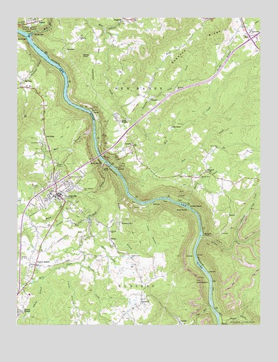
Fayetteville, WV USGS Topographic Map
Click on map above to begin viewing in our Map Viewer.

This topographic map contains these locations and features:
Feature Name Type Latitude Longitude GNIS ID View Map
Adkins BranchStreamN38.0187°W81.1115°1534817View Map
Altamont School (historical)SchoolN38.0379°W81.0770°1534895View Map
AmesPopulated PlaceN38.0862°W81.0859°1553726View Map
Ames HeightsPopulated PlaceN38.0854°W81.0757°1553727View Map
BachmanPopulated PlaceN38.0996°W81.1220°1553772View Map
BeautyPopulated PlaceN38.0448°W81.0162°1553826View Map
Beauty Mountain ChurchChurchN38.0723°W81.0220°1535444View Map
Boone (historical)Populated PlaceN38.0340°W81.0079°1556056View Map
Bridge Haven Golf ClubLocaleN38.0235°W81.0591°2634110View Map
Butcher BranchStreamN38.0529°W81.0684°1536788View Map
CapertonPopulated PlaceN38.0212°W81.0265°1554066View Map
Carver (historical)Populated PlaceN38.0759°W81.0840°1556063View Map
Clear CreekStreamN38.0926°W81.0565°1537387View Map
Coal RunStreamN38.0068°W81.0245°1537471View Map
Contrary CreekStreamN38.0346°W81.0132°1537590View Map
Craig BranchStreamN38.0496°W81.0587°1537774View Map
Crooked RunStreamN38.0429°W81.0879°1537845View Map
Crooked Run School (historical)SchoolN38.0321°W81.1073°1556070View Map
Dogwood Ridge School (historical)SchoolN38.1029°W81.0409°1556076View Map
Double Z RapidsRapidsN38.0496°W81.0429°1877638View Map
Dudleys Dip RapidsRapidsN38.0459°W81.0340°1877637View Map
Duncan School (historical)SchoolN38.1076°W81.0718°1556077View Map
EdmondPopulated PlaceN38.0623°W81.0273°1538559View Map
Edmond Post OfficePost OfficeN38.0593°W81.0199°2774648View Map
ElvertonPopulated PlaceN38.0279°W81.0345°1554397View Map
FayettePopulated PlaceN38.0634°W81.0734°1554449View Map
Fayette AirportAirportN38.0236°W81.1219°1558795View Map
Fayette CountyCivilN38.0288°W81.0812°1560095View Map
Fayette County CourthouseBuildingN38.0534°W81.1038°1556090View Map
Fayette County Sheriff's OfficeBuildingN38.0536°W81.1033°2727911View Map
Fayette HeightsPopulated PlaceN38.0243°W81.1151°1538908View Map
Fayette Station RapidsRapidsN38.0579°W81.0679°1877641View Map
FayettevillePopulated PlaceN38.0529°W81.1040°1538910View Map
Fayetteville Baptist ChurchChurchN38.0540°W81.1018°1556093View Map
Fayetteville Elementary SchoolSchoolN38.0524°W81.1063°1556094View Map
Fayetteville High SchoolSchoolN38.0453°W81.1137°1556095View Map
Fayetteville Middle School (historical)SchoolN38.0532°W81.1071°1556096View Map
Fayetteville Police DepartmentBuildingN38.0543°W81.1036°2727910View Map
Fayetteville Post OfficePost OfficeN38.0524°W81.1045°2774592View Map
Fayetteville Presbyterian ChurchChurchN38.0473°W81.1104°1556097View Map
Fayetteville Public LibraryBuildingN38.0520°W81.1054°2727203View Map
Fayetteville United Methodist ChurchChurchN38.0529°W81.1051°1556098View Map
Fayetteville Volunteer Fire DepartmentBuildingN38.0539°W81.1109°2577522View Map
Fern CreekStreamN38.0573°W81.0690°1538923View Map
First Church of GodChurchN38.0512°W81.1040°1556101View Map
Friends LandingLocaleN38.0007°W81.0004°1848416View Map
GartenPopulated PlaceN38.0346°W81.0768°1554534View Map
GatewoodPopulated PlaceN38.0107°W81.0609°1554539View Map
Gatewood Elementary SchoolSchoolN38.0068°W81.0654°1556105View Map
GaymontPopulated PlaceN38.1148°W81.0965°1554544View Map
Goodhope ChurchChurchN38.0965°W81.0440°1539508View Map
GraydenPopulated PlaceN38.0921°W81.0562°1554599View Map
Greyhound RapidsRapidsN38.0515°W81.0512°1877639View Map
Harlem HeightsPopulated PlaceN38.0057°W81.1223°1554649View Map
Harvey KnobSummitN38.1096°W81.0917°1554660View Map
Hawks NestPopulated PlaceN38.1159°W81.1170°1554665View Map
Hawks Nest State ParkParkN38.1240°W81.1190°1540077View Map
Hess School (historical)SchoolN38.1184°W81.0851°1556118View Map
HicoPopulated PlaceN38.1173°W81.0057°1554698View Map
Hico Census Designated PlaceCensusN38.1166°W81.0112°2586827View Map
Hico Post OfficePost OfficeN38.1130°W81.0032°2774645View Map
Historic Fayette Theatre (historical)BuildingN38.0526°W81.1032°2725497View Map
Hopewell Baptist ChurchChurchN38.1229°W81.0726°1556123View Map
House BranchStreamN38.0532°W81.0890°1540522View Map
Huse Memorial CemeteryCemeteryN38.0554°W81.0934°1540636View Map
Jan - Care Ambulance Service FayettevilleBuildingN38.0545°W81.1046°2581142View Map
Janutola ParkParkN38.0601°W81.1059°1556127View Map
KaymoorPopulated PlaceN38.0501°W81.0548°1554851View Map
Kaymoor Number 1MineN38.0418°W81.0737°1557854View Map
Keeney CreekStreamN38.0354°W81.0309°1541104View Map
Keeneys CreekPopulated PlaceN38.0373°W81.0295°1554855View Map
Keeneys RapidsRapidsN38.0362°W81.0312°1877636View Map
LansingPopulated PlaceN38.0734°W81.0657°1541351View Map
Lansing Post OfficePost OfficeN38.0730°W81.0722°2774642View Map
Levisee CreekStreamN38.0251°W81.0923°1541804View Map
Locust Grove ChurchChurchN38.0746°W81.1120°1542292View Map
Long PointCapeN38.0623°W81.0787°1542392View Map
Lower Railroad RapidsRapidsN38.0151°W81.0257°1877619View Map
MacDougalPopulated PlaceN38.1173°W81.1212°1555019View Map
Manns CreekStreamN38.0007°W81.0207°1542725View Map
Marr BranchStreamN38.0776°W81.0859°1542773View Map
McKenney ChurchChurchN38.1171°W81.0929°1543017View Map
Michigan (historical)Populated PlaceN38.0784°W81.0837°1556144View Map
Mill CreekStreamN38.1179°W81.1182°1543317View Map
Millers Folly RapidsRapidsN38.0543°W81.0687°1877640View Map
Mincar (historical)Populated PlaceN38.0090°W81.0337°1556148View Map
New River Gorge AirportAirportN38.0895°W81.0651°1558808View Map
New River Gorge BridgeBridgeN38.0687°W81.0826°1556157View Map
Newlyn (historical)Populated PlaceN38.0737°W81.0832°1556158View Map
Nuttalburg (historical)Populated PlaceN38.0501°W81.0404°1556160View Map
Nuttall StationLocaleN38.0490°W81.0376°1544254View Map
Oak RidgePopulated PlaceN38.0751°W81.1095°1555254View Map
Opossum CreekStreamN38.0829°W81.0651°1544423View Map
Osborne CreekStreamN38.1207°W81.0801°1544452View Map
Pendleton School (historical)SchoolN38.1037°W81.1165°1556172View Map
Penfield BranchStreamN38.1090°W81.1120°1544698View Map
Pierce CemeteryCemeteryN38.0504°W81.0954°1544804View Map
Pine GrovePopulated PlaceN38.0809°W81.0457°1555355View Map
Pleasant Grove ChurchChurchN38.0598°W81.0307°1544984View Map
Pleasant View CemeteryCemeteryN38.0279°W81.0854°1545041View Map
Pleasant View ChurchChurchN38.0276°W81.0659°1545042View Map
Short CreekStreamN38.0359°W81.0857°1546722View Map
Short CreekStreamN38.0490°W81.0379°1546724View Map
Smales BranchStreamN38.0946°W81.0245°1546953View Map
South CapertonPopulated PlaceN38.0182°W81.0270°1555662View Map
South FayettePopulated PlaceN38.0654°W81.0807°1555664View Map
South Nuttall (historical)Populated PlaceN38.0468°W81.0373°1555671View Map
Sunday Road ChurchChurchN38.1182°W81.0045°1547750View Map
Sunnyside (historical)Populated PlaceN38.0965°W81.0987°1556205View Map
Toney HollowValleyN38.0238°W81.0916°1548163View Map
Town of FayettevilleCivilN38.0624°W81.1084°2390179View Map
Tunny Hunsaker BridgeBridgeN38.0648°W81.0771°2635394View Map
Upper Railroad RapidsRapidsN38.0112°W81.0259°1877620View Map
Victory School (historical)SchoolN38.0221°W81.0640°1556211View Map
West Virginia Division of Forestry Fayette County Field OfficeBuildingN38.0528°W81.1034°2577805View Map
Whitney (historical)Populated PlaceN38.0896°W81.0993°1556216View Map
Willis CemeteryCemeteryN38.0983°W81.0713°2586245View Map
Wolf CreekStreamN38.0662°W81.0793°1549267View Map
Wolf Creek School (historical)SchoolN38.0362°W81.0857°1556218View Map

Note: Coordinates in the location and feature list above are referenced to NAD83 datum.


Copyright (C) 2008-2024 Ryan Niemi / Sunset Dynamics ... All Rights Reserved