TopoQuest Logo
Do you find TopoQuest useful?
Help keep TopoQuest running and adding new maps/features by donating!
Bitcoin:  19c7KJd3qBynnjoSw5npx9KScwjBe4ifkT
Litecoin:  LXs6TkuXGGXo1vDsWCkWVdjQX94eUKd6ui
Home View Maps Find Maps Find Places Resources & Links


Gawley Creek, Oregon Topographic Map

USGS Map Title: Gawley Creek, OR
USGS Map MRC: 44122H4
DRG (GeoTIFF) Download: o44122h4.tif


Neighboring USGS Topographic Map Quads:


  Wilhoit, OR  
45122A5
 

  Fernwood, OR  
45122A4
 

  Soosap Peak, OR  
45122A3
 

  Elk Prairie, OR  
44122H5
 

  Gawley Creek, OR  
44122H4
 

  Rooster Rock, OR  
44122H3
 

  Lyons, OR  
44122G5
 

  Mill City North, OR  
44122G4
 

  Elkhorn, OR  
44122G3


Map MRC Location:

N45°
W123°
N45°
W122°
H8 H7 H6 H5 H4 H3 H2 H1
G8 G7 G6 G5 G4 G3 G2 G1
F8 F7 F6 F5 F4 F3 F2 F1
E8 E7 E6 E5 E4 E3 E2 E1
D8 D7 D6 D5 D4 D3 D2 D1
C8 C7 C6 C5 C4 C3 C2 C1
B8 B7 B6 B5 B4 B3 B2 B1
A8 A7 A6 A5 A4 A3 A2 A1
N44°
W123°
N44°
W122°

Gawley Creek, OR USGS 1:24K Topographic Map Preview:
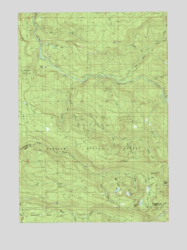
Gawley Creek, OR USGS Topographic Map
Click on map above to begin viewing in our Map Viewer.

This topographic map contains these locations and features:
Feature Name Type Latitude Longitude GNIS ID View Map
Avalanche CreekStreamN44.9485°W122.3806°1137351View Map
Bear CreekStreamN44.9926°W122.4859°1117358View Map
Bee RanchLocaleN44.9612°W122.4198°1117474View Map
Boar CampLocaleN44.9226°W122.4554°1130539View Map
Bull CreekStreamN44.9585°W122.3923°1138902View Map
Butte LakeLakeN44.8860°W122.4165°1130530View Map
Copper LakeLakeN44.8860°W122.3970°1130537View Map
Copperhead CreekStreamN44.9479°W122.4598°1119273View Map
Corbia LakeLakeN44.9794°W122.4714°1134225View Map
Cow CreekStreamN44.9818°W122.4831°1130575View Map
Dandelion CreekStreamN44.9735°W122.3970°1159239View Map
Dog RockSummitN44.9110°W122.4151°1130540View Map
Fibre CreekStreamN44.9040°W122.4206°1130535View Map
Fibre LakeLakeN44.8949°W122.4178°1134226View Map
Fibre RockSummitN44.8915°W122.4206°1130531View Map
Fill CreekStreamN44.8998°W122.3956°1130577View Map
Gawley BasinBasinN44.9151°W122.3915°1134227View Map
Gawley CreekStreamN44.9610°W122.4568°1121083View Map
Gawley MeadowFlatN44.9373°W122.4067°1130573View Map
Hell Cat RockSummitN44.8860°W122.4095°1130533View Map
Horse CreekStreamN44.9615°W122.4356°1121994View Map
Inventory CreekStreamN44.9248°W122.4609°1130572View Map
Lookout Mountain LookoutLocaleN44.8785°W122.3951°1123466View Map
Mud SpringsSpringN44.9121°W122.4095°1130543View Map
Murphy CampLocaleN44.8957°W122.3929°1130579View Map
North Gawley RidgeRidgeN44.9262°W122.3887°1130574View Map
Panther RockSummitN44.9046°W122.3865°1136613View Map
Pelkey LakeLakeN44.9804°W122.4804°1130580View Map
Picture PointCliffN44.9012°W122.3817°1130576View Map
Pine Crest TrailTrailN44.9898°W122.4087°1147705View Map
Rhody LakeLakeN44.8918°W122.4102°1130534View Map
Shoofly CreekStreamN44.9248°W122.4095°1130544View Map
Slide CreekStreamN44.9262°W122.4234°1130541View Map
South Fork Butte CreekStreamN44.9037°W122.4304°1130532View Map
South Gawley RidgeRidgeN44.9096°W122.4151°1130538View Map
Sucker CreekStreamN44.9823°W122.3817°1134228View Map
Sweet Spring CreekStreamN44.8804°W122.4567°1127832View Map
Trestle CreekStreamN44.9248°W122.4137°1130542View Map

Note: Coordinates in the location and feature list above are referenced to NAD83 datum.


Copyright (C) 2008-2024 Ryan Niemi / Sunset Dynamics ... All Rights Reserved