TopoQuest Logo
Do you find TopoQuest useful?
Help keep TopoQuest running and adding new maps/features by donating!
Bitcoin:  19c7KJd3qBynnjoSw5npx9KScwjBe4ifkT
Litecoin:  LXs6TkuXGGXo1vDsWCkWVdjQX94eUKd6ui
Home View Maps Find Maps Find Places Resources & Links


Mill City North, Oregon Topographic Map

USGS Map Title: Mill City North, OR
USGS Map MRC: 44122G4
DRG (GeoTIFF) Download: o44122g4.tif


Neighboring USGS Topographic Map Quads:


  Elk Prairie, OR  
44122H5
 

  Gawley Creek, OR  
44122H4
 

  Rooster Rock, OR  
44122H3
 

  Lyons, OR  
44122G5
 

  Mill City North, OR  
44122G4
 

  Elkhorn, OR  
44122G3
 

  Snow Peak, OR  
44122F5
 

  Mill City South, OR  
44122F4
 

  Lawhead Creek, OR  
44122F3


Map MRC Location:

N45°
W123°
N45°
W122°
H8 H7 H6 H5 H4 H3 H2 H1
G8 G7 G6 G5 G4 G3 G2 G1
F8 F7 F6 F5 F4 F3 F2 F1
E8 E7 E6 E5 E4 E3 E2 E1
D8 D7 D6 D5 D4 D3 D2 D1
C8 C7 C6 C5 C4 C3 C2 C1
B8 B7 B6 B5 B4 B3 B2 B1
A8 A7 A6 A5 A4 A3 A2 A1
N44°
W123°
N44°
W122°

Mill City North, OR USGS 1:24K Topographic Map Preview:
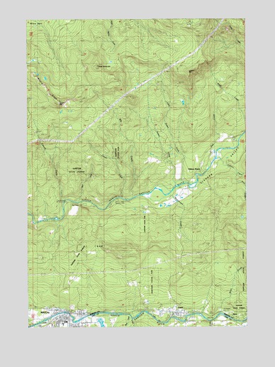
Mill City North, OR USGS Topographic Map
Click on map above to begin viewing in our Map Viewer.

This topographic map contains these locations and features:
Feature Name Type Latitude Longitude GNIS ID View Map
7th Street City Boat LaunchLocaleN44.7544°W122.4680°2700073View Map
Anderson CreekStreamN44.7526°W122.4429°1130515View Map
Bear CreekStreamN44.7998°W122.4734°1130518View Map
Bear Creek County ParkParkN44.8001°W122.4692°1966215View Map
Big CreekStreamN44.8021°W122.4406°1117601View Map
Buck CreekStreamN44.8115°W122.3826°1138776View Map
Burbank CreekStreamN44.7518°W122.3790°1162488View Map
Camp CascadeLocaleN44.8262°W122.3817°1162162View Map
Canyon CreekStreamN44.8018°W122.4801°1118574View Map
Cascade Operating Company (historical)LocaleN44.7568°W122.4095°1166420View Map
Chamberlain CreekStreamN44.8012°W122.4317°1130517View Map
City of GatesCivilN44.7560°W122.4201°2410576View Map
City of Mill CityCivilN44.7519°W122.4779°2411107View Map
Cougar CreekStreamN44.8018°W122.4465°1119374View Map
Doodle CreekStreamN44.8276°W122.4929°1153367View Map
Elkhorn CreekStreamN44.8182°W122.3920°1141816View Map
Elkhorn ValleyValleyN44.7990°W122.4623°1141825View Map
Elkhorn WoodsPopulated PlaceN44.8132°W122.4012°1162681View Map
Elkhorn Woods ParkParkN44.8235°W122.3887°1162161View Map
Fish CreekStreamN44.8207°W122.3940°1162989View Map
GatesPopulated PlaceN44.7562°W122.4167°1121079View Map
Gates City HallBuildingN44.7547°W122.4168°2699381View Map
Gates Park and RideLocaleN44.7556°W122.4159°2699184View Map
Gates Post OfficePost OfficeN44.7553°W122.4167°1165297View Map
Gates Public Works Department OfficeBuildingN44.7547°W122.4168°2699382View Map
Gates Rural Fire Protection DistrictBuildingN44.7534°W122.4128°2576465View Map
Henness Post Office (historical)Post OfficeN44.7523°W122.4109°1164404View Map
Homer (historical)LocaleN44.7571°W122.4298°1166428View Map
Homestead CreekStreamN44.8221°W122.4151°1130519View Map
House MountainSummitN44.8415°W122.4834°1134785View Map
Kimmel City Park Boat RampLocaleN44.7534°W122.4700°2700075View Map
Kimmel ParkParkN44.7526°W122.4720°1162150View Map
Linn County Sheriff's Office Mill City SubstationBuildingN44.7532°W122.4783°2737831View Map
Little Sinker CreekStreamN44.8460°W122.4226°1123282View Map
Livesay (historical)LocaleN44.7560°W122.4590°1166431View Map
Lookout MountainSummitN44.8537°W122.4098°1123465View Map
Mad CreekStreamN44.7526°W122.3967°1145717View Map
Mill CityPopulated PlaceN44.7540°W122.4781°1124148View Map
Mill City Elementary SchoolSchoolN44.7508°W122.4813°2466071View Map
Mill City Fire DepartmentBuildingN44.7521°W122.4770°2576635View Map
Mill City LibraryBuildingN44.7532°W122.4783°2699600View Map
Mill City Municipal CourtBuildingN44.7529°W122.4792°2699601View Map
Mill City Public Works Department OfficeBuildingN44.7529°W122.4792°2699602View Map
Mill City Sewage SystemLocaleN44.7512°W122.4666°2697151View Map
Mill City Town HallBuildingN44.7530°W122.4792°2699599View Map
Minto (historical)LocaleN44.7551°W122.3840°1163150View Map
Minto County ParkParkN44.7540°W122.3859°1162151View Map
Minto CreekStreamN44.7540°W122.3929°1130514View Map
Moorehouse CreekStreamN44.8032°W122.4187°1124335View Map
Packsaddle CreekStreamN44.7568°W122.3817°1163579View Map
Pierce CreekStreamN44.7512°W122.4290°1163557View Map
Rock CreekStreamN44.7532°W122.4423°1148597View Map
Sanitam Junior - Senior High SchoolSchoolN44.7519°W122.4794°2466072View Map
Schroeder (historical)LocaleN44.7554°W122.4015°1166433View Map
Sinker CreekStreamN44.8071°W122.4170°1163273View Map
Stayton Rural Fire Protection District Elkhorn StationBuildingN44.8170°W122.4013°2577098View Map
Sweet Spring MountainSummitN44.8560°W122.4606°1127833View Map
The Maples Safety Rest AreaLocaleN44.7554°W122.3887°1134786View Map
Turnridge CreekStreamN44.7526°W122.4415°1132742View Map
Wildcat RidgeRidgeN44.8504°W122.4956°1129069View Map
Wonder CreekStreamN44.8026°W122.4387°1163558View Map

Note: Coordinates in the location and feature list above are referenced to NAD83 datum.


Copyright (C) 2008-2025 Ryan Niemi / Sunset Dynamics ... All Rights Reserved