TopoQuest Logo
Do you find TopoQuest useful?
Help keep TopoQuest running and adding new maps/features by donating!
Bitcoin:  19c7KJd3qBynnjoSw5npx9KScwjBe4ifkT
Litecoin:  LXs6TkuXGGXo1vDsWCkWVdjQX94eUKd6ui
Home View Maps Find Maps Find Places Resources & Links


Wilhoit, Oregon Topographic Map

USGS Map Title: Wilhoit, OR
USGS Map MRC: 45122A5
DRG (GeoTIFF) Download: o45122a5.tif


Neighboring USGS Topographic Map Quads:


  Yoder, OR  
45122B6
 

  Molalla, OR  
45122B5
 

  Colton, OR  
45122B4
 

  Scotts Mills, OR  
45122A6
 

  Wilhoit, OR  
45122A5
 

  Fernwood, OR  
45122A4
 

  Drake Crossing, OR  
44122H6
 

  Elk Prairie, OR  
44122H5
 

  Gawley Creek, OR  
44122H4


Map MRC Location:

N46°
W123°
N46°
W122°
H8 H7 H6 H5 H4 H3 H2 H1
G8 G7 G6 G5 G4 G3 G2 G1
F8 F7 F6 F5 F4 F3 F2 F1
E8 E7 E6 E5 E4 E3 E2 E1
D8 D7 D6 D5 D4 D3 D2 D1
C8 C7 C6 C5 C4 C3 C2 C1
B8 B7 B6 B5 B4 B3 B2 B1
A8 A7 A6 A5 A4 A3 A2 A1
N45°
W123°
N45°
W122°

Wilhoit, OR USGS 1:24K Topographic Map Preview:
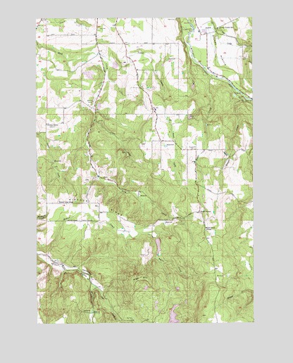
Wilhoit, OR USGS Topographic Map
Click on map above to begin viewing in our Map Viewer.

This topographic map contains these locations and features:
Feature Name Type Latitude Longitude GNIS ID View Map
Adams CemeteryCemeteryN45.1248°W122.5456°1116764View Map
Beaver CreekStreamN45.0279°W122.6206°1117429View Map
Beaver Lake School (historical)SchoolN45.0494°W122.6061°1117450View Map
Berrenth QuarryMineN45.0907°W122.5940°1117550View Map
Beyer ReservoirLakeN45.0323°W122.5565°1130513View Map
Cedar CreekStreamN45.1015°W122.5251°1118731View Map
Coal CreekStreamN45.0168°W122.5951°1119050View Map
Cotton CreekStreamN45.0829°W122.5926°1119310View Map
Dart CemeteryCemeteryN45.1203°W122.5898°1119694View Map
Deardorf PondsLakeN45.0110°W122.5526°1130520View Map
Deardorff ReservoirReservoirN45.0028°W122.5476°1133459View Map
Dickey CreekStreamN45.1190°W122.5356°1158209View Map
Dickey PrairieFlatN45.1126°W122.5218°1119934View Map
Dickey PrairieLocaleN45.1182°W122.5281°1119935View Map
Dickey Prairie Elementary SchoolSchoolN45.1210°W122.5214°1119936View Map
HermansLocaleN45.1137°W122.5915°1130510View Map
High HillSummitN45.0181°W122.5648°1136376View Map
Kokel CornerLocaleN45.0451°W122.5323°1122832View Map
Little Teasel CreekStreamN45.0679°W122.5470°1130512View Map
Maple Grove Elementary SchoolSchoolN45.0379°W122.5284°1123741View Map
Missouri RidgeRidgeN45.0496°W122.6193°1124259View Map
Molalla Rural Fire Protection District 73 Main StationBuildingN45.0748°W122.5550°2576858View Map
Neil Beyer DamDamN45.0348°W122.5562°1131592View Map
PunchbowlBasinN45.0746°W122.5087°1134675View Map
Russell CreekStreamN45.0954°W122.5112°1126371View Map
RussellvilleLocaleN45.0693°W122.5345°1130511View Map
Russellville CemeteryCemeteryN45.0711°W122.5347°1126375View Map
Sawtell CemeteryCemeteryN45.1071°W122.6027°1847455View Map
Teasel CreekStreamN45.1101°W122.5909°1127916View Map
Teasel Creek DamDamN45.1065°W122.5812°1131584View Map
Teasel Creek ReservoirReservoirN45.1055°W122.5805°1159139View Map
Wildcat SchoolLocaleN45.0815°W122.6204°1129070View Map
WilhoitPopulated PlaceN45.0526°W122.5679°1129090View Map
Wilhoit Mineral SpringsSpringN45.0523°W122.5683°1164015View Map
Wilhoit Post Office (historical)Post OfficeN45.0526°W122.5679°1166176View Map
Wilhoit Springs County ParkParkN45.0523°W122.5687°2040442View Map
Yoder QuarryMineN45.0840°W122.5384°1129385View Map

Note: Coordinates in the location and feature list above are referenced to NAD83 datum.


Copyright (C) 2008-2024 Ryan Niemi / Sunset Dynamics ... All Rights Reserved