TopoQuest Logo
Do you find TopoQuest useful?
Help keep TopoQuest running and adding new maps/features by donating!
Bitcoin:  19c7KJd3qBynnjoSw5npx9KScwjBe4ifkT
Litecoin:  LXs6TkuXGGXo1vDsWCkWVdjQX94eUKd6ui
Home View Maps Find Maps Find Places Resources & Links


Gerber, California Topographic Map

USGS Map Title: Gerber, CA
USGS Map MRC: 40122A2
DRG (GeoTIFF) Download: o40122a2.tif


Neighboring USGS Topographic Map Quads:


  Red Bluff West, CA  
40122B3
 

  Red Bluff East, CA  
40122B2
 

  Tuscan Springs, CA  
40122B1
 

  West of Gerber, CA  
40122A3
 

  Gerber, CA  
40122A2
 

  Los Molinos, CA  
40122A1
 

  Henleyville, CA  
39122H3
 

  Corning, CA  
39122H2
 

  Vina, CA  
39122H1


Map MRC Location:

N41°
W123°
N41°
W122°
H8 H7 H6 H5 H4 H3 H2 H1
G8 G7 G6 G5 G4 G3 G2 G1
F8 F7 F6 F5 F4 F3 F2 F1
E8 E7 E6 E5 E4 E3 E2 E1
D8 D7 D6 D5 D4 D3 D2 D1
C8 C7 C6 C5 C4 C3 C2 C1
B8 B7 B6 B5 B4 B3 B2 B1
A8 A7 A6 A5 A4 A3 A2 A1
N40°
W123°
N40°
W122°

Gerber, CA USGS 1:24K Topographic Map Preview:
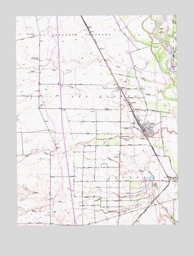
Gerber, CA USGS Topographic Map
Click on map above to begin viewing in our Map Viewer.

This topographic map contains these locations and features:
Feature Name Type Latitude Longitude GNIS ID View Map
Butler SloughStreamN40.1029°W122.1289°220281View Map
City of TehamaCivilN40.0218°W122.1269°2412042View Map
Corning CanalCanalN40.0599°W122.2253°233720View Map
Coyote CreekStreamN40.0782°W122.1367°221739View Map
El CaminoPopulated PlaceN40.0410°W122.1705°1658480View Map
El Camino GrangeLocaleN40.0521°W122.1694°223018View Map
GerberPopulated PlaceN40.0563°W122.1503°224126View Map
Gerber Census Designated PlaceCensusN40.0614°W122.1482°2628801View Map
Gerber Elementary SchoolSchoolN40.0696°W122.1809°1692745View Map
Gerber Fire DepartmentBuildingN40.0554°W122.1518°2622009View Map
Gerber Post OfficePost OfficeN40.0562°W122.1518°2760036View Map
Gerber-Las Flores Census Designated Place (historical)CensusN40.0644°W122.1508°2408290View Map
Haleakala RanchLocaleN40.0825°W122.1533°2703415View Map
KiskaPopulated PlaceN40.0682°W122.1605°1658910View Map
La Barranca ColoradaCivilN40.1082°W122.2178°234118View Map
Las FloresCivilN40.0749°W122.1761°234137View Map
Las FloresPopulated PlaceN40.0718°W122.1628°1658943View Map
Las Flores Census Designated PlaceCensusN40.0721°W122.1573°2628748View Map
Mooney IslandIslandN40.1068°W122.1422°229010View Map
ProbertaPopulated PlaceN40.0815°W122.1705°231067View Map
Proberta Census Designated PlaceCensusN40.0762°W122.1776°2628780View Map
Proberta Post OfficePost OfficeN40.0825°W122.1721°2789124View Map
RawsonPopulated PlaceN40.1177°W122.1944°1659473View Map
Red Bluff Omni Radio Range StationLocaleN40.0988°W122.2364°231313View Map
Rodeo CreekStreamN40.0257°W122.1325°231800View Map
Sacramento BarBarN40.0927°W122.1280°232077View Map
Sacramento River National Wildlife RefugeParkN40.1011°W122.1388°2765487View Map
SaucosCivilN40.0165°W122.1428°234653View Map
Tehama CemeteryCemeteryN40.0232°W122.1444°236072View Map
Tehama County Fire Department Station 9 El CaminoBuildingN40.0714°W122.1694°2622057View Map
Todd IslandIslandN40.1154°W122.1380°236409View Map
Truckee CreekStreamN40.0215°W122.1483°236577View Map
Willow CreekStreamN40.0807°W122.1997°237893View Map

Note: Coordinates in the location and feature list above are referenced to NAD83 datum.


Copyright (C) 2008-2025 Ryan Niemi / Sunset Dynamics ... All Rights Reserved