TopoQuest Logo
Do you find TopoQuest useful?
Help keep TopoQuest running and adding new maps/features by donating!
Bitcoin:  19c7KJd3qBynnjoSw5npx9KScwjBe4ifkT
Litecoin:  LXs6TkuXGGXo1vDsWCkWVdjQX94eUKd6ui
Home View Maps Find Maps Find Places Resources & Links


Red Bluff East, California Topographic Map

USGS Map Title: Red Bluff East, CA
USGS Map MRC: 40122B2
DRG (GeoTIFF) Download: o40122b2.tif


Neighboring USGS Topographic Map Quads:


  Hooker, CA  
40122C3
 

  Bend, CA  
40122C2
 

  Dales, CA  
40122C1
 

  Red Bluff West, CA  
40122B3
 

  Red Bluff East, CA  
40122B2
 

  Tuscan Springs, CA  
40122B1
 

  West of Gerber, CA  
40122A3
 

  Gerber, CA  
40122A2
 

  Los Molinos, CA  
40122A1


Map MRC Location:

N41°
W123°
N41°
W122°
H8 H7 H6 H5 H4 H3 H2 H1
G8 G7 G6 G5 G4 G3 G2 G1
F8 F7 F6 F5 F4 F3 F2 F1
E8 E7 E6 E5 E4 E3 E2 E1
D8 D7 D6 D5 D4 D3 D2 D1
C8 C7 C6 C5 C4 C3 C2 C1
B8 B7 B6 B5 B4 B3 B2 B1
A8 A7 A6 A5 A4 A3 A2 A1
N40°
W123°
N40°
W122°

Red Bluff East, CA USGS 1:24K Topographic Map Preview:
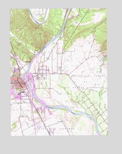
Red Bluff East, CA USGS Topographic Map
Click on map above to begin viewing in our Map Viewer.

This topographic map contains these locations and features:
Feature Name Type Latitude Longitude GNIS ID View Map
Academy of Our Lady of MercySchoolN40.1760°W122.2322°1692683View Map
Antelope Elementary SchoolSchoolN40.1862°W122.1939°218300View Map
Ayer ParkParkN40.1835°W122.2358°218482View Map
Berrendos Middle SchoolSchoolN40.1957°W122.2082°1692684View Map
Bidwell Elementary SchoolSchoolN40.1735°W122.2475°219110View Map
Big BendBendN40.2421°W122.2144°219132View Map
Blackberry IslandIslandN40.1424°W122.1436°219412View Map
Blue Tent CreekStreamN40.2060°W122.2161°219530View Map
Brewery CreekStreamN40.1843°W122.2378°219809View Map
Brickyard CreekStreamN40.1702°W122.2344°219815View Map
California Highway Patrol Red BluffBuildingN40.1932°W122.2394°2751101View Map
Calvary TempleChurchN40.1749°W122.2406°1692685View Map
Central ValleyValleyN40.1999°W122.2011°252254View Map
Church of GodChurchN40.1790°W122.2494°1692686View Map
Church of the NazareneChurchN40.1757°W122.2439°1692687View Map
City of Red BluffCivilN40.1735°W122.2413°2411527View Map
Craig CreekStreamN40.1385°W122.1414°221790View Map
Diamond ParkParkN40.1618°W122.2242°1692688View Map
Dibble CreekStreamN40.1929°W122.2278°222361View Map
East Sand SloughStreamN40.1643°W122.2194°222923View Map
First Baptist ChurchChurchN40.1763°W122.2369°1692690View Map
First Christian ChurchChurchN40.1782°W122.2392°1692691View Map
First Church of Christ ScientistChurchN40.1777°W122.2422°1692692View Map
First Methodist ChurchChurchN40.1754°W122.2419°1692693View Map
First Presbyterian ChurchChurchN40.1785°W122.2381°1692694View Map
Forward ParkParkN40.1852°W122.2439°223717View Map
Fry FieldParkN40.1540°W122.2403°1692695View Map
Gospel ChurchChurchN40.1746°W122.2386°1692696View Map
Herbert Kraft Free LibraryBuildingN40.1785°W122.2389°1692697View Map
Iron CanyonValleyN40.2268°W122.1864°225975View Map
Jackson Heights Elementary SchoolSchoolN40.1697°W122.2394°1692698View Map
KBLF-AM (Red Bluff)TowerN40.1910°W122.2161°1662697View Map
Lincoln Street Independent Elementary SchoolSchoolN40.1787°W122.2457°227155View Map
Little Antelope CreekStreamN40.1618°W122.1342°262504View Map
Little Salt CreekStreamN40.1985°W122.1800°227359View Map
Mercy High SchoolSchoolN40.1740°W122.2306°1692699View Map
Millrace CreekStreamN40.1646°W122.1733°228765View Map
New CreekStreamN40.1574°W122.1647°229488View Map
Oak Creek Golf CourseLocaleN40.1471°W122.2283°1692701View Map
Oak Hill CemeteryCemeteryN40.1699°W122.2444°229856View Map
Orchard Park SchoolSchoolN40.1382°W122.1844°230076View Map
Paynes Creek SloughStreamN40.1560°W122.1956°230428View Map
Red Bank CreekStreamN40.1527°W122.2053°265253View Map
Red BluffPopulated PlaceN40.1785°W122.2358°277581View Map
Red Bluff City HallBuildingN40.1757°W122.2353°1692702View Map
Red Bluff City ParkParkN40.1768°W122.2317°1692703View Map
Red Bluff Diversion DamDamN40.1535°W122.2024°231312View Map
Red Bluff Diverson Dam Recreation AreaParkN40.1590°W122.2069°1692704View Map
Red Bluff Fire DepartmentBuildingN40.1755°W122.2349°2621857View Map
Red Bluff High SchoolSchoolN40.1771°W122.2497°236826View Map
Red Bluff Police DepartmentBuildingN40.1756°W122.2351°2751047View Map
Red Bluff Post OfficePost OfficeN40.1773°W122.2372°1692705View Map
Reeds CreekStreamN40.1721°W122.2278°231465View Map
Sacred Heart Parish SchoolSchoolN40.1897°W122.2472°232093View Map
Sacred Heart Roman Catholic ChurchChurchN40.1757°W122.2339°1692707View Map
Saint Elizabeth Community HospitalHospitalN40.1481°W122.2188°1692708View Map
Saint Pauls Lutheran ChurchChurchN40.1746°W122.2356°1692709View Map
Saint Peters Episcopal ChurchChurchN40.1749°W122.2356°1692710View Map
Salt CreekStreamN40.1468°W122.1542°232314View Map
Samson SloughStreamN40.1660°W122.2008°232356View Map
Sevenmile CreekStreamN40.2385°W122.1800°232823View Map
South Log Pond 268 DamDamN40.1382°W122.2128°1663810View Map
Tehama CountyCivilN40.1257°W122.2339°1692767View Map
Tehama County CourthouseBuildingN40.1763°W122.2361°1692711View Map
Tehama County FairgroundsParkN40.1899°W122.2025°1692712View Map
Tehama County Fire Department Station 1 Red Bluff HeadquartersBuildingN40.1864°W122.2041°2622013View Map
Tehama County Sheriff's OfficeBuildingN40.1759°W122.2362°2751075View Map
Veterans Memorial BuildingBuildingN40.1740°W122.2383°1692714View Map
Vista Middle SchoolSchoolN40.1547°W122.2393°237117View Map
William B. Ide Adobe State Historic ParkParkN40.1971°W122.2261°237837View Map
William M Metteer Elementary SchoolSchoolN40.1566°W122.2341°1692700View Map

Note: Coordinates in the location and feature list above are referenced to NAD83 datum.


Copyright (C) 2008-2024 Ryan Niemi / Sunset Dynamics ... All Rights Reserved