TopoQuest Logo
Do you find TopoQuest useful?
Help keep TopoQuest running and adding new maps/features by donating!
Bitcoin:  19c7KJd3qBynnjoSw5npx9KScwjBe4ifkT
Litecoin:  LXs6TkuXGGXo1vDsWCkWVdjQX94eUKd6ui
Home View Maps Find Maps Find Places Resources & Links


Gerow Butte, Oregon Topographic Map

USGS Map Title: Gerow Butte, OR
USGS Map MRC: 44120C4
DRG (GeoTIFF) Download: o44120c4.tif


Neighboring USGS Topographic Map Quads:


  Steins Pillar, OR  
44120D5
 

  Whistler Point, OR  
44120D4
 

  Ochoco Butte, OR  
44120D3
 

  Cadle Butte, OR  
44120C5
 

  Gerow Butte, OR  
44120C4
 

  Lookout Mountain, OR  
44120C3
 

  Pilot Butte, OR  
44120B5
 

  Post, OR  
44120B4
 

  Prairie Hill, OR  
44120B3


Map MRC Location:

N45°
W121°
N45°
W120°
H8 H7 H6 H5 H4 H3 H2 H1
G8 G7 G6 G5 G4 G3 G2 G1
F8 F7 F6 F5 F4 F3 F2 F1
E8 E7 E6 E5 E4 E3 E2 E1
D8 D7 D6 D5 D4 D3 D2 D1
C8 C7 C6 C5 C4 C3 C2 C1
B8 B7 B6 B5 B4 B3 B2 B1
A8 A7 A6 A5 A4 A3 A2 A1
N44°
W121°
N44°
W120°

Gerow Butte, OR USGS 1:24K Topographic Map Preview:
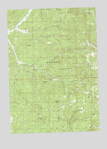
Gerow Butte, OR USGS Topographic Map
Click on map above to begin viewing in our Map Viewer.

This topographic map contains these locations and features:
Feature Name Type Latitude Longitude GNIS ID View Map
Blevins CreekStreamN44.3507°W120.4692°1138260View Map
Boardtree CreekStreamN44.3140°W120.4597°1138357View Map
Cadle CreekStreamN44.3235°W120.4878°1139135View Map
Crooked Tree SpringSpringN44.3727°W120.4162°1140476View Map
Crusher CreekStreamN44.2532°W120.4264°1140500View Map
Douthit SpringsSpringN44.3748°W120.4452°1639303View Map
Duncan ButteSummitN44.3629°W120.4103°1141397View Map
Duncan CreekStreamN44.3557°W120.4886°1141400View Map
Gerow ButteSummitN44.2632°W120.4605°1142621View Map
Gerow Butte Lookout TowerTowerN44.2634°W120.4602°1157543View Map
Gerow SpringSpringN44.2696°W120.4614°1153152View Map
Hawkins ButteSummitN44.3385°W120.4700°1143378View Map
Hedgepath CreekStreamN44.3715°W120.3895°1143448View Map
Howard ButteSummitN44.3174°W120.4036°1143842View Map
Howard CemeteryCemeteryN44.3735°W120.4636°1153153View Map
Kyle CreekStreamN44.3668°W120.3775°1144719View Map
Line ButteSummitN44.2846°W120.3869°1145041View Map
Madison CreekStreamN44.3715°W120.3900°1145722View Map
Monument SpringSpringN44.3671°W120.4354°1146407View Map
Nelson MonumentLocaleN44.2670°W120.3859°1146773View Map
North PointSummitN44.3386°W120.3850°1147050View Map
Peaslee CreekStreamN44.3660°W120.3764°1147536View Map
Sheep CreekStreamN44.3174°W120.4856°1149319View Map
Sheep Creek ButteSummitN44.2810°W120.4350°1149333View Map
Sulphur SpringSpringN44.3035°W120.4399°1150587View Map
Sulphur Spring ButteSummitN44.3007°W120.4511°1150590View Map

Note: Coordinates in the location and feature list above are referenced to NAD83 datum.


Copyright (C) 2008-2024 Ryan Niemi / Sunset Dynamics ... All Rights Reserved