TopoQuest Logo
Do you find TopoQuest useful?
Help keep TopoQuest running and adding new maps/features by donating!
Bitcoin:  19c7KJd3qBynnjoSw5npx9KScwjBe4ifkT
Litecoin:  LXs6TkuXGGXo1vDsWCkWVdjQX94eUKd6ui
Home View Maps Find Maps Find Places Resources & Links


Ochoco Butte, Oregon Topographic Map

USGS Map Title: Ochoco Butte, OR
USGS Map MRC: 44120D3
DRG (GeoTIFF) Download: o44120d3.tif


Neighboring USGS Topographic Map Quads:


  Stephenson Mountain, OR  
44120E4
 

  Lawson Mountain, OR  
44120E3
 

  Mitchell, OR  
44120E2
 

  Whistler Point, OR  
44120D4
 

  Ochoco Butte, OR  
44120D3
 

  Mount Pisgah, OR  
44120D2
 

  Gerow Butte, OR  
44120C4
 

  Lookout Mountain, OR  
44120C3
 

  Williams Prairie, OR  
44120C2


Map MRC Location:

N45°
W121°
N45°
W120°
H8 H7 H6 H5 H4 H3 H2 H1
G8 G7 G6 G5 G4 G3 G2 G1
F8 F7 F6 F5 F4 F3 F2 F1
E8 E7 E6 E5 E4 E3 E2 E1
D8 D7 D6 D5 D4 D3 D2 D1
C8 C7 C6 C5 C4 C3 C2 C1
B8 B7 B6 B5 B4 B3 B2 B1
A8 A7 A6 A5 A4 A3 A2 A1
N44°
W121°
N44°
W120°

Ochoco Butte, OR USGS 1:24K Topographic Map Preview:
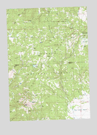
Ochoco Butte, OR USGS Topographic Map
Click on map above to begin viewing in our Map Viewer.

This topographic map contains these locations and features:
Feature Name Type Latitude Longitude GNIS ID View Map
Ahalt CreekStreamN44.4335°W120.3556°1137037View Map
Arthur Creek CampLocaleN44.4662°W120.2539°1638648View Map
Bacon ReservoirReservoirN44.4471°W120.3722°1638650View Map
Big Spread SpringSpringN44.4457°W120.3105°1138070View Map
Butterfield SpringSpringN44.4612°W120.3257°1139068View Map
Cady CreekStreamN44.4301°W120.3603°1139136View Map
Camp CreekStreamN44.4340°W120.3517°1139210View Map
Carroll ButteSummitN44.4837°W120.3652°1139390View Map
Carroll GladeFlatN44.4849°W120.3483°1139394View Map
Carroll Glade SpringsSpringN44.4851°W120.3399°1139395View Map
Cole SpringSpringN44.4677°W120.3393°1139979View Map
Corral FlatFlatN44.4710°W120.3713°1140149View Map
Cram ReservoirReservoirN44.3906°W120.3263°1140365View Map
Crystal Springs Organization CampLocaleN44.4729°W120.3495°1156336View Map
Cup SpringSpringN44.4446°W120.2721°1140553View Map
Davis SpringSpringN44.4157°W120.3577°1140669View Map
Dunn SpringSpringN44.4676°W120.2674°1638651View Map
East Fork Howard CreekStreamN44.4235°W120.2961°1141570View Map
Fisher SpringSpringN44.3815°W120.3699°1153150View Map
Hellbore SpringSpringN44.4554°W120.2578°1143459View Map
Howard SpringSpringN44.4630°W120.2844°1638652View Map
Indian ButteSummitN44.4274°W120.2564°1144016View Map
Indian PrairieFlatN44.4599°W120.2553°1144067View Map
Judy SpringSpringN44.3968°W120.3645°1144418View Map
King DamDamN44.4366°W120.3377°1155585View Map
Lake SpringSpringN44.4388°W120.3284°1154252View Map
Lava SpringSpringN44.4216°W120.3138°1144879View Map
Lone ReservoirReservoirN44.4743°W120.2506°1131104View Map
Lost Lake SpringSpringN44.4631°W120.3070°1145550View Map
Lunch SpringSpringN44.4317°W120.2751°1145679View Map
Mayflower Mining Settlement (historical)LocaleN44.4187°W120.3733°1167642View Map
McAllister CreekStreamN44.4262°W120.3650°1145900View Map
McAllister SpringSpringN44.4358°W120.3679°1145902View Map
Merritt CreekStreamN44.3782°W120.2800°1146108View Map
Mud SpringSpringN44.4431°W120.3740°1146597View Map
Ochoco ButteSummitN44.4593°W120.3003°1147140View Map
Ochoco MineMineN44.4169°W120.3726°1158402View Map
Ochoco Post Office (historical)Post OfficeN44.4340°W120.3547°1164560View Map
Ochoco SpringSpringN44.4476°W120.3263°1147150View Map
Old Kelly Mill (historical)LocaleN44.4943°W120.3120°1161463View Map
Poison SpringSpringN44.4613°W120.2536°1638649View Map
Prospect SpringSpringN44.4921°W120.3564°1148019View Map
Round MountainSummitN44.3923°W120.3468°1148786View Map
Round Mountain MineMineN44.3905°W120.3289°1148791View Map
Scissors SpringSpringN44.4030°W120.3358°1149155View Map
ScissorsvilleLocaleN44.4207°W120.3553°1153155View Map
Sheep CorralsLocaleN44.4549°W120.3383°1149312View Map
Simpson PlaceLocaleN44.4862°W120.2533°1161512View Map
Slide LakeLakeN44.4766°W120.2762°1149714View Map
Slide MountainSummitN44.4689°W120.2748°1149717View Map
South Fork Howard CreekStreamN44.3957°W120.2839°1149977View Map
Thompson SpringSpringN44.4667°W120.2578°1151116View Map
Thronson CreekStreamN44.4418°W120.3542°1151198View Map
Trail SpringSpringN44.4559°W120.3350°1151381View Map
Walton LakeReservoirN44.4355°W120.3354°1161614View Map
Walton Lake Boat RampLocaleN44.4366°W120.3337°2700198View Map
Walton Lake CampgroundLocaleN44.4332°W120.3367°1167641View Map
Walton Lake Recreation SiteLocaleN44.4337°W120.3372°1156335View Map
West Fork Howard CreekStreamN44.4232°W120.2958°1152082View Map
Wildhorse SpringSpringN44.3857°W120.3472°1152366View Map
Wildwood Recreation SiteLocaleN44.4840°W120.3381°1162600View Map

Note: Coordinates in the location and feature list above are referenced to NAD83 datum.


Copyright (C) 2008-2025 Ryan Niemi / Sunset Dynamics ... All Rights Reserved