TopoQuest Logo
Do you find TopoQuest useful?
Help keep TopoQuest running and adding new maps/features by donating!
Bitcoin:  19c7KJd3qBynnjoSw5npx9KScwjBe4ifkT
Litecoin:  LXs6TkuXGGXo1vDsWCkWVdjQX94eUKd6ui
Home View Maps Find Maps Find Places Resources & Links


Whistler Point, Oregon Topographic Map

USGS Map Title: Whistler Point, OR
USGS Map MRC: 44120D4
DRG (GeoTIFF) Download: o44120d4.tif


Neighboring USGS Topographic Map Quads:


  Opal Mountain, OR  
44120E5
 

  Stephenson Mountain, OR  
44120E4
 

  Lawson Mountain, OR  
44120E3
 

  Steins Pillar, OR  
44120D5
 

  Whistler Point, OR  
44120D4
 

  Ochoco Butte, OR  
44120D3
 

  Cadle Butte, OR  
44120C5
 

  Gerow Butte, OR  
44120C4
 

  Lookout Mountain, OR  
44120C3


Map MRC Location:

N45°
W121°
N45°
W120°
H8 H7 H6 H5 H4 H3 H2 H1
G8 G7 G6 G5 G4 G3 G2 G1
F8 F7 F6 F5 F4 F3 F2 F1
E8 E7 E6 E5 E4 E3 E2 E1
D8 D7 D6 D5 D4 D3 D2 D1
C8 C7 C6 C5 C4 C3 C2 C1
B8 B7 B6 B5 B4 B3 B2 B1
A8 A7 A6 A5 A4 A3 A2 A1
N44°
W121°
N44°
W120°

Whistler Point, OR USGS 1:24K Topographic Map Preview:
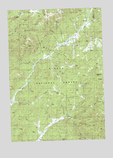
Whistler Point, OR USGS Topographic Map
Click on map above to begin viewing in our Map Viewer.

This topographic map contains these locations and features:
Feature Name Type Latitude Longitude GNIS ID View Map
Bandit SpringSpringN44.4877°W120.3980°1137496View Map
Bandit Spring Safety Rest AreaLocaleN44.4865°W120.3971°1156333View Map
Buck CreekStreamN44.4465°W120.4672°1138762View Map
Buck SpringSpringN44.4492°W120.4736°1133892View Map
Canyon CreekStreamN44.3957°W120.4203°1139329View Map
Claypool SpringSpringN44.4207°W120.4357°1139771View Map
Cornez CreekStreamN44.4643°W120.4336°1140127View Map
Cougar Forest CampLocaleN44.4499°W120.4664°1156707View Map
Cougar RockSummitN44.4729°W120.4773°1153151View Map
Cox ReservoirReservoirN44.4351°W120.4933°1157539View Map
Coyle ButteSummitN44.4462°W120.3886°1140305View Map
Coyle CreekStreamN44.3962°W120.4250°1140306View Map
Coyle SpringSpringN44.4427°W120.3854°1140307View Map
Crystal CreekStreamN44.4807°W120.4031°1140509View Map
Deadman CreekStreamN44.4462°W120.4420°1140733View Map
Douthit CreekStreamN44.3751°W120.4664°1141213View Map
Downs SpringSpringN44.4221°W120.4130°1133893View Map
Fisher CreekStreamN44.4065°W120.3936°1142176View Map
Garden CreekStreamN44.3924°W120.4428°1142568View Map
Garden SpringSpringN44.4093°W120.4462°1142571View Map
Grant ButteSummitN44.4691°W120.3984°1142937View Map
Grant MeadowsFlatN44.4643°W120.3920°1142944View Map
Halfway SpringSpringN44.4974°W120.4067°1143216View Map
Hamilton ButteSummitN44.4550°W120.4225°1143241View Map
Hamilton CreekStreamN44.4540°W120.4531°1143244View Map
Hamilton SpringSpringN44.4601°W120.3921°1143247View Map
Hon SpringSpringN44.3954°W120.4780°1143702View Map
Judy CreekStreamN44.4146°W120.3797°1144417View Map
Koch ButteSummitN44.3868°W120.4903°1144697View Map
Koch ReservoirReservoirN44.3840°W120.4706°1133894View Map
Little Hay CreekStreamN44.4137°W120.4972°1123204View Map
Long Hollow CreekStreamN44.4693°W120.4222°1145414View Map
Mahogany SpringSpringN44.4647°W120.4724°1133891View Map
Marks Creek LodgeLocaleN44.4654°W120.4345°1638213View Map
Marks LakeReservoirN44.4661°W120.4272°1155609View Map
Marks Lake DamDamN44.4659°W120.4296°1155610View Map
Marks SpringSpringN44.4225°W120.4732°1133890View Map
McGinnis CreekStreamN44.4726°W120.4103°1145981View Map
Mercury CreekStreamN44.4010°W120.4239°1157540View Map
Metal CreekStreamN44.3962°W120.4281°1146114View Map
Mount Bachelor AcademySchoolN44.4664°W120.4347°2416271View Map
Nature CreekStreamN44.4871°W120.3931°1146736View Map
O'Neil ButteSummitN44.3845°W120.3787°1147096View Map
O'Neil CreekStreamN44.3876°W120.4131°1147097View Map
O'Neil SpringSpringN44.3882°W120.3927°1147098View Map
Ochoco Divide Research AreaLocaleN44.4832°W120.3764°1156353View Map
Ochoco MountainsRangeN44.4432°W120.3936°1147145View Map
Ochoco Recreation SiteLocaleN44.3999°W120.4206°1156706View Map
Pothole SpringSpringN44.4008°W120.4961°1147944View Map
Rail CreekStreamN44.4718°W120.4189°1148148View Map
Reilly CreekStreamN44.4662°W120.4281°1148370View Map
Rush CreekStreamN44.4543°W120.4508°1148847View Map
Rush SpringSpringN44.4380°W120.4286°1148852View Map
Scissors CreekStreamN44.4154°W120.3778°1149154View Map
Section Eight ReservoirReservoirN44.3768°W120.4831°1157538View Map
Shamrock CreekStreamN44.4293°W120.4789°1149280View Map
Spears MeadowFlatN44.4132°W120.4989°1150108View Map
Stewart SpringSpringN44.4461°W120.4110°1150423View Map
Thorn CreekStreamN44.3782°W120.4058°1151125View Map
View PointSummitN44.4946°W120.4534°1151767View Map
Whistler PointSummitN44.4930°W120.4900°1152218View Map
Whistler Recreation SiteLocaleN44.4926°W120.4853°1156594View Map
Whistler SpringSpringN44.4963°W120.4851°1133895View Map
Whitney CreekStreamN44.4251°W120.4017°1152283View Map
Whitney ReservoirReservoirN44.4302°W120.4069°1157537View Map
Wickheiser SpringSpringN44.4331°W120.3792°1152290View Map
Wildcat CreekStreamN44.4118°W120.4989°1129059View Map
Willow CreekStreamN44.4071°W120.4150°1152409View Map

Note: Coordinates in the location and feature list above are referenced to NAD83 datum.


Copyright (C) 2008-2025 Ryan Niemi / Sunset Dynamics ... All Rights Reserved