TopoQuest Logo
Do you find TopoQuest useful?
Help keep TopoQuest running and adding new maps/features by donating!
Bitcoin:  19c7KJd3qBynnjoSw5npx9KScwjBe4ifkT
Litecoin:  LXs6TkuXGGXo1vDsWCkWVdjQX94eUKd6ui
Home View Maps Find Maps Find Places Resources & Links


Mellow Valley, Alabama Topographic Map

USGS Map Title: Mellow Valley, AL
USGS Map MRC: 33085B6
DRG (GeoTIFF) Download: o33085b6.tif


Neighboring USGS Topographic Map Quads:


  Lineville West, AL  
33085C7
 

  Lineville East, AL  
33085C6
 

  Ofelia, AL  
33085C5
 

  Gibsonville, AL  
33085B7
 

  Mellow Valley, AL  
33085B6
 

  Wadley North, AL  
33085B5
 

  New Site, AL  
33085A7
 

  Daviston, AL  
33085A6
 

  Wadley South, AL  
33085A5


Map MRC Location:

N34°
W86°
N34°
W85°
H8 H7 H6 H5 H4 H3 H2 H1
G8 G7 G6 G5 G4 G3 G2 G1
F8 F7 F6 F5 F4 F3 F2 F1
E8 E7 E6 E5 E4 E3 E2 E1
D8 D7 D6 D5 D4 D3 D2 D1
C8 C7 C6 C5 C4 C3 C2 C1
B8 B7 B6 B5 B4 B3 B2 B1
A8 A7 A6 A5 A4 A3 A2 A1
N33°
W86°
N33°
W85°

Mellow Valley, AL USGS 1:24K Topographic Map Preview:
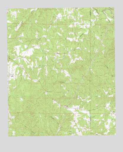
Mellow Valley, AL USGS Topographic Map
Click on map above to begin viewing in our Map Viewer.

This topographic map contains these locations and features:
Feature Name Type Latitude Longitude GNIS ID View Map
Amason ProspectMineN33.2090°W85.6613°151044View Map
Bells Store (historical)LocaleN33.2301°W85.7013°139659View Map
Blackjack Lookout TowerTowerN33.1773°W85.6886°164289View Map
Bluff Spring Post Office (historical)Post OfficeN33.1487°W85.7352°166092View Map
Carter LakeReservoirN33.2468°W85.6966°131341View Map
Carter ProspectMineN33.2140°W85.6952°151049View Map
Cooley CrossroadsPopulated PlaceN33.1685°W85.7058°156211View Map
CorinthPopulated PlaceN33.2054°W85.6916°151050View Map
Corinth Baptist ChurchChurchN33.2060°W85.6925°116635View Map
Corinth CemeteryCemeteryN33.2062°W85.6922°1805378View Map
County Line Volunteer Fire DepartmentBuildingN33.1311°W85.6633°2683285View Map
Crooked Creek Watershed Dam Number 16DamN33.2468°W85.6966°131340View Map
Dawkins ProspectMineN33.2240°W85.6750°151048View Map
Dinner CreekStreamN33.2196°W85.6819°117293View Map
Evan RidgeRidgeN33.1773°W85.6880°139665View Map
Farrar-Wallace ProspectMineN33.2401°W85.6741°151045View Map
Flint Hill Church (historical)ChurchN33.1479°W85.7483°139666View Map
Gum Spring Church (historical)ChurchN33.2293°W85.7494°139669View Map
Hall CreekStreamN33.2185°W85.6683°119581View Map
Jehovah CemeteryCemeteryN33.2479°W85.6636°1805386View Map
Jehovah ChurchChurchN33.2479°W85.6630°151041View Map
Knights Mill (historical)LocaleN33.2329°W85.6730°139672View Map
Knights Mill ProspectMineN33.2334°W85.6741°151047View Map
Landowners Hunting ClubLocaleN33.1332°W85.6816°151052View Map
Little Mississippi CreekStreamN33.2198°W85.7013°121817View Map
Loombeam Gin (historical)LocaleN33.1585°W85.7497°139674View Map
Maitland Gin (historical)LocaleN33.2479°W85.7472°139675View Map
Manning Placer MineMineN33.2454°W85.6561°151042View Map
McDaniel CemeteryCemeteryN33.2018°W85.7319°122518View Map
Mellow ValleyPopulated PlaceN33.1860°W85.7480°156695View Map
Mellow Valley Baptist ChurchChurchN33.1848°W85.7438°151053View Map
Mellow Valley CemeteryCemeteryN33.1854°W85.7441°1730272View Map
Mellow Valley High SchoolSchoolN33.1840°W85.7444°139677View Map
Mitchell Prospect Number OneMineN33.2315°W85.6636°151043View Map
Mount Gilead CemeteryCemeteryN33.1287°W85.6758°1805395View Map
Mount Gilead ChurchChurchN33.1287°W85.6763°123195View Map
Mount Olive CemeteryCemeteryN33.1537°W85.6827°1805397View Map
Mount Olive ChurchChurchN33.1532°W85.6825°123311View Map
New Hope CemeteryCemeteryN33.2251°W85.6400°1805733View Map
New Hope ChurchChurchN33.2257°W85.6405°123827View Map
SikesvillePopulated PlaceN33.1265°W85.6747°157060View Map
Tallapoosa River Hunting ClubLocaleN33.2012°W85.6347°135822View Map
Walker ProspectMineN33.2265°W85.6675°151046View Map
Wesobulga CreekStreamN33.2476°W85.6480°128750View Map
Westobulga (historical)LocaleN33.2437°W85.6769°139686View Map
White Oak CreekStreamN33.2321°W85.6616°128886View Map
White Oak MountainSummitN33.2321°W85.7316°139687View Map
Wilson CemeteryCemeteryN33.1496°W85.6547°151051View Map

Note: Coordinates in the location and feature list above are referenced to NAD83 datum.


Copyright (C) 2008-2025 Ryan Niemi / Sunset Dynamics ... All Rights Reserved