TopoQuest Logo
Do you find TopoQuest useful?
Help keep TopoQuest running and adding new maps/features by donating!
Bitcoin:  19c7KJd3qBynnjoSw5npx9KScwjBe4ifkT
Litecoin:  LXs6TkuXGGXo1vDsWCkWVdjQX94eUKd6ui
Home View Maps Find Maps Find Places Resources & Links


Gleason, Pennsylvania Topographic Map

USGS Map Title: Gleason, PA
USGS Map MRC: 41076F8
DRG (GeoTIFF) Download: o41076f8.tif


Neighboring USGS Topographic Map Quads:


  Mansfield, PA  
41077G1
 

  Roseville, PA  
41076G8
 

  Troy, PA  
41076G7
 

  Blossburg, PA  
41077F1
 

  Gleason, PA  
41076F8
 

  Canton, PA  
41076F7
 

  Liberty, PA  
41077E1
 

  Ralston, PA  
41076E8
 

  Grover, PA  
41076E7


Map MRC Location:

N42°
W77°
N42°
W76°
H8 H7 H6 H5 H4 H3 H2 H1
G8 G7 G6 G5 G4 G3 G2 G1
F8 F7 F6 F5 F4 F3 F2 F1
E8 E7 E6 E5 E4 E3 E2 E1
D8 D7 D6 D5 D4 D3 D2 D1
C8 C7 C6 C5 C4 C3 C2 C1
B8 B7 B6 B5 B4 B3 B2 B1
A8 A7 A6 A5 A4 A3 A2 A1
N41°
W77°
N41°
W76°

Gleason, PA USGS 1:24K Topographic Map Preview:
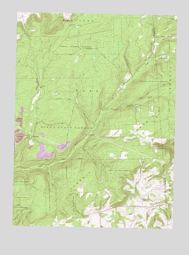
Gleason, PA USGS Topographic Map
Click on map above to begin viewing in our Map Viewer.

This topographic map contains these locations and features:
Feature Name Type Latitude Longitude GNIS ID View Map
Armenia MountainSummitN41.6917°W76.8886°1198335View Map
Bear RunStreamN41.6601°W76.9744°1168929View Map
Borough of Fall Brook (historical)CivilN41.6779°W76.9867°2675257View Map
Coon CreekStreamN41.6701°W76.9441°1172404View Map
County Bridge Picnic AreaLocaleN41.6790°W76.9416°1172503View Map
Fall BrookPopulated PlaceN41.6773°W76.9858°1203551View Map
Fallbrook CemeteryCemeteryN41.6875°W76.9743°2774814View Map
Fallbrook FallsFallsN41.6776°W76.9880°1201385View Map
Fellows CreekStreamN41.6859°W76.9350°1174666View Map
GleasonPopulated PlaceN41.6337°W76.9319°1203676View Map
McIntosh CemeteryCemeteryN41.7235°W76.8974°2774835View Map
McIntosh HollowValleyN41.7144°W76.9089°1180729View Map
North Union CemeteryCemeteryN41.6415°W76.8984°1182643View Map
North Union ChurchChurchN41.6373°W76.8994°1182645View Map
North Union School (historical)SchoolN41.6429°W76.8994°1197652View Map
Rathbone CreekStreamN41.7209°W76.8969°1184664View Map
Rundall CreekStreamN41.6940°W76.9319°1198118View Map
South CreekStreamN41.6734°W76.9505°1188053View Map
Township of WardCivilN41.7026°W76.9498°1217126View Map
Ward SchoolSchoolN41.6790°W76.9077°1197651View Map
Webier CreekStreamN41.7323°W76.8922°1199755View Map
WKAD-FM (Canton)TowerN41.6726°W76.8922°1200318View Map

Note: Coordinates in the location and feature list above are referenced to NAD83 datum.


Copyright (C) 2008-2025 Ryan Niemi / Sunset Dynamics ... All Rights Reserved