TopoQuest Logo
Do you find TopoQuest useful?
Help keep TopoQuest running and adding new maps/features by donating!
Bitcoin:  19c7KJd3qBynnjoSw5npx9KScwjBe4ifkT
Litecoin:  LXs6TkuXGGXo1vDsWCkWVdjQX94eUKd6ui
Home View Maps Find Maps Find Places Resources & Links


Roseville, Pennsylvania Topographic Map

USGS Map Title: Roseville, PA
USGS Map MRC: 41076G8
DRG (GeoTIFF) Download: o41076g8.tif


Neighboring USGS Topographic Map Quads:


  Jackson Summit, PA  
41077H1
 

  Millerton, PA  
41076H8
 

  Gillett, PA  
41076H7
 

  Mansfield, PA  
41077G1
 

  Roseville, PA  
41076G8
 

  Troy, PA  
41076G7
 

  Blossburg, PA  
41077F1
 

  Gleason, PA  
41076F8
 

  Canton, PA  
41076F7


Map MRC Location:

N42°
W77°
N42°
W76°
H8 H7 H6 H5 H4 H3 H2 H1
G8 G7 G6 G5 G4 G3 G2 G1
F8 F7 F6 F5 F4 F3 F2 F1
E8 E7 E6 E5 E4 E3 E2 E1
D8 D7 D6 D5 D4 D3 D2 D1
C8 C7 C6 C5 C4 C3 C2 C1
B8 B7 B6 B5 B4 B3 B2 B1
A8 A7 A6 A5 A4 A3 A2 A1
N41°
W77°
N41°
W76°

Roseville, PA USGS 1:24K Topographic Map Preview:
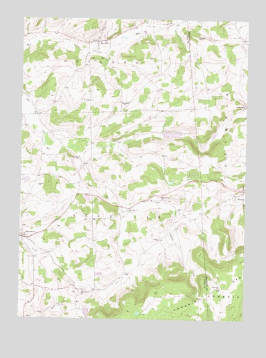
Roseville, PA USGS Topographic Map
Click on map above to begin viewing in our Map Viewer.

This topographic map contains these locations and features:
Feature Name Type Latitude Longitude GNIS ID View Map
Ames Hill CemeteryCemeteryN41.7934°W76.9805°2770033View Map
Armenia ChurchChurchN41.7631°W76.8883°1168399View Map
Bear CreekStreamN41.8712°W76.9336°1168867View Map
Benson KnobSummitN41.8673°W76.9025°1169272View Map
Borough of RosevilleCivilN41.8637°W76.9576°1215627View Map
Elk Run ChurchChurchN41.8167°W76.9669°1174130View Map
Gaffers CreekStreamN41.7937°W76.9136°1175375View Map
Gray Valley SchoolSchoolN41.7942°W76.9441°1197656View Map
Grays Valley Post Office (historical)Post OfficeN41.7951°W76.9422°1214386View Map
Grey Valley CemeteryCemeteryN41.7953°W76.9396°1176219View Map
Holly Hill - Wood CemeteryCemeteryN41.8344°W76.9311°2774825View Map
Hulslander CemeteryCemeteryN41.8195°W76.9254°2774827View Map
King Hill CemeteryCemeteryN41.7824°W76.9224°1178477View Map
MainesburgPopulated PlaceN41.7840°W76.9983°1180234View Map
Mainesburg CemeteryCemeteryN41.7862°W77.0000°1192881View Map
Mainesburg Post OfficePost OfficeN41.7822°W76.9976°2772816View Map
Mansfield ChurchChurchN41.8387°W76.9411°1180305View Map
RosevillePopulated PlaceN41.8656°W76.9575°1185483View Map
Rutland Post Office (historical)Post OfficeN41.8659°W76.9414°1214154View Map
Smith CemeteryCemeteryN41.8158°W76.9604°1187861View Map
State Road CemeteryCemeteryN41.7619°W76.9644°2774852View Map
State Road ChurchChurchN41.7615°W76.9641°1188559View Map
Township of SullivanCivilN41.7871°W76.9610°1217123View Map
Union Church (historical)ChurchN41.7706°W76.9375°1197655View Map
Van Ness Hill CemeteryCemeteryN41.8408°W76.9621°1190339View Map
Watson - Roseville CemeteryCemeteryN41.8618°W76.9603°2774845View Map

Note: Coordinates in the location and feature list above are referenced to NAD83 datum.


Copyright (C) 2008-2025 Ryan Niemi / Sunset Dynamics ... All Rights Reserved