TopoQuest Logo
Do you find TopoQuest useful?
Help keep TopoQuest running and adding new maps/features by donating!
Bitcoin:  19c7KJd3qBynnjoSw5npx9KScwjBe4ifkT
Litecoin:  LXs6TkuXGGXo1vDsWCkWVdjQX94eUKd6ui
Home View Maps Find Maps Find Places Resources & Links


Liberty, Pennsylvania Topographic Map

USGS Map Title: Liberty, PA
USGS Map MRC: 41077E1
DRG (GeoTIFF) Download: o41077e1.tif


Neighboring USGS Topographic Map Quads:


  Cherry Flats, PA  
41077F2
 

  Blossburg, PA  
41077F1
 

  Gleason, PA  
41076F8
 

  Nauvoo, PA  
41077E2
 

  Liberty, PA  
41077E1
 

  Ralston, PA  
41076E8
 

  White Pine, PA  
41077D2
 

  Trout Run, PA  
41077D1
 

  Bodines, PA  
41076D8


Map MRC Location:

N42°
W78°
N42°
W77°
H8 H7 H6 H5 H4 H3 H2 H1
G8 G7 G6 G5 G4 G3 G2 G1
F8 F7 F6 F5 F4 F3 F2 F1
E8 E7 E6 E5 E4 E3 E2 E1
D8 D7 D6 D5 D4 D3 D2 D1
C8 C7 C6 C5 C4 C3 C2 C1
B8 B7 B6 B5 B4 B3 B2 B1
A8 A7 A6 A5 A4 A3 A2 A1
N41°
W78°
N41°
W77°

Liberty, PA USGS 1:24K Topographic Map Preview:
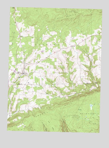
Liberty, PA USGS Topographic Map
Click on map above to begin viewing in our Map Viewer.

This topographic map contains these locations and features:
Feature Name Type Latitude Longitude GNIS ID View Map
Borough of LibertyCivilN41.5585°W77.1055°1215624View Map
Brier MountainSummitN41.6162°W77.0489°1170250View Map
Brion CreekStreamN41.5401°W77.0314°1170270View Map
East PointPopulated PlaceN41.5870°W77.0397°1173857View Map
East Point CemeteryCemeteryN41.5839°W77.0370°2774811View Map
Friedens ChurchChurchN41.5434°W77.1136°1175246View Map
Greenwood Hunting ClubLocaleN41.5137°W77.0155°1197374View Map
Harrer School (historical)SchoolN41.5654°W77.0300°1197375View Map
HenslertownPopulated PlaceN41.5515°W77.0983°1202031View Map
Hickory KnobSummitN41.5498°W77.0055°1176963View Map
House Landing StripPopulated PlaceN41.5573°W77.1150°1203847View Map
Independence School (historical)SchoolN41.5395°W77.1002°1197370View Map
Jew HillSummitN41.5492°W77.0989°1178074View Map
Kahler SchoolSchoolN41.5356°W77.0544°1197373View Map
Kings School (historical)SchoolN41.5642°W77.0675°1197372View Map
Laurel HillSummitN41.5159°W77.0816°1178942View Map
LibertyPopulated PlaceN41.5584°W77.1047°1179255View Map
Liberty Junior / Senior High SchoolSchoolN41.5591°W77.1117°1178134View Map
Liberty Post OfficePost OfficeN41.5581°W77.1041°2773185View Map
Liberty Volunteer Fire CompanyBuildingN41.5593°W77.1035°2653033View Map
Little Elk RunStreamN41.5351°W77.0480°1179537View Map
Long RidgeRidgeN41.5092°W77.0694°1179876View Map
Mountain School (historical)SchoolN41.5220°W77.1011°1197371View Map
Old East Point - Ebenezer Church Yard CemeteryCemeteryN41.5872°W77.0409°2774812View Map
Salt Spring RunStreamN41.5476°W77.0089°1186880View Map
SebringPopulated PlaceN41.5951°W77.1100°1187206View Map
Sebring CemeteryCemeteryN41.5953°W77.1094°2774849View Map
Skelly School (historical)SchoolN41.5923°W77.0011°1197376View Map
The LakesLakeN41.5240°W77.0272°1189417View Map
Township of JacksonCivilN41.5172°W77.1105°1216720View Map
Township of LibertyCivilN41.5924°W77.1134°1217115View Map
Union CemeteryCemeteryN41.5702°W77.0855°2774859View Map
Union ChurchChurchN41.5692°W77.0858°1190144View Map
VeilstownPopulated PlaceN41.5687°W77.1030°1202030View Map

Note: Coordinates in the location and feature list above are referenced to NAD83 datum.


Copyright (C) 2008-2024 Ryan Niemi / Sunset Dynamics ... All Rights Reserved