TopoQuest Logo
Do you find TopoQuest useful?
Help keep TopoQuest running and adding new maps/features by donating!
Bitcoin:  19c7KJd3qBynnjoSw5npx9KScwjBe4ifkT
Litecoin:  LXs6TkuXGGXo1vDsWCkWVdjQX94eUKd6ui
Home View Maps Find Maps Find Places Resources & Links


Marquand, Missouri Topographic Map

USGS Map Title: Marquand, MO
USGS Map MRC: 37090D2
DRG (GeoTIFF) Download: o37090d2.tif


Neighboring USGS Topographic Map Quads:


  Fredericktown, MO  
37090E3
 

  Higdon, MO  
37090E2
 

  Patton, MO  
37090E1
 

  Cherokee Pass, MO  
37090D3
 

  Marquand, MO  
37090D2
 

  Hurricane, MO  
37090D1
 

  Cascade, MO  
37090C3
 

  Allbright, MO  
37090C2
 

  Glenallen, MO  
37090C1


Map MRC Location:

N38°
W91°
N38°
W90°
H8 H7 H6 H5 H4 H3 H2 H1
G8 G7 G6 G5 G4 G3 G2 G1
F8 F7 F6 F5 F4 F3 F2 F1
E8 E7 E6 E5 E4 E3 E2 E1
D8 D7 D6 D5 D4 D3 D2 D1
C8 C7 C6 C5 C4 C3 C2 C1
B8 B7 B6 B5 B4 B3 B2 B1
A8 A7 A6 A5 A4 A3 A2 A1
N37°
W91°
N37°
W90°

Marquand, MO USGS 1:24K Topographic Map Preview:
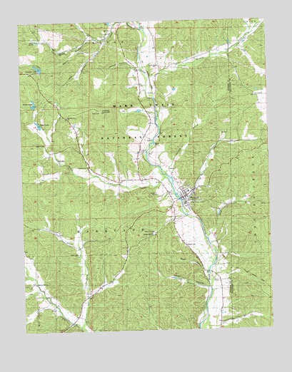
Marquand, MO USGS Topographic Map
Click on map above to begin viewing in our Map Viewer.

This topographic map contains these locations and features:
Feature Name Type Latitude Longitude GNIS ID View Map
Aslinger BranchStreamN37.4374°W90.1765°748621View Map
Big Four SchoolSchoolN37.3953°W90.1543°748833View Map
Brown LakeReservoirN37.4670°W90.2436°753732View Map
Canaan CampLocaleN37.4142°W90.1851°753740View Map
City of MarquandCivilN37.4287°W90.1671°2395016View Map
Cornwall ChurchChurchN37.4953°W90.2040°753730View Map
Cottoner MountainSummitN37.4634°W90.2096°749490View Map
Cozean Mine (historical)MineN37.3951°W90.1418°749506View Map
Dog Trot HollowValleyN37.4273°W90.1657°753738View Map
East Prong Shetley CreekStreamN37.3773°W90.2212°749787View Map
Greasy CreekStreamN37.4373°W90.1765°750128View Map
Greasy Creek School (historical)SchoolN37.4478°W90.2329°736411View Map
Grounds CreekStreamN37.4778°W90.1854°750169View Map
Henderson CreekStreamN37.4967°W90.1873°750289View Map
Indian CreekStreamN37.4992°W90.1940°753603View Map
Joseph HollowValleyN37.3926°W90.1562°753741View Map
KlendikePopulated PlaceN37.4406°W90.2248°750632View Map
Leaky LakeReservoirN37.4987°W90.2037°765021View Map
MarquandPopulated PlaceN37.4292°W90.1682°750940View Map
Marquand Post OfficePost OfficeN37.4289°W90.1680°2782711View Map
Marquand Volunteer Fire DepartmentBuildingN37.4282°W90.1688°2621248View Map
Martin HollowValleyN37.4889°W90.2082°751162View Map
Mountain View ChurchChurchN37.4614°W90.2268°753734View Map
Mouser CemeteryCemeteryN37.4303°W90.1826°751212View Map
Mouser SchoolSchoolN37.4362°W90.1946°751213View Map
Myers BranchStreamN37.3976°W90.1579°751251View Map
Neville DamDamN37.4984°W90.2034°765020View Map
Newman LakeReservoirN37.4816°W90.2411°753731View Map
Newman Lake DamDamN37.4817°W90.2368°764304View Map
Pine Union ChurchChurchN37.4692°W90.1312°753737View Map
Pine Union SchoolSchoolN37.4698°W90.1329°751628View Map
Pogue LakeReservoirN37.4586°W90.2410°763762View Map
Pogue Lake DamDamN37.4584°W90.2384°763761View Map
Pond BranchStreamN37.3923°W90.1565°751694View Map
Rhodes ChapelChurchN37.4778°W90.1812°751861View Map
Shetley Creek ChurchChurchN37.3945°W90.2440°753742View Map
Shetley Creek School (historical)SchoolN37.3951°W90.2421°752118View Map
Smittys Catfish Pond DamDamN37.4651°W90.2401°764448View Map
Snowden BranchStreamN37.4995°W90.1932°752238View Map
Snowdenville SchoolSchoolN37.4956°W90.2037°752240View Map
Starkey Mine (historical)MineN37.4831°W90.1962°752339View Map
Stephens CemeteryCemeteryN37.4506°W90.2379°753736View Map
Stevens BranchStreamN37.4081°W90.2209°752358View Map
Tiptop SchoolSchoolN37.4717°W90.1801°752550View Map
Township of MarquandCivilN37.4217°W90.2116°766986View Map
Vernum HollowValleyN37.4806°W90.1896°753733View Map
Walnut Grove ChurchChurchN37.4409°W90.2148°752741View Map
Wash CreekStreamN37.4126°W90.1565°752768View Map
White SpringSpringN37.4921°W90.2421°752863View Map
White Spring BranchStreamN37.4939°W90.2112°752864View Map
Whitener CemeteryCemeteryN37.4089°W90.1687°752866View Map
Whitener CreekStreamN37.4264°W90.1701°752338View Map
Whiteners CreekStreamN37.4020°W90.1540°736410View Map
Wright ChapelChurchN37.4151°W90.1846°753739View Map
Younts CemeteryCemeteryN37.4064°W90.2221°753017View Map

Note: Coordinates in the location and feature list above are referenced to NAD83 datum.


Copyright (C) 2008-2025 Ryan Niemi / Sunset Dynamics ... All Rights Reserved