TopoQuest Logo
Do you find TopoQuest useful?
Help keep TopoQuest running and adding new maps/features by donating!
Bitcoin:  19c7KJd3qBynnjoSw5npx9KScwjBe4ifkT
Litecoin:  LXs6TkuXGGXo1vDsWCkWVdjQX94eUKd6ui
Home View Maps Find Maps Find Places Resources & Links


Cedarville, West Virginia Topographic Map

USGS Map Title: Cedarville, WV
USGS Map MRC: 38080G7
DRG (GeoTIFF) Download: o38080g7.tif


Neighboring USGS Topographic Map Quads:


  Tanner, WV  
38080H8
 

  Glenville, WV  
38080H7
 

  Gilmer, WV  
38080H6
 

  Normantown, WV  
38080G8
 

  Cedarville, WV  
38080G7
 

  Burnsville, WV  
38080G6
 

  Rosedale, WV  
38080F8
 

  Gassaway, WV  
38080F7
 

  Sutton, WV  
38080F6


Map MRC Location:

N39°
W81°
N39°
W80°
H8 H7 H6 H5 H4 H3 H2 H1
G8 G7 G6 G5 G4 G3 G2 G1
F8 F7 F6 F5 F4 F3 F2 F1
E8 E7 E6 E5 E4 E3 E2 E1
D8 D7 D6 D5 D4 D3 D2 D1
C8 C7 C6 C5 C4 C3 C2 C1
B8 B7 B6 B5 B4 B3 B2 B1
A8 A7 A6 A5 A4 A3 A2 A1
N38°
W81°
N38°
W80°

Cedarville, WV USGS 1:24K Topographic Map Preview:
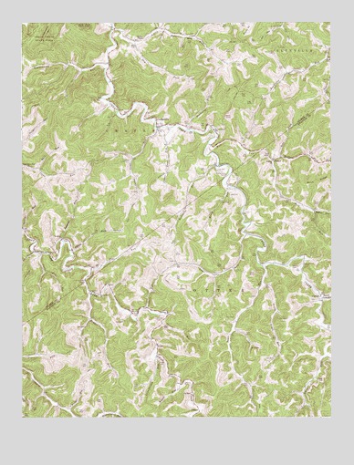
Cedarville, WV USGS Topographic Map
Click on map above to begin viewing in our Map Viewer.

This topographic map contains these locations and features:
Feature Name Type Latitude Longitude GNIS ID View Map
Back Fork School (historical)SchoolN38.7568°W80.7612°1727230View Map
Baker HollowValleyN38.8154°W80.7568°1535150View Map
Bender RunStreamN38.7898°W80.8479°1535626View Map
Bender Run ChurchChurchN38.7887°W80.8443°1535627View Map
Brush Camp RunStreamN38.7873°W80.7543°1536461View Map
Brush RunStreamN38.8229°W80.7918°1536470View Map
Bull RunStreamN38.8373°W80.7993°1536708View Map
Burk CemeteryCemeteryN38.8426°W80.8084°1536740View Map
Butchers RunStreamN38.8301°W80.7962°1536800View Map
Butchers Run Truss BridgeBridgeN38.8297°W80.7964°2635398View Map
Cedar Creek ChurchChurchN38.8298°W80.7954°1537129View Map
CedarvillePopulated PlaceN38.8423°W80.8193°1537147View Map
Cedarville Post OfficePost OfficeN38.8429°W80.8202°1689650View Map
Currycomb CemeteryCemeteryN38.7920°W80.8501°1537936View Map
CutlipsPopulated PlaceN38.7887°W80.7543°1549650View Map
Dry ForkStreamN38.8684°W80.8295°1538355View Map
DuskPopulated PlaceN38.8640°W80.7512°1689666View Map
Dusk ChurchChurchN38.8634°W80.7512°1538458View Map
Engel CemeteryCemeteryN38.7679°W80.8195°1538712View Map
Engel School (historical)SchoolN38.7634°W80.8118°1727259View Map
Fairview School (historical)SchoolN38.8612°W80.7937°1689671View Map
Flat RunStreamN38.7970°W80.8470°1539056View Map
FlowerPopulated PlaceN38.8315°W80.7732°1549687View Map
Gate ForkStreamN38.8326°W80.7707°1539356View Map
German (historical)Populated PlaceN38.7701°W80.8198°1727265View Map
Gilmer County Volunteer Fire Department Cedarville StationBuildingN38.8413°W80.8189°2577941View Map
Granddaddy RunStreamN38.7695°W80.8207°1539570View Map
Hines School (historical)SchoolN38.8157°W80.7568°1727271View Map
Hope (historical)Populated PlaceN38.7987°W80.8126°1727273View Map
Jack CemeteryCemeteryN38.8209°W80.7909°1540760View Map
Laurel RunStreamN38.8059°W80.8584°1541505View Map
Laurel Run School (historical)SchoolN38.8023°W80.8604°1689689View Map
Leatherbark RunStreamN38.8609°W80.8407°1541588View Map
Leatherbark School (historical)SchoolN38.8454°W80.8448°1689690View Map
Leopard RunStreamN38.7840°W80.8248°1541790View Map
Little Bull RunStreamN38.8731°W80.8382°1542047View Map
Little Trace RunStreamN38.7923°W80.7779°1542242View Map
Lower Bull Run School (historical)SchoolN38.8676°W80.8290°1689700View Map
Lower Level RunStreamN38.8418°W80.8201°1542551View Map
Lower Two RunStreamN38.8023°W80.8698°1542588View Map
Mark RunStreamN38.8287°W80.8684°1542765View Map
MossPopulated PlaceN38.8709°W80.8048°1549835View Map
Moss CemeteryCemeteryN38.8679°W80.8309°1543597View Map
Moyers CemeteryCemeteryN38.7976°W80.7659°1543895View Map
Pigeon RunStreamN38.8034°W80.8557°1544817View Map
Pistol RunStreamN38.7518°W80.8562°1544962View Map
Progress (historical)Populated PlaceN38.7593°W80.8659°1727286View Map
Rhodes ChapelChurchN38.8701°W80.8257°1545528View Map
Rider School (historical)SchoolN38.7520°W80.8420°1727287View Map
Rockcamp RunStreamN38.8415°W80.8065°1545945View Map
Romeich ChurchChurchN38.8070°W80.8590°1546054View Map
Rutherford CemeteryCemeteryN38.8273°W80.7929°1546196View Map
Shock School (historical)SchoolN38.8490°W80.8387°1689733View Map
Spring RunStreamN38.8098°W80.8743°1547209View Map
Sprive RunStreamN38.7801°W80.8184°1547223View Map
Steer Run School (historical)SchoolN38.8293°W80.8720°1689738View Map
Toler ForkStreamN38.8640°W80.7515°1548111View Map
Toms RunStreamN38.8079°W80.7840°1548145View Map
Trace RunStreamN38.7976°W80.7776°1548242View Map
Trace School (historical)SchoolN38.7807°W80.7887°1727298View Map
Upper Level RunStreamN38.8418°W80.8148°1548533View Map
Upper Steer Run ChurchChurchN38.8293°W80.8726°1548555View Map
Upper Two RunStreamN38.8018°W80.8665°1548569View Map
Waldeck ChurchChurchN38.8312°W80.7734°1548709View Map
Walker ForkStreamN38.8312°W80.7740°1548726View Map
Walker Fork School (historical)SchoolN38.8309°W80.7570°1727299View Map
Wyatt RunStreamN38.7607°W80.8115°1549441View Map

Note: Coordinates in the location and feature list above are referenced to NAD83 datum.


Copyright (C) 2008-2025 Ryan Niemi / Sunset Dynamics ... All Rights Reserved