TopoQuest Logo
Do you find TopoQuest useful?
Help keep TopoQuest running and adding new maps/features by donating!
Bitcoin:  19c7KJd3qBynnjoSw5npx9KScwjBe4ifkT
Litecoin:  LXs6TkuXGGXo1vDsWCkWVdjQX94eUKd6ui
Home View Maps Find Maps Find Places Resources & Links


Burnsville, West Virginia Topographic Map

USGS Map Title: Burnsville, WV
USGS Map MRC: 38080G6
DRG (GeoTIFF) Download: o38080g6.tif


Neighboring USGS Topographic Map Quads:


  Glenville, WV  
38080H7
 

  Gilmer, WV  
38080H6
 

  Peterson, WV  
38080H5
 

  Cedarville, WV  
38080G7
 

  Burnsville, WV  
38080G6
 

  Orlando, WV  
38080G5
 

  Gassaway, WV  
38080F7
 

  Sutton, WV  
38080F6
 

  Newville, WV  
38080F5


Map MRC Location:

N39°
W81°
N39°
W80°
H8 H7 H6 H5 H4 H3 H2 H1
G8 G7 G6 G5 G4 G3 G2 G1
F8 F7 F6 F5 F4 F3 F2 F1
E8 E7 E6 E5 E4 E3 E2 E1
D8 D7 D6 D5 D4 D3 D2 D1
C8 C7 C6 C5 C4 C3 C2 C1
B8 B7 B6 B5 B4 B3 B2 B1
A8 A7 A6 A5 A4 A3 A2 A1
N38°
W81°
N38°
W80°

Burnsville, WV USGS 1:24K Topographic Map Preview:
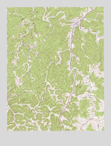
Burnsville, WV USGS Topographic Map
Click on map above to begin viewing in our Map Viewer.

This topographic map contains these locations and features:
Feature Name Type Latitude Longitude GNIS ID View Map
ArnettPopulated PlaceN38.8093°W80.7215°1553745View Map
Beech ForkStreamN38.7751°W80.7109°1535525View Map
Berry ForkStreamN38.7632°W80.6401°1535666View Map
BonniePopulated PlaceN38.7695°W80.6932°1549603View Map
BowerPopulated PlaceN38.8584°W80.7198°1549605View Map
Bower RunStreamN38.8584°W80.7182°1536259View Map
Bragg RunStreamN38.8182°W80.6859°1536297View Map
BraxtonPopulated PlaceN38.7895°W80.7293°1549609View Map
Braxton County Emergency Ambulance Service AuthorityBuildingN38.8558°W80.6559°2581193View Map
Browns RunStreamN38.8523°W80.6526°1536443View Map
Buck RidgeRidgeN38.8257°W80.7437°1536562View Map
Buffalo CreekStreamN38.8659°W80.6751°1536635View Map
Buffington RunStreamN38.7793°W80.6256°1536665View Map
Bull ForkStreamN38.8382°W80.7304°1536696View Map
Burns RunStreamN38.8120°W80.6682°1536756View Map
BurnsvillePopulated PlaceN38.8562°W80.6548°1554034View Map
Burnsville Elementary SchoolSchoolN38.8590°W80.6569°2088148View Map
Burnsville Police DepartmentBuildingN38.8560°W80.6561°2727875View Map
Burnsville Post OfficePost OfficeN38.8548°W80.6555°1727240View Map
Burnsville Public LibraryBuildingN38.8592°W80.6573°2727194View Map
Burnsville School (historical)SchoolN38.8590°W80.6568°1727241View Map
Burnsville Volunteer Fire DepartmentBuildingN38.8596°W80.6572°2577953View Map
Carter HollowValleyN38.8504°W80.7190°1537074View Map
Cedar Creek School (historical)SchoolN38.7773°W80.7484°1537130View Map
Cloat RunStreamN38.7865°W80.6429°1537422View Map
CopenPopulated PlaceN38.8376°W80.7295°1549639View Map
Copen Post OfficePost OfficeN38.8379°W80.7304°1727246View Map
Copen Run ChurchChurchN38.8701°W80.7176°1537667View Map
Cutlip ChurchChurchN38.7765°W80.7479°1537947View Map
Dumpling RunStreamN38.8645°W80.6507°1538424View Map
ExchangeLocaleN38.7690°W80.7426°1538778View Map
Gabel KnobSummitN38.7945°W80.6573°1554520View Map
GemPopulated PlaceN38.8293°W80.6676°1560647View Map
Grass RunStreamN38.8029°W80.6440°1539606View Map
HeatersPopulated PlaceN38.7618°W80.6415°1540107View Map
Heaters Post OfficePost OfficeN38.7620°W80.6420°1727268View Map
Hutchinson School (historical)SchoolN38.8107°W80.6879°1689927View Map
HyersPopulated PlaceN38.8637°W80.6993°1549756View Map
Hyers RunStreamN38.8626°W80.7007°1540646View Map
Interchange 79CrossingN38.8584°W80.6607°1727276View Map
K of P CemeteryCemeteryN38.8559°W80.6663°2586191View Map
Little Kanawha Memorial GardensCemeteryN38.7735°W80.6412°2586197View Map
Little Kanawha River BridgeBridgeN38.8614°W80.6551°2635301View Map
Maggie Hoover Memorial Methodist Episcopal Church SouthChurchN38.8293°W80.6676°1727280View Map
Marsh RunStreamN38.7762°W80.7329°1542791View Map
McCauley RunStreamN38.8626°W80.6362°1542927View Map
O'Brien ForkStreamN38.7845°W80.6393°1544269View Map
Oil CreekStreamN38.8629°W80.6554°1544334View Map
Paddys RunStreamN38.8265°W80.6679°1544518View Map
Perkins ForkStreamN38.7737°W80.7470°1544715View Map
Pleasant Hill ChurchChurchN38.7857°W80.7043°1544999View Map
Providence ChurchChurchN38.8318°W80.7207°1545299View Map
Right Fork Cedar CreekStreamN38.7745°W80.7476°1545624View Map
Right Fork O'Brien ForkStreamN38.7632°W80.6398°1545684View Map
Right Fork Saltlick CreekStreamN38.8309°W80.6690°1545693View Map
Right Hand Fork CemeteryCemeteryN38.8201°W80.6951°1727289View Map
RollysonPopulated PlaceN38.7834°W80.6409°1549903View Map
Saltlick CreekStreamN38.8568°W80.6562°1546315View Map
Scott ForkStreamN38.7648°W80.6840°1546517View Map
Shaver ForkStreamN38.7670°W80.7407°1546632View Map
Shock HollowValleyN38.8548°W80.7165°1546699View Map
Slabcamp RunStreamN38.7779°W80.7495°1546896View Map
Squires School (historical)SchoolN38.7995°W80.7007°1689939View Map
Stouts Mills ChurchChurchN38.8695°W80.7440°1547519View Map
Stouts RunStreamN38.8440°W80.6670°1547520View Map
Town of BurnsvilleCivilN38.8579°W80.6538°2390763View Map
Union ChapelChurchN38.8187°W80.6937°1548470View Map
Venison ForkStreamN38.7557°W80.7376°1548641View Map
Westfall ForkStreamN38.7684°W80.6923°1548964View Map
Williams RunStreamN38.8440°W80.6320°1549180View Map
Wolfpen RunStreamN38.8309°W80.7204°1549339View Map

Note: Coordinates in the location and feature list above are referenced to NAD83 datum.


Copyright (C) 2008-2025 Ryan Niemi / Sunset Dynamics ... All Rights Reserved