TopoQuest Logo
Do you find TopoQuest useful?
Help keep TopoQuest running and adding new maps/features by donating!
Bitcoin:  19c7KJd3qBynnjoSw5npx9KScwjBe4ifkT
Litecoin:  LXs6TkuXGGXo1vDsWCkWVdjQX94eUKd6ui
Home View Maps Find Maps Find Places Resources & Links


Wallace Lake, Washington Topographic Map

USGS Map Title: Wallace Lake, WA
USGS Map MRC: 47121H6
DRG (GeoTIFF) Download: o47121h6.tif


Neighboring USGS Topographic Map Quads:


  Verlot, WA  
48121A7
 

  Mallardy Ridge, WA  
48121A6
 

  Silverton, WA  
48121A5
 

  Lake Chaplain, WA  
47121H7
 

  Wallace Lake, WA  
47121H6
 

  Mount Stickney, WA  
47121H5
 

  Sultan, WA  
47121G7
 

  Gold Bar, WA  
47121G6
 

  Index, WA  
47121G5


Map MRC Location:

N48°
W122°
N48°
W121°
H8 H7 H6 H5 H4 H3 H2 H1
G8 G7 G6 G5 G4 G3 G2 G1
F8 F7 F6 F5 F4 F3 F2 F1
E8 E7 E6 E5 E4 E3 E2 E1
D8 D7 D6 D5 D4 D3 D2 D1
C8 C7 C6 C5 C4 C3 C2 C1
B8 B7 B6 B5 B4 B3 B2 B1
A8 A7 A6 A5 A4 A3 A2 A1
N47°
W122°
N47°
W121°

Wallace Lake, WA USGS 1:24K Topographic Map Preview:
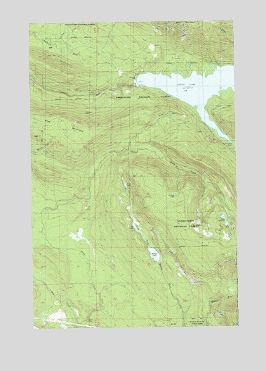
Wallace Lake, WA USGS Topographic Map
Click on map above to begin viewing in our Map Viewer.

This topographic map contains these locations and features:
Feature Name Type Latitude Longitude GNIS ID View Map
Cecelia LakeLakeN47.9288°W121.6638°1529334View Map
City of Everett WatershedAreaN47.9929°W121.6998°1530282View Map
Culmback DamDamN47.9754°W121.6865°1531308View Map
Dick CreekStreamN47.9909°W121.7360°1529335View Map
Jay LakeLakeN47.9158°W121.6885°1521338View Map
Lake StickneyLakeN47.9189°W121.6341°1526561View Map
Lockwood MineMineN47.9618°W121.7182°1522342View Map
Olney FallsFallsN47.8790°W121.7176°1524032View Map
Olney Park Recreation AreaLocaleN47.9170°W121.6568°1534132View Map
Olney PassGapN47.9598°W121.6582°1524033View Map
Poplin DamDamN47.8815°W121.7429°1532747View Map
Shaw LakeLakeN47.9329°W121.6937°1525624View Map
South Fork Sultan RiverStreamN47.9676°W121.6512°1526262View Map
Spada LakeReservoirN47.9742°W121.6395°1529336View Map
Sultan BasinBasinN47.9759°W121.6365°1526701View Map
Sultan RidgeSummitN47.9584°W121.7223°1516708View Map
Wallace LakeLakeN47.9045°W121.6769°1527775View Map

Note: Coordinates in the location and feature list above are referenced to NAD83 datum.


Copyright (C) 2008-2024 Ryan Niemi / Sunset Dynamics ... All Rights Reserved