TopoQuest Logo
Do you find TopoQuest useful?
Help keep TopoQuest running and adding new maps/features by donating!
Bitcoin:  19c7KJd3qBynnjoSw5npx9KScwjBe4ifkT
Litecoin:  LXs6TkuXGGXo1vDsWCkWVdjQX94eUKd6ui
Home View Maps Find Maps Find Places Resources & Links


Lake Chaplain, Washington Topographic Map

USGS Map Title: Lake Chaplain, WA
USGS Map MRC: 47121H7
DRG (GeoTIFF) Download: o47121h7.tif


Neighboring USGS Topographic Map Quads:


  Granite Falls, WA  
48121A8
 

  Verlot, WA  
48121A7
 

  Mallardy Ridge, WA  
48121A6
 

  Lake Roesiger, WA  
47121H8
 

  Lake Chaplain, WA  
47121H7
 

  Wallace Lake, WA  
47121H6
 

  Monroe, WA  
47121G8
 

  Sultan, WA  
47121G7
 

  Gold Bar, WA  
47121G6


Map MRC Location:

N48°
W122°
N48°
W121°
H8 H7 H6 H5 H4 H3 H2 H1
G8 G7 G6 G5 G4 G3 G2 G1
F8 F7 F6 F5 F4 F3 F2 F1
E8 E7 E6 E5 E4 E3 E2 E1
D8 D7 D6 D5 D4 D3 D2 D1
C8 C7 C6 C5 C4 C3 C2 C1
B8 B7 B6 B5 B4 B3 B2 B1
A8 A7 A6 A5 A4 A3 A2 A1
N47°
W122°
N47°
W121°

Lake Chaplain, WA USGS 1:24K Topographic Map Preview:
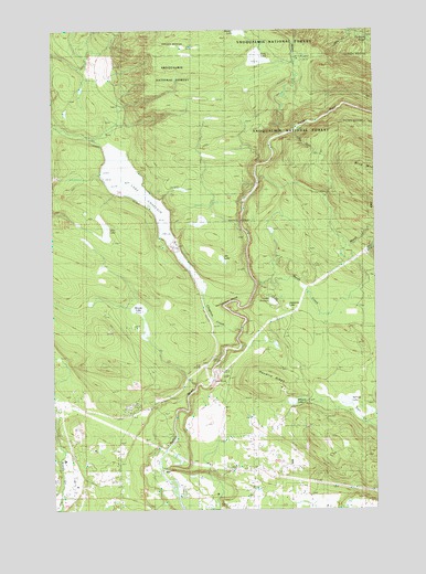
Lake Chaplain, WA USGS Topographic Map
Click on map above to begin viewing in our Map Viewer.

This topographic map contains these locations and features:
Feature Name Type Latitude Longitude GNIS ID View Map
Beaver LakeLakeN47.9995°W121.8037°1528516View Map
Big Four CreekStreamN47.9732°W121.7818°1516508View Map
Blue Boy West Golf CourseLocaleN47.8835°W121.8577°2608377View Map
Blue Mountain LookoutLocaleN47.9620°W121.7504°1530287View Map
Chaplain CreekStreamN47.9209°W121.8035°1517625View Map
Chaplain Lake North DamDamN47.9698°W121.8546°1532181View Map
Chaplain Lake South DamDamN47.9448°W121.8312°1532182View Map
Echo LakeLakeN47.9924°W121.7965°1519170View Map
Everett Water Work IntakeLocaleN47.9437°W121.8287°1534111View Map
Freeman DamDamN47.8848°W121.7896°1532746View Map
Haywire RidgeRidgeN47.9070°W121.7962°1520635View Map
Horseshoe BendBendN47.9273°W121.8060°1520947View Map
Ida LakeLakeN47.9399°W121.8101°1529325View Map
Japanese LakeLakeN47.9279°W121.7852°1521329View Map
Kellog LakeLakeN47.9029°W121.7628°1521594View Map
Lake BronsonLakeN47.9290°W121.7910°1516971View Map
Lake ChaplainReservoirN47.9592°W121.8448°1517626View Map
Lost LakeLakeN47.9474°W121.8553°1522488View Map
Marsh CreekStreamN47.9332°W121.7962°1522746View Map
Miners CreekStreamN47.9365°W121.7918°1530169View Map
North SultanPopulated PlaceN47.8818°W121.8071°1852955View Map
North Sultan Census Designated PlaceCensusN47.8827°W121.8251°2408950View Map
Rain Spirit FarmLocaleN47.8842°W121.8544°2706261View Map
Ritz CreekStreamN47.9987°W121.7601°1529324View Map
Winters LakeLakeN47.9029°W121.7839°1528257View Map
Woods LakeLakeN47.9272°W121.8429°1528305View Map

Note: Coordinates in the location and feature list above are referenced to NAD83 datum.


Copyright (C) 2008-2024 Ryan Niemi / Sunset Dynamics ... All Rights Reserved